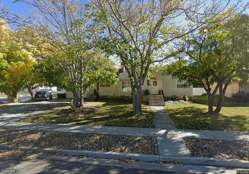
290 N 800 E Spanish Fork, UT 84660
Estimated Value: $551,000 - $640,000
4
Beds
2
Baths
3,900
Sq Ft
$150/Sq Ft
Est. Value
About This Home
This home is located at 290 N 800 E, Spanish Fork, UT 84660 and is currently estimated at $583,414, approximately $149 per square foot. 290 N 800 E is a home located in Utah County with nearby schools including Park Elementary School, Spanish Fork Jr High School, and Spanish Fork High School.
Ownership History
Date
Name
Owned For
Owner Type
Purchase Details
Closed on
Jun 22, 2020
Sold by
Stutz Darren and Stutz Diana Lee
Bought by
Stutz Darren and Stutz Diana Lee
Current Estimated Value
Home Financials for this Owner
Home Financials are based on the most recent Mortgage that was taken out on this home.
Original Mortgage
$273,000
Outstanding Balance
$241,994
Interest Rate
3.2%
Mortgage Type
New Conventional
Estimated Equity
$341,420
Purchase Details
Closed on
Jul 12, 2018
Sold by
Stutz Darren and Stutz Diana Lee
Bought by
Stutz Darren and Stutz Diana Lee
Home Financials for this Owner
Home Financials are based on the most recent Mortgage that was taken out on this home.
Original Mortgage
$30,000
Interest Rate
4.6%
Mortgage Type
Credit Line Revolving
Purchase Details
Closed on
May 21, 2018
Sold by
Stutz Darren and Stutz Diana Lee
Bought by
Stutz Darren and Stutz Diana Lee
Home Financials for this Owner
Home Financials are based on the most recent Mortgage that was taken out on this home.
Original Mortgage
$30,000
Interest Rate
4.6%
Mortgage Type
Credit Line Revolving
Purchase Details
Closed on
May 15, 2018
Sold by
Stutz Darren and Stutz Diana Lee
Bought by
Stutz Darren and Stutz Diana Lee
Home Financials for this Owner
Home Financials are based on the most recent Mortgage that was taken out on this home.
Original Mortgage
$30,000
Interest Rate
4.6%
Mortgage Type
Credit Line Revolving
Purchase Details
Closed on
Mar 7, 2014
Sold by
Stutz Darren and Stutz Diana
Bought by
Stutz Darren and Stutz Diana Lee
Purchase Details
Closed on
Aug 24, 2007
Sold by
Holbrook Clayton
Bought by
Stutz Darren and Stutz Diana
Home Financials for this Owner
Home Financials are based on the most recent Mortgage that was taken out on this home.
Original Mortgage
$232,940
Interest Rate
6.67%
Mortgage Type
Purchase Money Mortgage
Create a Home Valuation Report for This Property
The Home Valuation Report is an in-depth analysis detailing your home's value as well as a comparison with similar homes in the area
Home Values in the Area
Average Home Value in this Area
Purchase History
We collect this data history from publicly available records. To have your information removed, we recommend requesting removal directly through your county’s website.
| Date | Buyer | Sale Price | Title Company |
|---|---|---|---|
| Stutz Darren | -- | Access Title Co | |
| Stutz Darren | -- | Access Title Co | |
| Stutz Darren | -- | Meridan Title Co | |
| Stutz Darren | -- | Meridian Title Co | |
| Stutz Darren | -- | Charger Title | |
| Stutz Darren | -- | Charger Title | |
| Stutz Darren | -- | None Available | |
| Stutz Darren | -- | Mountain View Title St Geor |
Source: Public Records
Mortgage History
We collect this data history from publicly available records. To have your information removed, we recommend requesting removal directly through your county’s website.
| Date | Status | Borrower | Loan Amount |
|---|---|---|---|
| Open | Stutz Darren | $273,000 | |
| Closed | Stutz Darren | $30,000 | |
| Closed | Stutz Darren | $243,200 | |
| Closed | Stutz Darren | $232,940 |
Source: Public Records
Tax History
| Year | Tax Paid | Tax Assessment Tax Assessment Total Assessment is a certain percentage of the fair market value that is determined by local assessors to be the total taxable value of land and additions on the property. | Land | Improvement |
|---|---|---|---|---|
| 2025 | $2,423 | $288,255 | -- | -- |
| 2024 | $2,423 | $249,700 | $0 | $0 |
| 2023 | $2,425 | $250,195 | $0 | $0 |
| 2022 | $2,412 | $244,145 | $0 | $0 |
| 2021 | $2,218 | $359,100 | $88,100 | $271,000 |
| 2020 | $2,017 | $317,500 | $73,400 | $244,100 |
| 2019 | $1,745 | $288,900 | $73,400 | $215,500 |
| 2018 | $1,629 | $260,800 | $73,400 | $187,400 |
| 2017 | $1,587 | $136,565 | $0 | $0 |
| 2016 | $1,426 | $121,055 | $0 | $0 |
| 2015 | $1,278 | $107,195 | $0 | $0 |
| 2014 | $1,157 | $97,405 | $0 | $0 |
Source: Public Records
Map
Nearby Homes
- 120 N 800 E
- 284 N 1000 E
- 306 N 1070 E
- 306 N 1070 E Unit 17
- 274 N 1070 E Unit 14
- 299 N 1070 E
- 299 N 1070 E Unit 8
- 212 N 1070 E Unit 9
- 224 N 1070 E Unit 10
- 992 E 260 N Unit 15
- 237 N 1120 E
- 973 E 60 S
- 107 S 800 E
- 556 Lynnbrook Dr
- 694 E 100 S
- 144 N 400 E
- 1033 E 120 S
- 2884 E 360 N Unit 211
- 2827 E 360 N Unit 208
- 991 E 360 N Unit 8
Your Personal Tour Guide
Ask me questions while you tour the home.