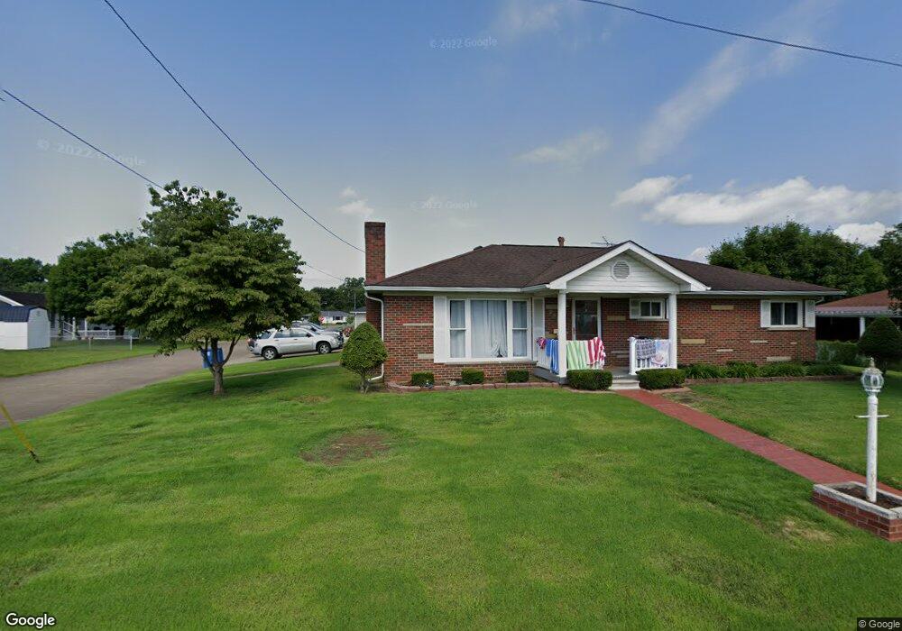
2905 Maple Ave Point Pleasant, WV 25550
Estimated Value: $162,000 - $189,000
2
Beds
1
Bath
1,316
Sq Ft
$135/Sq Ft
Est. Value
About This Home
This home is located at 2905 Maple Ave, Point Pleasant, WV 25550 and is currently estimated at $177,384, approximately $134 per square foot. 2905 Maple Ave is a home located in Mason County with nearby schools including Point Pleasant Primary School, Point Pleasant Intermediate School, and Point Pleasant High School.
Ownership History
Date
Name
Owned For
Owner Type
Purchase Details
Closed on
Aug 20, 2020
Bought by
Cromley Bryan S
Current Estimated Value
Purchase Details
Closed on
Jan 9, 2014
Sold by
Donald E Donald E and Tolliver Wanda
Bought by
Tolliver Donald E and Tolliver Wanda
Create a Home Valuation Report for This Property
The Home Valuation Report is an in-depth analysis detailing your home's value as well as a comparison with similar homes in the area
Home Values in the Area
Average Home Value in this Area
Purchase History
| Date | Buyer | Sale Price | Title Company |
|---|---|---|---|
| Cromley Bryan S | $108,000 | -- | |
| Tolliver Donald E | -- | -- |
Source: Public Records
Mortgage History
| Date | Status | Borrower | Loan Amount |
|---|---|---|---|
| Closed | Tolliver Donald E | -- |
Source: Public Records
Tax History
| Year | Tax Paid | Tax Assessment Tax Assessment Total Assessment is a certain percentage of the fair market value that is determined by local assessors to be the total taxable value of land and additions on the property. | Land | Improvement |
|---|---|---|---|---|
| 2025 | $1,173 | $82,020 | $13,620 | $68,400 |
| 2024 | $1,173 | $79,140 | $13,620 | $65,520 |
| 2023 | $1,052 | $73,440 | $13,620 | $59,820 |
| 2022 | $1,034 | $72,180 | $13,620 | $58,560 |
| 2021 | $926 | $84,600 | $13,620 | $70,980 |
| 2020 | $881 | $83,460 | $13,620 | $69,840 |
| 2019 | $854 | $81,540 | $13,620 | $67,920 |
| 2018 | $828 | $79,620 | $13,620 | $66,000 |
| 2017 | $791 | $77,760 | $13,620 | $64,140 |
| 2016 | $757 | $74,700 | $13,620 | $61,080 |
| 2015 | $775 | $73,920 | $13,620 | $60,300 |
| 2014 | $775 | $73,140 | $13,620 | $59,520 |
Source: Public Records
Map
Nearby Homes
- 2808 Meadowbrook Dr
- 5033 Sandhill Rd
- 00 Sandhill Rd
- 72 Milton Dr
- 3213 Jackson Ave
- 508 29th St
- 509 Mcneil Ave
- 507 Kathnor Ln
- 2515 Mount Vernon Ave
- 3411 Mossman Ave
- 2324 Lincoln Ave
- 687 Lucas Ln
- 3257 Sandhill Rd
- 1820 Jefferson Blvd
- 4452 Sandhill Rd
- 506 Lewis St
- 3391 Henson Rd
- 1541 State Route 7 N
- 0 Corner Rt 62 N and Lock 25 Rd Unit 279629
- 234 Honeysuckle Dr
- 2907 Maple Ave
- 2902 Maple Ave
- 2813 Maple Ave
- 2904 Maple Ave
- 2814 Maple Ave
- 2909 Maple Ave
- 2902 Spruce Ave
- 2814 Meadowbrook Dr
- 2904 Spruce Ave
- 2906 Maple Ave
- 2811 Maple Ave
- 2812 Maple Ave
- 2911 Maple Ave
- 2906 Spruce Ave
- 2812 Meadowbrook Dr
- 2809 Maple Ave
- 2908 Maple Ave
- 2903 Birch Ave
- 2903 Spruce Ave
- 2905 Birch Ave
Your Personal Tour Guide
Ask me questions while you tour the home.