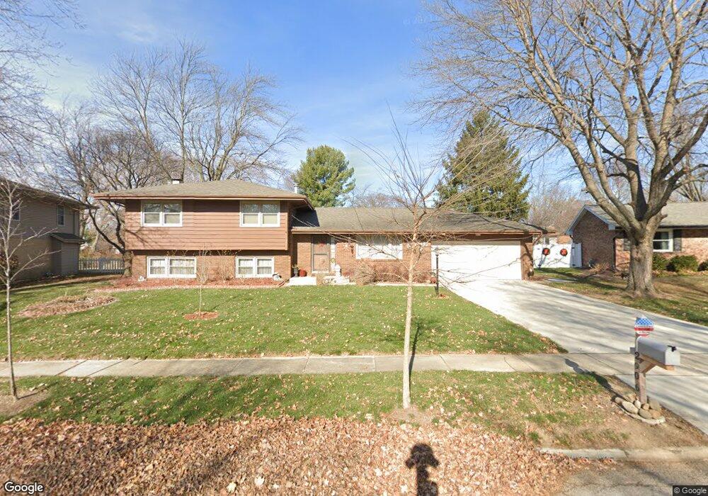
2906 Mockingbird Ln Bloomington, IL 61704
Estimated Value: $249,000 - $281,000
4
Beds
3
Baths
2,169
Sq Ft
$120/Sq Ft
Est. Value
About This Home
This home is located at 2906 Mockingbird Ln, Bloomington, IL 61704 and is currently estimated at $259,754, approximately $119 per square foot. 2906 Mockingbird Ln is a home located in McLean County with nearby schools including Oakland Elementary School, Bloomington Junior High School, and Bloomington High School.
Ownership History
Date
Name
Owned For
Owner Type
Purchase Details
Closed on
Nov 19, 2012
Sold by
Peterson Robert
Bought by
Lan Ma and Peterson Ma Lan
Current Estimated Value
Purchase Details
Closed on
Nov 5, 2009
Sold by
Gall Carol Sullivan
Bought by
Peterson Robert and Peterson Ma Lan
Home Financials for this Owner
Home Financials are based on the most recent Mortgage that was taken out on this home.
Original Mortgage
$120,573
Interest Rate
4.9%
Create a Home Valuation Report for This Property
The Home Valuation Report is an in-depth analysis detailing your home's value as well as a comparison with similar homes in the area
Purchase History
| Date | Buyer | Sale Price | Title Company |
|---|---|---|---|
| Lan Ma | -- | Attorney | |
| Peterson Robert | $158,500 | Frontier Title Co |
Source: Public Records
Mortgage History
| Date | Status | Borrower | Loan Amount |
|---|---|---|---|
| Previous Owner | Peterson Robert | $120,573 |
Source: Public Records
Tax History
| Year | Tax Paid | Tax Assessment Tax Assessment Total Assessment is a certain percentage of the fair market value that is determined by local assessors to be the total taxable value of land and additions on the property. | Land | Improvement |
|---|---|---|---|---|
| 2025 | $5,253 | $78,850 | $15,868 | $62,982 |
| 2024 | $4,441 | $70,792 | $14,246 | $56,546 |
| 2022 | $4,441 | $58,252 | $11,723 | $46,529 |
| 2021 | $4,109 | $54,347 | $10,937 | $43,410 |
| 2020 | $4,012 | $53,334 | $10,733 | $42,601 |
| 2019 | $4,000 | $53,334 | $10,733 | $42,601 |
| 2018 | $3,569 | $48,409 | $10,414 | $37,995 |
| 2017 | $3,149 | $48,409 | $10,414 | $37,995 |
| 2016 | $3,223 | $49,347 | $10,616 | $38,731 |
| 2015 | $3,159 | $48,695 | $10,476 | $38,219 |
| 2014 | $3,024 | $48,272 | $10,476 | $37,796 |
| 2013 | -- | $48,272 | $10,476 | $37,796 |
Source: Public Records
Map
Nearby Homes
- 1005 S Hershey Rd
- 2805 Coventry Ct
- 1114 Andover St
- 5 Devon Rd
- 37 Pendleton Way
- 207 Hampton Dr
- 1304 S Hershey Rd
- 27 Brandywine Ct
- 2306 Maysel St
- 807 Verkler Ct
- 2419 Maloney Dr
- 2211 Benjamin Ln Unit 1
- 610 Old Farm Rd
- 308 Granada Rd
- 47 Stonebrook Ct
- 1307 Longford Ln
- 2118 Eastgate Place
- 2110 E Oakland Ave
- 59 Stonebrook Ct
- 9 Brookstone Cir
- 2908 Mockingbird Ln
- 2904 Mockingbird Ln
- 2905 Kingsbury Ct
- 2907 Kingsbury Ct
- 2903 Kingsbury Ct
- 2910 Mockingbird Ln
- 2903 Mockingbird Ln
- 2905 Mockingbird Ln
- 2909 Kingsbury Ct
- 2901 Kingsbury Ct
- 2902 Morningside Dr
- 2907 Mockingbird Ln
- 2912 Mockingbird Ln
- 2911 Kingsbury Ct
- 2906 Kingsbury Ct
- 3004 Morningside Dr
- 2908 Kingsbury Ct
- 2904 Kingsbury Ct
- 2909 Mockingbird Ln
- 2910 Kingsbury Ct
Your Personal Tour Guide
Ask me questions while you tour the home.