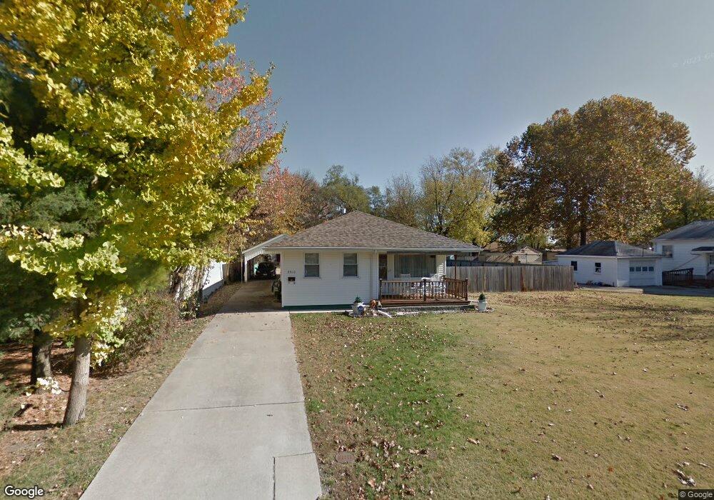
2910 S State St Unit 1 Springfield, IL 62704
Estimated Value: $83,000 - $104,000
Studio
--
Bath
--
Sq Ft
5,793
Sq Ft Lot
About This Home
This home is located at 2910 S State St Unit 1, Springfield, IL 62704 and is currently estimated at $91,591. 2910 S State St Unit 1 is a home located in Sangamon County with nearby schools including Black Hawk Elementary School, Jefferson Middle School, and Springfield Southeast High School.
Ownership History
Date
Name
Owned For
Owner Type
Purchase Details
Closed on
Sep 21, 2022
Sold by
Richards Jack L
Bought by
Richards James J
Current Estimated Value
Home Financials for this Owner
Home Financials are based on the most recent Mortgage that was taken out on this home.
Original Mortgage
$56,643
Outstanding Balance
$54,063
Interest Rate
5.13%
Mortgage Type
VA
Estimated Equity
$37,528
Purchase Details
Closed on
Jul 27, 2007
Purchase Details
Closed on
Mar 15, 2004
Create a Home Valuation Report for This Property
The Home Valuation Report is an in-depth analysis detailing your home's value as well as a comparison with similar homes in the area
Purchase History
| Date | Buyer | Sale Price | Title Company |
|---|---|---|---|
| Richards James J | $57,000 | -- | |
| -- | $65,000 | -- | |
| -- | -- | -- |
Source: Public Records
Mortgage History
| Date | Status | Borrower | Loan Amount |
|---|---|---|---|
| Open | Richards James J | $56,643 |
Source: Public Records
Tax History
| Year | Tax Paid | Tax Assessment Tax Assessment Total Assessment is a certain percentage of the fair market value that is determined by local assessors to be the total taxable value of land and additions on the property. | Land | Improvement |
|---|---|---|---|---|
| 2024 | $1,738 | $27,441 | $5,181 | $22,260 |
| 2023 | $1,666 | $25,408 | $4,797 | $20,611 |
| 2022 | $1,571 | $24,045 | $4,540 | $19,505 |
| 2021 | $1,495 | $23,102 | $4,362 | $18,740 |
| 2020 | $1,437 | $22,851 | $4,315 | $18,536 |
| 2019 | $1,377 | $22,452 | $4,240 | $18,212 |
| 2018 | $1,328 | $22,356 | $4,222 | $18,134 |
| 2017 | $1,289 | $22,012 | $4,157 | $17,855 |
| 2016 | $1,238 | $21,444 | $4,050 | $17,394 |
| 2015 | $1,204 | $20,960 | $3,959 | $17,001 |
| 2014 | $1,179 | $20,785 | $3,926 | $16,859 |
| 2013 | $1,167 | $21,008 | $3,968 | $17,040 |
Source: Public Records
Map
Nearby Homes
- 2830 S State St Unit 1
- 2609 S Lowell Ave Unit 1
- 3025 S Lincoln Ave Unit 1
- 2817 S Park Ave Unit 1
- 10 Reed Ct
- 300 W Lenox Ave Unit 1
- 2404 S Whittier Ave
- 2501 S College St
- 2321 S Pasfield St
- 3416 S Lincoln Ave Unit 1
- 3418 S Park Ave Unit 1
- 2136 S Whittier Ave
- 2621 S 4th St Unit 1
- 0 S Park Ave
- 2537 S 5th St
- 37 Belle Place
- 3022 S 3rd St Unit 1
- 1832 S State St
- 2349 S 5th St
- 1912 S Whittier Ave
- 2904 S State St
- 2900 S State St Unit 1
- 2916 S State St Unit 1
- 2918 S State St Unit 1
- 2841 S Glenwood Ave Unit 1
- 2909 S State St Unit 1
- 908 W Maple Ave S
- 2917 S Glenwood Ave Unit 1
- 2920 S State St
- 2905 S Glenwood Ave
- 2925 S Glenwood Ave
- 2842 S Glenwood Ave Unit 1
- 2901 S Glenwood Ave
- 2922 S State St
- 2929 S Glenwood Ave
- 2825 S Glenwood Ave Unit 1
- 2917 S State St
- 2927 S Glenwood Ave
- 2838 S Glenwood Ave
- 918 W Maple Ave S
Your Personal Tour Guide
Ask me questions while you tour the home.