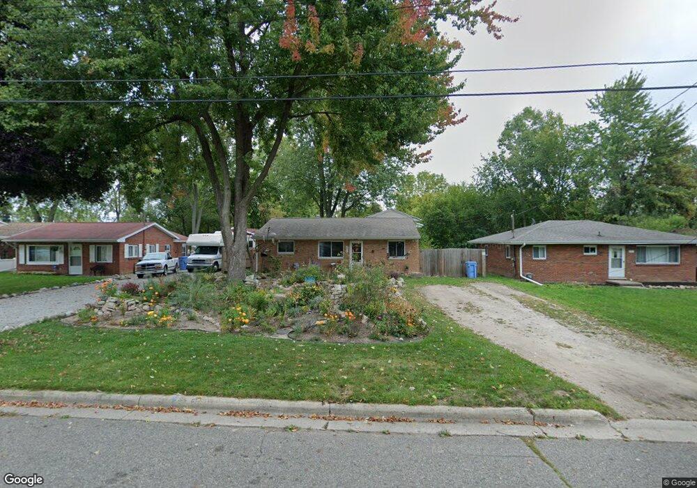
2911 Viking St Lansing, MI 48911
Pleasant Grove NeighborhoodEstimated Value: $148,328 - $178,000
About This Home
This home is located at 2911 Viking St, Lansing, MI 48911 and is currently estimated at $164,582, approximately $107 per square foot. 2911 Viking St is a home located in Ingham County with nearby schools including Averill Elementary School, Attwood School, and J.W. Sexton High School.
Ownership History
We collect this data history from publicly available records. To have your information removed, we recommend requesting removal directly through your county’s website.
Purchase Details
Home Financials for this Owner
Home Financials are based on the most recent Mortgage that was taken out on this home.Purchase Details
Home Values in the Area
Average Home Value in this Area
Purchase History
We collect this data history from publicly available records. To have your information removed, we recommend requesting removal directly through your county’s website.
| Date | Buyer | Sale Price | Title Company |
|---|---|---|---|
| $101,000 | Multiple | ||
| $50,000 | -- |
Mortgage History
We collect this data history from publicly available records. To have your information removed, we recommend requesting removal directly through your county’s website.
| Date | Status | Borrower | Loan Amount |
|---|---|---|---|
| Open | $103,020 |
Tax History
We collect this data history from publicly available records. To have your information removed, we recommend requesting removal directly through your county’s website.
| Year | Tax Paid | Tax Assessment Tax Assessment Total Assessment is a certain percentage of the fair market value that is determined by local assessors to be the total taxable value of land and additions on the property. | Land | Improvement |
|---|---|---|---|---|
| 2025 | $1,833 | $59,200 | $7,900 | $51,300 |
| 2024 | $18 | $50,100 | $7,900 | $42,200 |
| 2023 | $2,135 | $45,000 | $7,900 | $37,100 |
| 2022 | $1,927 | $41,400 | $7,900 | $33,500 |
| 2021 | $1,888 | $37,400 | $4,200 | $33,200 |
| 2020 | $1,876 | $35,900 | $4,200 | $31,700 |
| 2019 | $1,797 | $34,300 | $4,200 | $30,100 |
| 2018 | $1,685 | $31,500 | $4,200 | $27,300 |
| 2017 | $1,613 | $31,500 | $4,200 | $27,300 |
| 2016 | $1,543 | $29,600 | $4,200 | $25,400 |
| 2015 | $1,543 | $28,400 | $8,403 | $19,997 |
| 2014 | $1,543 | $26,900 | $13,655 | $13,245 |
Map
- 0 Dunlap St
- 3012 Ingham St
- 2409 Victor Ave
- 3122 Ingham St
- 3016 Pleasant Grove Rd
- 2941 S Deerfield Ave
- 2913 Quincy Ln
- 0 S Deerfield Ave
- 3303 S Deerfield Ave
- 2525 Bedford Rd
- 3201 Norwich Rd
- 2801 Chatham Rd
- 2200 Rossiter Place
- 2117 Edwin Place
- 2222 Fairfax Rd
- 3407 Churchill Ave
- 1718 Rock Way
- 3607 Pleasant Grove Rd
- 2709 Belaire Dr
- 1729 Loraine Ave
- 2907 Viking St
- 2917 Viking St
- 2901 Viking St
- 2612 Dunlap St
- 2600 Dunlap St
- 2910 Viking St
- 2916 Viking St
- 8 N Street Frontage
- 2518 Dunlap St
- 2709 Fauna Ave
- 2922 Viking St
- 2615 Dunlap St
- 2607 Dunlap St
- 2504 Dunlap St
- 2717 Fauna Ave
- 2714 Dunlap St
- 2603 Dunlap St
- 2500 Dunlap St
- 2511 Dunlap St
- 8 Dunlap St
Ask me questions while you tour the home.