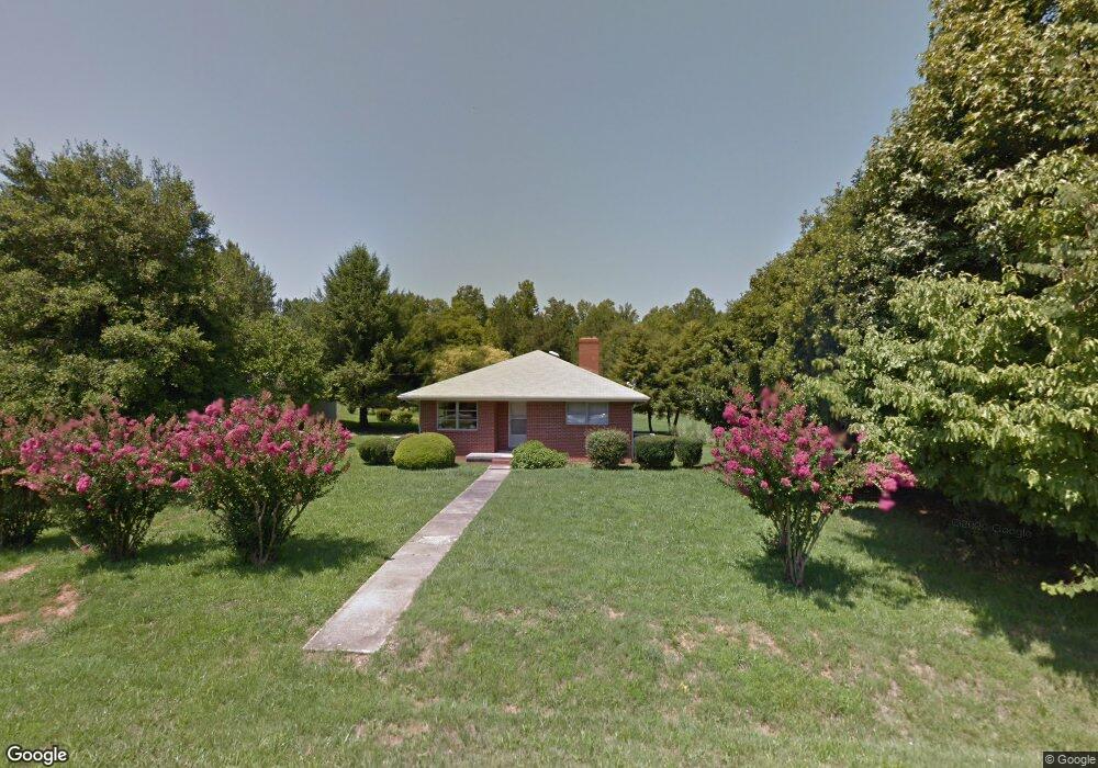
2915 Sparger Rd Durham, NC 27705
Croasdaile NeighborhoodEstimated Value: $359,066 - $419,000
2
Beds
2
Baths
1,730
Sq Ft
$232/Sq Ft
Est. Value
About This Home
This home is located at 2915 Sparger Rd, Durham, NC 27705 and is currently estimated at $401,267, approximately $231 per square foot. 2915 Sparger Rd is a home located in Durham County with nearby schools including Hillandale Elementary School, George L Carrington Middle, and Riverside High School.
Ownership History
Date
Name
Owned For
Owner Type
Purchase Details
Closed on
Dec 27, 2019
Sold by
Joe F Berini Construction Co Inc
Bought by
Deck Timothy
Current Estimated Value
Home Financials for this Owner
Home Financials are based on the most recent Mortgage that was taken out on this home.
Original Mortgage
$232,750
Outstanding Balance
$206,040
Interest Rate
3.7%
Mortgage Type
New Conventional
Estimated Equity
$195,227
Purchase Details
Closed on
Aug 22, 2019
Sold by
Crosby Curtis W
Bought by
Joe F Berini Construction Co Inc
Create a Home Valuation Report for This Property
The Home Valuation Report is an in-depth analysis detailing your home's value as well as a comparison with similar homes in the area
Home Values in the Area
Average Home Value in this Area
Purchase History
| Date | Buyer | Sale Price | Title Company |
|---|---|---|---|
| Deck Timothy | $247,000 | None Available | |
| Joe F Berini Construction Co Inc | $245,000 | None Available |
Source: Public Records
Mortgage History
| Date | Status | Borrower | Loan Amount |
|---|---|---|---|
| Open | Deck Timothy | $232,750 |
Source: Public Records
Tax History
| Year | Tax Paid | Tax Assessment Tax Assessment Total Assessment is a certain percentage of the fair market value that is determined by local assessors to be the total taxable value of land and additions on the property. | Land | Improvement |
|---|---|---|---|---|
| 2025 | $2,881 | $290,645 | $93,750 | $196,895 |
| 2024 | $2,824 | $202,461 | $44,850 | $157,611 |
| 2023 | $2,652 | $202,461 | $44,850 | $157,611 |
| 2022 | $2,591 | $202,461 | $44,850 | $157,611 |
| 2021 | $2,579 | $202,461 | $44,850 | $157,611 |
| 2020 | $2,518 | $202,461 | $44,850 | $157,611 |
| 2019 | $2,891 | $232,408 | $74,797 | $157,611 |
| 2018 | $2,265 | $166,945 | $52,027 | $114,918 |
| 2017 | $2,248 | $166,945 | $52,027 | $114,918 |
| 2016 | $2,172 | $166,945 | $52,027 | $114,918 |
| 2015 | $1,788 | $129,129 | $37,179 | $91,950 |
| 2014 | -- | $129,249 | $37,299 | $91,950 |
Source: Public Records
Map
Nearby Homes
- 2801 Sparger Rd
- 4404 Regis Ave
- 2606 Newquay St
- 2708 Ferrand Dr
- 6026 Willett Rd
- 2415 Sparwood Dr
- 208 Jefferson Dr
- 4116 Sunny Ct
- 2408 Orangewood Dr
- 4408 Cheshire Ct
- 2323 Orangewood Dr
- 5 Leathers Ct
- 22 Meadowbrook Ave
- 4331 Berini Dr
- 319 Fleming Dr
- 1214 E Oak Dr
- 2205 Skipping Stone Dr
- 2116 Skipping Stone Dr
- 4627 Stafford Dr
- 2104 Skipping Stone Dr
- 2921 Sparger Rd
- 2911 Sparger Rd
- 2918 Sparger Rd
- 2916 Sparger Rd
- 2914 Sparger Rd
- 2920 Sparger Rd
- 2909 Sparger Rd
- 2910 Sparger Rd
- 2922 Sparger Rd
- 2908 Sparger Rd
- 2926 Sparger Rd
- 2905 Sparger Rd
- 2906 Sparger Rd
- 2929 Sparger Rd
- 2930 Sparger Rd
- 2904 Sparger Rd
- 2901 Sparger Rd
- 3014 Sparger Rd
- 2902 Sparger Rd
- 2932 Sparger Rd
Your Personal Tour Guide
Ask me questions while you tour the home.