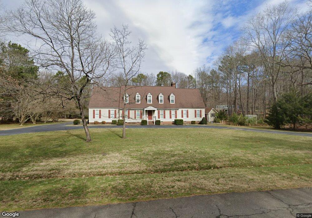
2920 E Brigstock Rd Midlothian, VA 23113
Salisbury NeighborhoodEstimated Value: $593,000 - $743,000
4
Beds
3
Baths
2,598
Sq Ft
$268/Sq Ft
Est. Value
About This Home
This home is located at 2920 E Brigstock Rd, Midlothian, VA 23113 and is currently estimated at $696,363, approximately $268 per square foot. 2920 E Brigstock Rd is a home located in Chesterfield County with nearby schools including Bettie Weaver Elementary School, Midlothian Middle School, and Midlothian High School.
Ownership History
Date
Name
Owned For
Owner Type
Purchase Details
Closed on
Dec 9, 2013
Sold by
Kelly Dorothy S
Bought by
Kelly Jeffrey W
Current Estimated Value
Home Financials for this Owner
Home Financials are based on the most recent Mortgage that was taken out on this home.
Original Mortgage
$312,300
Outstanding Balance
$232,777
Interest Rate
4.14%
Mortgage Type
New Conventional
Estimated Equity
$463,586
Create a Home Valuation Report for This Property
The Home Valuation Report is an in-depth analysis detailing your home's value as well as a comparison with similar homes in the area
Home Values in the Area
Average Home Value in this Area
Purchase History
| Date | Buyer | Sale Price | Title Company |
|---|---|---|---|
| Kelly Jeffrey W | $362,400 | -- |
Source: Public Records
Mortgage History
| Date | Status | Borrower | Loan Amount |
|---|---|---|---|
| Open | Kelly Jeffrey W | $312,300 |
Source: Public Records
Tax History
| Year | Tax Paid | Tax Assessment Tax Assessment Total Assessment is a certain percentage of the fair market value that is determined by local assessors to be the total taxable value of land and additions on the property. | Land | Improvement |
|---|---|---|---|---|
| 2025 | $5,563 | $622,200 | $131,000 | $491,200 |
| 2024 | $5,563 | $573,700 | $111,000 | $462,700 |
| 2023 | $4,846 | $532,500 | $106,000 | $426,500 |
| 2022 | $4,589 | $498,800 | $103,000 | $395,800 |
| 2021 | $4,385 | $454,600 | $101,000 | $353,600 |
| 2020 | $4,171 | $439,000 | $101,000 | $338,000 |
| 2019 | $4,171 | $439,000 | $101,000 | $338,000 |
| 2018 | $4,028 | $424,000 | $101,000 | $323,000 |
| 2017 | $3,911 | $407,400 | $100,000 | $307,400 |
| 2016 | $3,880 | $404,200 | $96,000 | $308,200 |
| 2015 | $3,739 | $386,900 | $96,000 | $290,900 |
| 2014 | $3,640 | $376,600 | $96,000 | $280,600 |
Source: Public Records
Map
Nearby Homes
- 2911 Vistapoint Rd
- 2540 Kentford Rd
- 3230 Queens Grant Dr
- 3306 Kings Farm Dr
- 13311 Glendower Rd
- 13637 Langford Dr
- 3607 Rivermist Terrace
- 521 Bel Crest Terrace
- 2711 Salisbury Rd
- 453 Bel Bridge Cir
- 2560 Chartstone Dr
- 2530 Whitecastle Dr
- 3107 Handley Rd
- 13155 Sodbury Dr
- 14335 Lander Rd
- 3201 Handley Rd
- 2940 River Hills Ln
- 3000 River Hills Ln
- 2121 Christendom Dr
- 1813 Gildenborough Ct
- 2910 E Brigstock Rd
- 2910 Mount Hill Dr
- 2920 Mount Hill Dr
- 2930 Barrow Place
- 2911 E Brigstock Rd
- 2900 Mount Hill Dr
- 2931 E Brigstock Rd
- 2900 E Brigstock Rd
- 2930 Mount Hill Dr
- 2901 E Brigstock Rd
- 2920 Barrow Place
- 2941 E Brigstock Rd
- 13900 Whitechapel Rd
- 2921 Barrow Place
- 13731 Solstice Close
- 2861 E Brigstock Rd
- 13852 Grey Friars Ln
- 2921 Mount Hill Dr
- 2940 Mount Hill Dr
- 2931 Mount Hill Dr
Your Personal Tour Guide
Ask me questions while you tour the home.