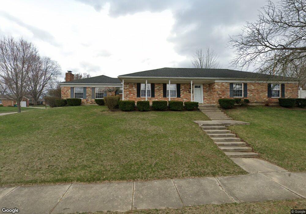
2920 Wellsford Dr Springfield, OH 45503
Springfield AreaEstimated Value: $276,000 - $331,000
About This Home
This home is located at 2920 Wellsford Dr, Springfield, OH 45503 and is currently estimated at $300,336, approximately $134 per square foot. 2920 Wellsford Dr is a home located in Clark County with nearby schools including Kenton Elementary School, Roosevelt Middle School, and Springfield High School.
Ownership History
We collect this data history from publicly available records. To have your information removed, we recommend requesting removal directly through your county’s website.
Purchase Details
Home Financials for this Owner
Home Financials are based on the most recent Mortgage that was taken out on this home.Home Values in the Area
Average Home Value in this Area
Purchase History
We collect this data history from publicly available records. To have your information removed, we recommend requesting removal directly through your county’s website.
| Date | Buyer | Sale Price | Title Company |
|---|---|---|---|
| $130,000 | -- |
Mortgage History
We collect this data history from publicly available records. To have your information removed, we recommend requesting removal directly through your county’s website.
| Date | Status | Borrower | Loan Amount |
|---|---|---|---|
| Open | $105,000 | ||
| Closed | $104,000 |
Tax History
We collect this data history from publicly available records. To have your information removed, we recommend requesting removal directly through your county’s website.
| Year | Tax Paid | Tax Assessment Tax Assessment Total Assessment is a certain percentage of the fair market value that is determined by local assessors to be the total taxable value of land and additions on the property. | Land | Improvement |
|---|---|---|---|---|
| 2025 | $2,989 | $87,150 | $17,220 | $69,930 |
| 2024 | $2,911 | $60,400 | $15,130 | $45,270 |
| 2023 | $2,911 | $60,400 | $15,130 | $45,270 |
| 2022 | $2,982 | $60,400 | $15,130 | $45,270 |
| 2021 | $2,679 | $50,100 | $12,300 | $37,800 |
| 2020 | $2,685 | $50,100 | $12,300 | $37,800 |
| 2019 | $2,691 | $50,100 | $12,300 | $37,800 |
| 2018 | $2,450 | $43,800 | $9,690 | $34,110 |
| 2017 | $2,448 | $50,169 | $9,688 | $40,481 |
| 2016 | $2,451 | $50,169 | $9,688 | $40,481 |
| 2015 | $2,580 | $45,374 | $9,226 | $36,148 |
| 2014 | $2,569 | $45,374 | $9,226 | $36,148 |
| 2013 | $2,542 | $45,374 | $9,226 | $36,148 |
Map
- 851 Weybridge Dr
- 939 Torrence Dr
- 2727 Wellsford Dr
- 2943 Imperial Blvd
- 1118 Robin Rd
- 3135 Imperial Blvd
- 541 Argonne Ave
- 2807 Rensselaer St
- 3116 El Camino Dr Unit 3
- 2636 Rebecca Dr
- 531 Argonne Ave
- 2553 Derr Rd
- 613 Villa Rd Unit H
- 366 Northfield Blvd Unit 1C
- 2606 Cavins Dr
- 2439 Greystone Ln
- 2323 Lilac Dr
- 1315 Greystone Dr
- 1323 Greystone Dr
- 2486 Signal Hill Rd
- 2910 Wellsford Ln
- 2910 Wellsford Dr
- 808 Torrence Dr
- 2909 Wellsford Ln
- 2909 Wellsford Dr
- 2838 Wellsford Dr
- 811 Weybridge Dr
- 818 Torrence Dr
- 2838 Wellsford Ln
- 2921 Wellsford Dr
- 813 Torrence Dr
- 732 Torrence Dr
- 821 Weybridge Dr
- 2828 Wellsford Dr
- 828 Torrence Dr
- 841 Weybridge Dr
- 731 Torrence Dr
- 823 Torrence Dr
- 712 Torrence Dr
- 731 Weybridge Dr
Ask me questions while you tour the home.