Estimated Value: $362,000 - $400,000
4
Beds
3
Baths
1,176
Sq Ft
$325/Sq Ft
Est. Value
About This Home
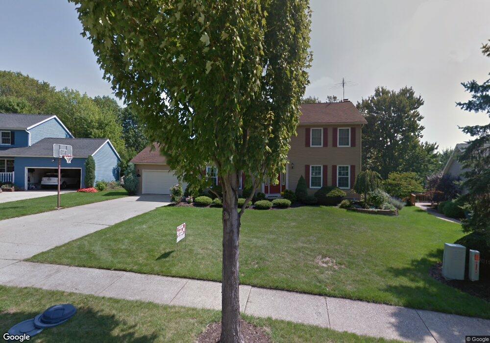
This home is located at 2923 Williamsburg Cir, Stow, OH 44224 and is currently estimated at $381,753, approximately $324 per square foot. 2923 Williamsburg Cir is a home located in Summit County with nearby schools including Stow-Munroe Falls High School, St Patrick Elementary School, and Walsh Jesuit High School.
Ownership History
Date
Name
Owned For
Owner Type
Purchase Details
Closed on
Feb 28, 2022
Sold by
White Jonathan C and White Jessica K
Bought by
Kaczmarczyk Matthew L and Kaczmarczyk Brittany N
Current Estimated Value
Home Financials for this Owner
Home Financials are based on the most recent Mortgage that was taken out on this home.
Original Mortgage
$248,000
Outstanding Balance
$227,184
Interest Rate
3.55%
Mortgage Type
New Conventional
Estimated Equity
$154,569
Purchase Details
Closed on
Mar 8, 2012
Sold by
Mckeey James S and Mckeen Amy S
Bought by
White Jonathan C and White Jessica K
Home Financials for this Owner
Home Financials are based on the most recent Mortgage that was taken out on this home.
Original Mortgage
$207,480
Interest Rate
3.88%
Mortgage Type
New Conventional
Create a Home Valuation Report for This Property
The Home Valuation Report is an in-depth analysis detailing your home's value as well as a comparison with similar homes in the area
Home Values in the Area
Average Home Value in this Area
Purchase History
We collect this data history from publicly available records. To have your information removed, we recommend requesting removal directly through your county’s website.
| Date | Buyer | Sale Price | Title Company |
|---|---|---|---|
| Kaczmarczyk Matthew L | $310,000 | Windon Jeffrey D | |
| White Jonathan C | $218,400 | Attorney |
Source: Public Records
Mortgage History
We collect this data history from publicly available records. To have your information removed, we recommend requesting removal directly through your county’s website.
| Date | Status | Borrower | Loan Amount |
|---|---|---|---|
| Open | Kaczmarczyk Matthew L | $248,000 | |
| Previous Owner | White Jonathan C | $207,480 |
Source: Public Records
Tax History
| Year | Tax Paid | Tax Assessment Tax Assessment Total Assessment is a certain percentage of the fair market value that is determined by local assessors to be the total taxable value of land and additions on the property. | Land | Improvement |
|---|---|---|---|---|
| 2026 | $8,361 | $104,514 | $15,852 | $88,662 |
| 2024 | $5,881 | $104,514 | $15,852 | $88,662 |
| 2023 | $5,881 | $104,514 | $15,852 | $88,662 |
| 2022 | $5,134 | $80,507 | $12,194 | $68,313 |
| 2021 | $4,596 | $80,507 | $12,194 | $68,313 |
| 2020 | $4,517 | $80,500 | $12,190 | $68,310 |
| 2019 | $4,893 | $81,620 | $12,070 | $69,550 |
| 2018 | $4,813 | $81,620 | $12,070 | $69,550 |
| 2017 | $4,379 | $81,620 | $12,070 | $69,550 |
| 2016 | $4,508 | $72,110 | $12,070 | $60,040 |
| 2015 | $4,379 | $72,110 | $12,070 | $60,040 |
| 2014 | $4,383 | $72,110 | $12,070 | $60,040 |
| 2013 | $3,999 | $66,130 | $12,070 | $54,060 |
Source: Public Records
Map
Nearby Homes
- 4215 Quail Hollow Cir
- 2940 Progress Park Dr
- 4544 Fishcreek Rd
- 3958 Lake Run Blvd
- 2917 Windsor Ct Unit 106
- 4501 Chatwood Dr
- 0 Pardee Rd
- 4155 Burton Dr
- 2760 Stockman Ct Unit 10
- 4534 Foresthill Rd
- 4915 Friar Rd Unit B
- 4795 Fishcreek Rd
- 2591 Jefferson Place Unit B
- 1132 Windward Ln
- 4709 Nottingham Ln
- 1312 Sunset Way Cir
- 2344 Echo Valley Dr
- 3826 Hile Rd
- 1162 Windward Ln
- 1295 Shady Lakes Dr
- 2917 Williamsburg Cir
- 2929 Williamsburg Cir
- 4266 Bunker Ln
- 4272 Bunker Ln
- 4258 Bunker Ln
- 2911 Williamsburg Cir
- 2935 Williamsburg Cir
- 2928 Williamsburg Cir
- 4278 Bunker Ln
- 4252 Bunker Ln
- 2914 Williamsburg Cir
- 2903 Williamsburg Cir
- 4286 Bunker Ln
- 2939 Williamsburg Cir
- 2906 Williamsburg Cir
- 2855 Saybrooke Blvd
- 2934 Williamsburg Cir
- 2869 Saybrooke Blvd
- 2847 Saybrooke Blvd
- 2896 Williamsburg Cir
Your Personal Tour Guide
Ask me questions while you tour the home.