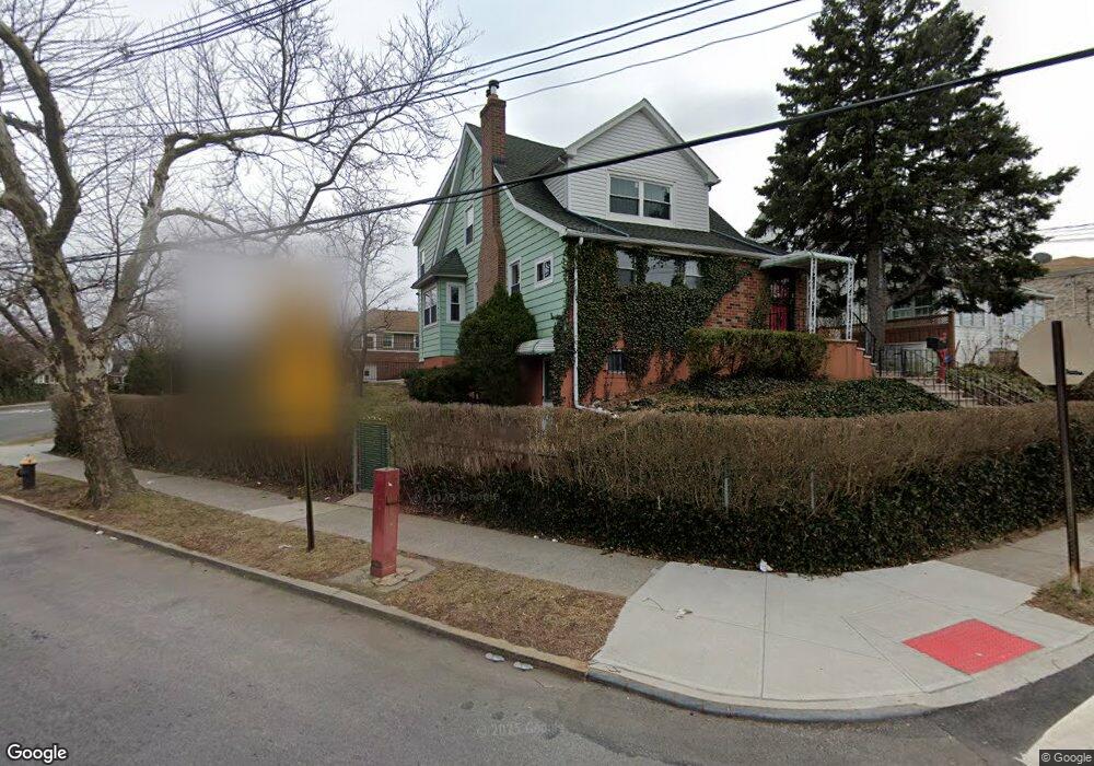
2928 Sampson Ave Bronx, NY 10465
Throgs Neck-Edgewater Park NeighborhoodEstimated Value: $665,241 - $790,000
Studio
--
Bath
1,179
Sq Ft
$617/Sq Ft
Est. Value
About This Home
This home is located at 2928 Sampson Ave, Bronx, NY 10465 and is currently estimated at $727,060, approximately $616 per square foot. 2928 Sampson Ave is a home located in Bronx County with nearby schools including P.S. 72 - Dr. William Dorney, Herbert H Lehman High School, and St. Frances de Chantal School.
Ownership History
Date
Name
Owned For
Owner Type
Purchase Details
Closed on
Jun 19, 2017
Sold by
Christopher Lee Administrator
Bought by
Lee Christopher
Current Estimated Value
Purchase Details
Closed on
Sep 12, 2011
Sold by
Valentin Jose and Valentin Zoila
Bought by
Lee Christopher and Photopoulos Philip C
Home Financials for this Owner
Home Financials are based on the most recent Mortgage that was taken out on this home.
Original Mortgage
$300,000
Interest Rate
4.15%
Mortgage Type
Purchase Money Mortgage
Create a Home Valuation Report for This Property
The Home Valuation Report is an in-depth analysis detailing your home's value as well as a comparison with similar homes in the area
Home Values in the Area
Average Home Value in this Area
Purchase History
We collect this data history from publicly available records. To have your information removed, we recommend requesting removal directly through your county’s website.
| Date | Buyer | Sale Price | Title Company |
|---|---|---|---|
| Lee Christopher | -- | -- | |
| Lee Christopher | $500,000 | -- |
Source: Public Records
Mortgage History
We collect this data history from publicly available records. To have your information removed, we recommend requesting removal directly through your county’s website.
| Date | Status | Borrower | Loan Amount |
|---|---|---|---|
| Previous Owner | Lee Christopher | $300,000 |
Source: Public Records
Tax History
| Year | Tax Paid | Tax Assessment Tax Assessment Total Assessment is a certain percentage of the fair market value that is determined by local assessors to be the total taxable value of land and additions on the property. | Land | Improvement |
|---|---|---|---|---|
| 2026 | $6,457 | $34,073 | $8,269 | $25,804 |
| 2025 | $6,091 | $32,146 | $7,115 | $25,031 |
| 2024 | $6,091 | $30,326 | $8,003 | $22,323 |
| 2023 | $6,004 | $29,894 | $6,979 | $22,915 |
| 2022 | $5,369 | $37,980 | $9,960 | $28,020 |
| 2021 | $5,976 | $32,160 | $9,960 | $22,200 |
| 2020 | $5,670 | $35,520 | $9,960 | $25,560 |
| 2019 | $5,287 | $36,600 | $9,960 | $26,640 |
| 2018 | $5,078 | $24,912 | $7,773 | $17,139 |
| 2017 | $3,508 | $23,688 | $7,976 | $15,712 |
| 2016 | $4,420 | $23,662 | $8,339 | $15,323 |
| 2015 | $2,475 | $22,323 | $10,669 | $11,654 |
| 2014 | $2,475 | $21,060 | $11,040 | $10,020 |
Source: Public Records
Map
Nearby Homes
- 2935 Miles Ave
- 416 Revere Ave
- 287 Logan Ave
- 2858 Sampson Ave
- 2882 Miles Ave
- 412 Calhoun Ave
- 426 Calhoun Ave
- 276 Revere Ave
- 2866 Dewey Ave
- 512 Logan Ave
- 351 Quincy Ave
- 347 Quincy Ave
- 2864 Dewey Ave
- 264 Throgs Neck Blvd
- 535 Edison Ave
- 541 Edison Ave
- 541 Logan Ave
- 4216 E Tremont Ave
- 244 Revere Ave
- 545 Hollywood Ave
- 2918 Sampson Ave Unit 1
- 2918 Sampson Ave
- 2916 Sampson Ave Unit 1
- 2916 Sampson Ave
- 2922 Sampson Ave
- 2912 Sampson Ave
- 333 Logan Ave
- 2917 Gerber Place
- 2919 Gerber Place
- 2915 Gerber Place
- 2921 Gerber Place
- 2911 Gerber Place
- 4011 E Tremont Ave
- 4001 E Tremont Ave
- 2923 Gerber Place
- 4017 E Tremont Ave
- 2923 Sampson Ave Unit 1
- 2925 Gerber Place
- 4003 E Tremont Ave
- 2919 Sampson Ave Unit 2
Your Personal Tour Guide
Ask me questions while you tour the home.