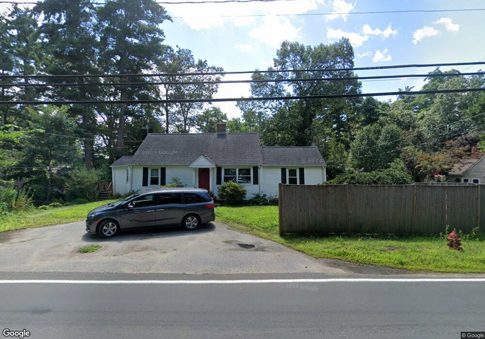
293 Hudson Rd Sudbury, MA 01776
Estimated Value: $603,000 - $674,000
2
Beds
1
Bath
1,332
Sq Ft
$480/Sq Ft
Est. Value
About This Home
This home is located at 293 Hudson Rd, Sudbury, MA 01776 and is currently estimated at $639,184, approximately $479 per square foot. 293 Hudson Rd is a home located in Middlesex County with nearby schools including General John Nixon Elementary School, Ephraim Curtis Middle School, and Lincoln-Sudbury Regional High School.
Ownership History
Date
Name
Owned For
Owner Type
Purchase Details
Closed on
Jan 29, 2009
Sold by
Fnma
Bought by
Mccain Danielle M and Stackpole Wayne C
Current Estimated Value
Purchase Details
Closed on
Jan 2, 2009
Sold by
Alum Donna
Bought by
Federal National Mortgage Association
Create a Home Valuation Report for This Property
The Home Valuation Report is an in-depth analysis detailing your home's value as well as a comparison with similar homes in the area
Home Values in the Area
Average Home Value in this Area
Purchase History
We collect this data history from publicly available records. To have your information removed, we recommend requesting removal directly through your county’s website.
| Date | Buyer | Sale Price | Title Company |
|---|---|---|---|
| Mccain Danielle M | $268,500 | -- | |
| Federal National Mortgage Association | $293,728 | -- | |
| Mccain Danielle M | $268,500 | -- | |
| Federal National Mortgage Association | $293,728 | -- |
Source: Public Records
Mortgage History
We collect this data history from publicly available records. To have your information removed, we recommend requesting removal directly through your county’s website.
| Date | Status | Borrower | Loan Amount |
|---|---|---|---|
| Open | Federal National Mortgage Association | $214,800 | |
| Previous Owner | Federal National Mortgage Association | $208,000 |
Source: Public Records
Tax History
| Year | Tax Paid | Tax Assessment Tax Assessment Total Assessment is a certain percentage of the fair market value that is determined by local assessors to be the total taxable value of land and additions on the property. | Land | Improvement |
|---|---|---|---|---|
| 2025 | $8,291 | $566,300 | $323,700 | $242,600 |
| 2024 | $8,009 | $548,200 | $314,200 | $234,000 |
| 2023 | $8,357 | $529,900 | $301,900 | $228,000 |
| 2022 | $8,099 | $448,700 | $277,100 | $171,600 |
| 2021 | $7,865 | $417,700 | $277,100 | $140,600 |
| 2020 | $7,707 | $417,700 | $277,100 | $140,600 |
| 2019 | $7,481 | $417,700 | $277,100 | $140,600 |
| 2018 | $7,159 | $399,300 | $268,600 | $130,700 |
| 2017 | $6,885 | $388,100 | $265,900 | $122,200 |
| 2016 | $6,627 | $372,300 | $255,700 | $116,600 |
| 2015 | $6,311 | $358,600 | $243,400 | $115,200 |
| 2014 | $6,287 | $348,700 | $236,300 | $112,400 |
Source: Public Records
Map
Nearby Homes
- 17 Brentwood Rd
- 55 Saxony Dr
- 138 Fairbank Rd
- 45 Webster Cir
- 8 Twillingate Rd
- 9 Priest Rd
- 30 Harness Ln
- 125 Hudson Rd
- 96 Hudson Rd
- 59 Tanbark Rd
- 228 Horse Pond Rd
- 55 Widow Rites Ln
- 7 Saddle Ridge Rd
- 45 Widow Rights Ln
- 355 Maynard Rd
- 65 Fox Run Rd
- 42 Pinewood Ave
- 64 Cudworth Ln
- 11 Axdell Rd
- 15 Ronald Rd
- 16 Richard Ave
- 16 Richard Ave Unit 16
- 16 Richard Ave
- 14 Richard Ave
- 15 Lillian Ave
- 15 Richard Ave
- 18 Richard Ave
- 10 Richard Ave
- 10 Richard Ave Unit SF
- 24 Richard Ave
- 21 Richard Ave
- 9 Lillian Ave
- 7 Richard Ave
- 7 Richard Ave
- 18 Lillian Ave
- 8 Frye St
- 12 Lillian Ave
- 27 Lillian Ave
- 26 Reeves St
- 28 Reeves St
Your Personal Tour Guide
Ask me questions while you tour the home.