Estimated Value: $191,000 - $344,000
Studio
--
Bath
--
Sq Ft
59,677
Sq Ft Lot
About This Home
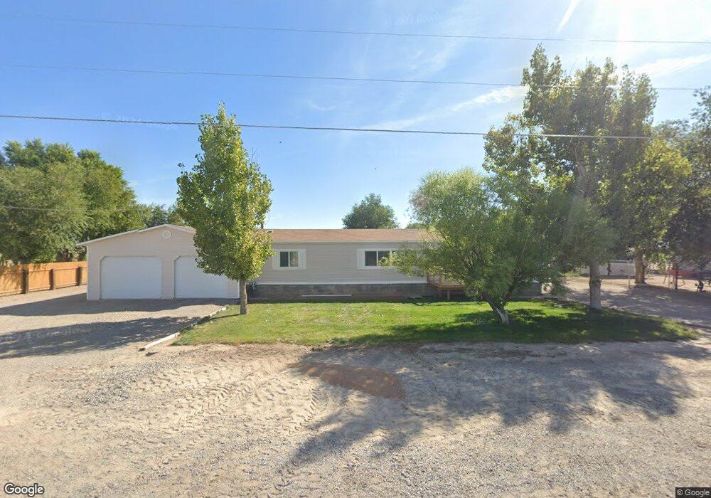
This home is located at 293 S Main St, Delta, UT 84624 and is currently estimated at $281,633. 293 S Main St is a home.
Ownership History
Date
Name
Owned For
Owner Type
Purchase Details
Closed on
May 15, 2023
Sold by
Remkes Carl N
Bought by
Silviculture Llc
Current Estimated Value
Purchase Details
Closed on
Feb 27, 2018
Sold by
Garland Annette H
Bought by
Orozco Luz O and Ruiz Lilia
Home Financials for this Owner
Home Financials are based on the most recent Mortgage that was taken out on this home.
Original Mortgage
$79,800
Interest Rate
4.04%
Mortgage Type
New Conventional
Purchase Details
Closed on
Apr 14, 2016
Sold by
Fullmer Sandra
Bought by
Remakes Carl N and Remakes Mary K
Home Financials for this Owner
Home Financials are based on the most recent Mortgage that was taken out on this home.
Original Mortgage
$60,000
Interest Rate
3.64%
Mortgage Type
New Conventional
Create a Home Valuation Report for This Property
The Home Valuation Report is an in-depth analysis detailing your home's value as well as a comparison with similar homes in the area
Purchase History
| Date | Buyer | Sale Price | Title Company |
|---|---|---|---|
| Silviculture Llc | -- | None Listed On Document | |
| Orozco Luz O | -- | -- | |
| Remakes Carl N | -- | First American Title |
Source: Public Records
Mortgage History
| Date | Status | Borrower | Loan Amount |
|---|---|---|---|
| Previous Owner | Orozco Luz O | $79,800 | |
| Previous Owner | Remakes Carl N | $60,000 |
Source: Public Records
Tax History
| Year | Tax Paid | Tax Assessment Tax Assessment Total Assessment is a certain percentage of the fair market value that is determined by local assessors to be the total taxable value of land and additions on the property. | Land | Improvement |
|---|---|---|---|---|
| 2025 | $1,210 | $155,807 | $32,700 | $123,107 |
| 2024 | $1,210 | $135,203 | $22,332 | $112,871 |
| 2023 | $1,440 | $135,203 | $22,332 | $112,871 |
| 2022 | $1,187 | $109,859 | $18,609 | $91,250 |
| 2021 | $872 | $77,121 | $15,508 | $61,613 |
| 2020 | $739 | $65,704 | $13,485 | $52,219 |
| 2019 | $722 | $64,510 | $12,259 | $52,251 |
| 2018 | $657 | $59,948 | $10,660 | $49,288 |
| 2017 | $651 | $56,724 | $10,660 | $46,064 |
| 2016 | $558 | $50,531 | $10,650 | $39,881 |
| 2015 | $558 | $50,531 | $10,650 | $39,881 |
| 2014 | -- | $50,531 | $10,650 | $39,881 |
| 2013 | -- | $50,531 | $10,650 | $39,881 |
Source: Public Records
Map
Nearby Homes
- 289 W Center St S
- 33 S 800 West Rd
- 30 S 800 West Rd
- 861 W 75 S
- 3480 S 4000 W
- 700 Acres
- 1500 S 10000 W
- 6000 N 10000 W
- 7560 W 8500 N
- 4500 N 10000 W
- 400 S 200 E
- 850 W 15900 N
- 4500 N 9000 W
- 700 Acres Hwy 6 & Main St (Hwy 50)
- 2000 E 10500 N
- 6200 S 3000 W
- 18000 W Hwy 50 6
- 4265 S 4000 W
- 6177 S 3000 Rd W
- Tbd Highway 6-50
Your Personal Tour Guide
Ask me questions while you tour the home.