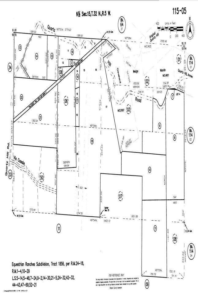
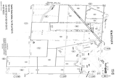
2935 Quartz Hill Rd Redding, CA 96003
Buckeye NeighborhoodEstimated payment $2,046/month
Highlights
- 65 Acre Lot
- Partially Fenced Property
- Lot Has A Rolling Slope
About This Lot
65+acres in the City of Redding fronting Quartz Hill Road and Keswick Dam road. There are 4 AP#s. Said property has the potential for a subdivision with the extension of sewer from Lake Blvd or would make a great secluded building site. Buyer to confirm with City of Redding all utility availability and zoning.
Property Details
Property Type
- Land
Lot Details
- 65 Acre Lot
- Partially Fenced Property
- Lot Has A Rolling Slope
- Zoning described as RED - R-1 - Single Family Residential District
Listing and Financial Details
- Assessor Parcel Number 115-050-08,09,10&11
Map
Home Values in the Area
Average Home Value in this Area
Tax History
We collect this data history from publicly available records. To have your information removed, we recommend requesting removal directly through your county’s website.
| Year | Tax Paid | Tax Assessment Tax Assessment Total Assessment is a certain percentage of the fair market value that is determined by local assessors to be the total taxable value of land and additions on the property. | Land | Improvement |
|---|---|---|---|---|
| 2025 | $273 | $25,405 | $25,405 | -- |
| 2024 | $268 | $24,907 | $24,907 | -- |
| 2023 | $268 | $24,419 | $24,419 | $0 |
| 2022 | $261 | $23,941 | $23,941 | $0 |
| 2021 | $257 | $23,472 | $23,472 | $0 |
| 2020 | $256 | $23,232 | $23,232 | $0 |
| 2019 | $248 | $22,777 | $22,777 | $0 |
| 2018 | $249 | $22,331 | $22,331 | $0 |
| 2017 | $244 | $21,894 | $21,894 | $0 |
| 2016 | $234 | $21,465 | $21,465 | $0 |
| 2015 | $230 | $21,143 | $21,143 | $0 |
| 2014 | -- | $20,729 | $20,729 | $0 |
Property History
We collect this data history from publicly available records. To have your information removed, we recommend requesting removal directly through your county’s website.
| Date | Event | Price | List to Sale | Price per Sq Ft |
|---|---|---|---|---|
| 12/03/2025 12/03/25 | Price Changed | $375,000 | -5.1% | -- |
| 02/03/2023 02/03/23 | Price Changed | $395,000 | -3.7% | -- |
| 09/02/2022 09/02/22 | For Sale | $410,000 | -- | -- |
Purchase History
We collect this data history from publicly available records. To have your information removed, we recommend requesting removal directly through your county’s website.
| Date | Type | Sale Price | Title Company |
|---|---|---|---|
| Interfamily Deed Transfer | -- | None Available | |
| Gift Deed | -- | -- | |
| Gift Deed | -- | -- |
Source: Shasta Association of REALTORS®
MLS Number: 22-4416
APN: 115-050-008-000
Disclaimer: Certain information contained herein is derived from information provided by parties other than Homes.com. All information provided is deemed reliable, but is not guaranteed to be accurate and should be independently verified.
![]() IDX information is provided exclusively for personal, non-commercial use, and may not be used for any purpose other than to identify prospective properties consumers may be interested in purchasing. Information is deemed reliable but not guaranteed.
IDX information is provided exclusively for personal, non-commercial use, and may not be used for any purpose other than to identify prospective properties consumers may be interested in purchasing. Information is deemed reliable but not guaranteed.
- 1760 Bishop
- 2966 Quartz Hill Rd
- 1720 Mckinney Ln
- 3175 Pinehaven Dr
- 12003 Counter Ln
- 3451 Snavely Ward Dr
- 1800 Jason Way
- 0000 Snavely Dr
- 3291 Keswick Dam Rd
- 3550 Oasis Rd
- 2580 Keswick Dam Rd
- 12125 Lake Blvd
- 3586 E Keswick Dam Rd
- 12116 Lake Blvd
- 17505 Forest View Dr
- 12125 Romar St
- 3588 Magnums Way
- 17789 Peterson Ln
- 3746 Yuletide Ave
- 3345 Golden Heights Dr
- 1433 Mishka Ct Unit 2 bedroom 950 sq ft
- 1424 Calexico Dr
- 1437 Mariposa Ct
- 3657 Santa Rosa Way
- 933 July Way
- 861 July Way Unit 1
- 4288 Bradley Dr
- 410 Buckeye Terrace Unit 3
- 2820 Panorama Dr
- 359 Lemon Dr Unit 17
- 17875 Walker Mine Rd
- 835 Shiloh Ct Unit 1
- 6053 Fallworth Dr
- 6073 Fallworth Dr
- 466 Woodcliff Dr
- 466 Woodcliff Dr
- 1031 West St Unit 1031 West Street
- 1855 Gold Hills Dr
- 3747 Sunday Ct
- 500 Hilltop Dr

Ask me questions while you tour the home.