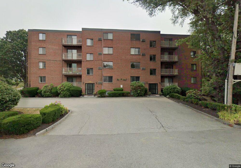
295 Main St Unit 10 Reading, MA 01867
Estimated Value: $358,608 - $393,000
2
Beds
1
Bath
782
Sq Ft
$480/Sq Ft
Est. Value
About This Home
This home is located at 295 Main St Unit 10, Reading, MA 01867 and is currently estimated at $375,402, approximately $480 per square foot. 295 Main St Unit 10 is a home located in Middlesex County with nearby schools including J. Warren Killam Elementary School, Walter S. Parker Middle School, and Reading Memorial High School.
Ownership History
Date
Name
Owned For
Owner Type
Purchase Details
Closed on
Sep 1, 1998
Sold by
Paul M Mccarthy T and Mccarthy Paul M
Bought by
Poles Gabriella
Current Estimated Value
Home Financials for this Owner
Home Financials are based on the most recent Mortgage that was taken out on this home.
Original Mortgage
$86,400
Outstanding Balance
$18,456
Interest Rate
6.9%
Mortgage Type
Purchase Money Mortgage
Estimated Equity
$356,946
Create a Home Valuation Report for This Property
The Home Valuation Report is an in-depth analysis detailing your home's value as well as a comparison with similar homes in the area
Home Values in the Area
Average Home Value in this Area
Purchase History
We collect this data history from publicly available records. To have your information removed, we recommend requesting removal directly through your county’s website.
| Date | Buyer | Sale Price | Title Company |
|---|---|---|---|
| Poles Gabriella | $97,500 | -- |
Source: Public Records
Mortgage History
We collect this data history from publicly available records. To have your information removed, we recommend requesting removal directly through your county’s website.
| Date | Status | Borrower | Loan Amount |
|---|---|---|---|
| Open | Poles Gabriella | $86,400 |
Source: Public Records
Tax History
| Year | Tax Paid | Tax Assessment Tax Assessment Total Assessment is a certain percentage of the fair market value that is determined by local assessors to be the total taxable value of land and additions on the property. | Land | Improvement |
|---|---|---|---|---|
| 2025 | $3,693 | $324,200 | $0 | $324,200 |
| 2024 | $3,624 | $309,200 | $0 | $309,200 |
| 2023 | $3,349 | $266,000 | $0 | $266,000 |
| 2022 | $3,325 | $249,400 | $0 | $249,400 |
| 2021 | $3,368 | $243,900 | $0 | $243,900 |
| 2020 | $3,284 | $235,400 | $0 | $235,400 |
| 2019 | $3,300 | $231,900 | $0 | $231,900 |
| 2018 | $2,519 | $181,600 | $0 | $181,600 |
| 2017 | $2,548 | $181,600 | $0 | $181,600 |
| 2016 | $2,651 | $182,800 | $0 | $182,800 |
| 2015 | $2,559 | $174,100 | $0 | $174,100 |
| 2014 | $2,422 | $164,300 | $0 | $164,300 |
Source: Public Records
Map
Nearby Homes
- 295 Main St Unit 16
- 20 Pinevale Ave
- 400 Main St
- 190 Main St
- 48 Village St Unit 1001
- 713 Gazebo Cir Unit 713
- 115 Prescott St
- 12 Lakeview Ave
- 812 Gazebo Cir
- 33 Old Farm Rd
- 52 Sanborn St Unit 7
- 1 Summit Dr Unit 24
- 1 Summit Dr Unit 57
- 1 Charles St Unit V
- 62 Abigail Way Unit 1006
- 62 Abigail Way Unit 4006
- 168 Summer Ave
- 7 King St
- 13 Carnation Cir Unit B
- 23 Augustus Ct Unit 4003
- 295 Main St Unit 30
- 295 Main St Unit 29
- 295 Main St Unit 28
- 295 Main St Unit 27
- 295 Main St Unit 26
- 295 Main St Unit 25
- 295 Main St Unit 24
- 295 Main St Unit 23
- 295 Main St Unit 22
- 295 Main St Unit 21
- 295 Main St Unit 20
- 295 Main St Unit 19
- 295 Main St Unit 18
- 295 Main St Unit 14
- 295 Main St Unit 12A
- 295 Main St Unit 12
- 295 Main St Unit 11
- 295 Main St Unit 9
- 295 Main St Unit 8
- 295 Main St Unit 7
Your Personal Tour Guide
Ask me questions while you tour the home.