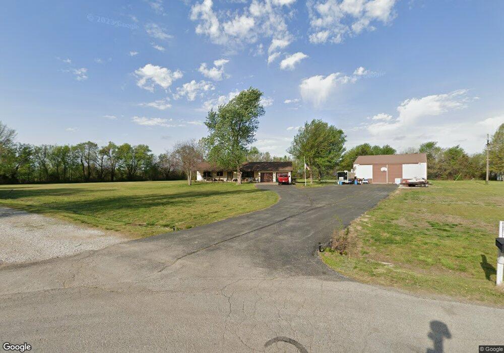
2953 S Maple St Carthage, MO 64836
Estimated Value: $249,000 - $381,000
4
Beds
3
Baths
2,452
Sq Ft
$128/Sq Ft
Est. Value
About This Home
This home is located at 2953 S Maple St, Carthage, MO 64836 and is currently estimated at $314,861, approximately $128 per square foot. 2953 S Maple St is a home located in Jasper County with nearby schools including Carthage High School, St. Ann's Catholic School, and Victory Academy.
Ownership History
Date
Name
Owned For
Owner Type
Purchase Details
Closed on
Jun 17, 2008
Sold by
Channel Thomas and Channel Pennie
Bought by
Hurrell Roger S and Hurrell Jeanne M
Current Estimated Value
Home Financials for this Owner
Home Financials are based on the most recent Mortgage that was taken out on this home.
Original Mortgage
$159,600
Outstanding Balance
$102,126
Interest Rate
6.08%
Mortgage Type
Unknown
Estimated Equity
$212,735
Create a Home Valuation Report for This Property
The Home Valuation Report is an in-depth analysis detailing your home's value as well as a comparison with similar homes in the area
Purchase History
| Date | Buyer | Sale Price | Title Company |
|---|---|---|---|
| Hurrell Roger S | -- | None Available |
Source: Public Records
Mortgage History
| Date | Status | Borrower | Loan Amount |
|---|---|---|---|
| Open | Hurrell Roger S | $159,600 |
Source: Public Records
Tax History
| Year | Tax Paid | Tax Assessment Tax Assessment Total Assessment is a certain percentage of the fair market value that is determined by local assessors to be the total taxable value of land and additions on the property. | Land | Improvement |
|---|---|---|---|---|
| 2025 | $1,639 | $38,740 | $4,430 | $34,310 |
| 2024 | $1,639 | $35,040 | $4,430 | $30,610 |
| 2023 | $1,639 | $35,040 | $4,430 | $30,610 |
| 2022 | $1,734 | $37,210 | $4,430 | $32,780 |
| 2021 | $1,714 | $37,210 | $4,430 | $32,780 |
| 2020 | $1,653 | $34,480 | $4,430 | $30,050 |
| 2019 | $1,656 | $34,480 | $4,430 | $30,050 |
| 2018 | $1,784 | $37,180 | $0 | $0 |
| 2017 | $1,788 | $37,180 | $0 | $0 |
| 2016 | $1,870 | $39,010 | $0 | $0 |
Source: Public Records
Map
Nearby Homes
- Tbd Doctor Russell Smith Way
- Tract 1 E Fir Rd Unit 146014000000014000
- Tract 2 E Fir Rd Unit 146014000000014000
- Tract 1 E Fir Rd
- Tract 3 E Fir Rd
- Tract 3 E Fir Rd Unit 146014000000014000
- Tract 2 E Fir Rd
- Tract 4 E Fir Rd Unit 146014000000014000
- Tract 4 E Fir Rd
- NEC Fir Rd & Hazel Ave Unit Par 2
- 000 Annie Baxter & George Phelps
- Tbd W George E Phelps Blvd
- SWC Fir Rd & I-49 Parcel 2
- SWC Fir Rd & I-49 Unit 1
- TBD George E Phelps Blvd
- XXXX Clinton
- Tbd W Fir Rd Unit 3
- 1310 W Fir Rd
- Tbd W Fir Rd Unit 2
- Tbd W Fir Rd Unit 1
- 2927 S Maple St Unit 1
- 2927 S Maple St
- 2956 S Maple St
- 1410 Foundry Dr
- 269 Virginia Ave Unit 1
- 269 Virginia St
- 2911 S Maple St
- 254 Virginia Ave
- 251 Virginia St
- 232 Virginia Ave
- 2889 S Maple St
- 2910 S Maple St
- 2892 S Maple St
- TBD Peach Tree Lots
- 2873 S Maple St
- 206 Virginia Ave
- 410 W Fir Rd Unit C207
- 410 W Fir Rd
- 410 W Fir Rd Unit d104
- 410 W Fir Rd Unit b203
Your Personal Tour Guide
Ask me questions while you tour the home.