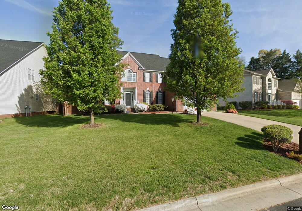
2955 Shady View Dr High Point, NC 27265
Bent Tree NeighborhoodEstimated Value: $501,000 - $548,000
4
Beds
3
Baths
3,762
Sq Ft
$139/Sq Ft
Est. Value
About This Home
This home is located at 2955 Shady View Dr, High Point, NC 27265 and is currently estimated at $524,764, approximately $139 per square foot. 2955 Shady View Dr is a home located in Guilford County with nearby schools including Southwest Elementary School, Southwest Guilford Middle School, and Southwest Guilford High School.
Ownership History
Date
Name
Owned For
Owner Type
Purchase Details
Closed on
Sep 23, 2002
Sold by
The New Fortis Corp
Bought by
Taylor Brian S and Taylor Levada
Current Estimated Value
Home Financials for this Owner
Home Financials are based on the most recent Mortgage that was taken out on this home.
Original Mortgage
$281,900
Outstanding Balance
$117,329
Interest Rate
6.19%
Estimated Equity
$407,435
Purchase Details
Closed on
May 22, 2002
Sold by
Peaceford Meadows Llc
Bought by
The New Fortis Corp Inc
Create a Home Valuation Report for This Property
The Home Valuation Report is an in-depth analysis detailing your home's value as well as a comparison with similar homes in the area
Home Values in the Area
Average Home Value in this Area
Purchase History
We collect this data history from publicly available records. To have your information removed, we recommend requesting removal directly through your county’s website.
| Date | Buyer | Sale Price | Title Company |
|---|---|---|---|
| Taylor Brian S | $291,500 | -- | |
| The New Fortis Corp Inc | $33,000 | -- |
Source: Public Records
Mortgage History
We collect this data history from publicly available records. To have your information removed, we recommend requesting removal directly through your county’s website.
| Date | Status | Borrower | Loan Amount |
|---|---|---|---|
| Open | Taylor Brian S | $281,900 |
Source: Public Records
Tax History
| Year | Tax Paid | Tax Assessment Tax Assessment Total Assessment is a certain percentage of the fair market value that is determined by local assessors to be the total taxable value of land and additions on the property. | Land | Improvement |
|---|---|---|---|---|
| 2025 | $6,446 | $467,800 | $85,000 | $382,800 |
| 2024 | $6,446 | $467,800 | $85,000 | $382,800 |
| 2023 | $6,446 | $467,800 | $85,000 | $382,800 |
| 2022 | $6,306 | $467,800 | $85,000 | $382,800 |
| 2021 | $3,959 | $287,300 | $48,000 | $239,300 |
| 2020 | $3,959 | $287,300 | $48,000 | $239,300 |
| 2019 | $3,959 | $287,300 | $0 | $0 |
| 2018 | $3,939 | $287,300 | $0 | $0 |
| 2017 | $3,939 | $287,300 | $0 | $0 |
| 2016 | $3,539 | $252,300 | $0 | $0 |
| 2015 | $3,557 | $252,300 | $0 | $0 |
| 2014 | $3,618 | $252,300 | $0 | $0 |
Source: Public Records
Map
Nearby Homes
- 3021 Sycamore Point Trail
- 4353 Thistle Down Ct
- 3208 Riley Ford Trail
- 3273 Alyssa Way
- 3023 Maple Branch Dr
- 4386 Ashton Oaks Ct
- 2603 Bingham Ct
- 4421 Ashton Oaks Ct
- 4000 Trappers Run Ct
- 4430 Ashton Oaks Ct
- 2304 Faircloth Way
- 2309 Faircloth Way
- 4447 Kendale Rd
- 633 Stags Leap Ct
- 2460 Alderbrook Dr
- 661 Nikyle Cir
- 3625 Oak Chase Dr
- 4712 Willowstone Dr
- 4714 Willowstone Dr
- 4713 Willowstone Dr
- 2951 Shady View Dr
- 2955 Glen Echo Ct
- 2952 Shady View Dr
- 2959 Shady View Dr
- 2952 Glen Echo Ct
- 2948 Glen Echo Ct
- 2956 Shady View Dr
- 2948 Shady View Dr
- 2953 Glen Echo Ct
- 2942 Shady View Dr
- 2944 Glen Echo Ct
- 4408 Peaceford Glen Dr
- 3048 Sycamore Point Trail
- 2947 Glen Echo Ct
- 3048 Sycamore Point Tr
- 3052 Sycamore Point Trail
- 3044 Sycamore Point Trail
- 2935 Shady View Dr
- 2938 Shady View Dr
- 4404 Peaceford Glen Dr
Your Personal Tour Guide
Ask me questions while you tour the home.