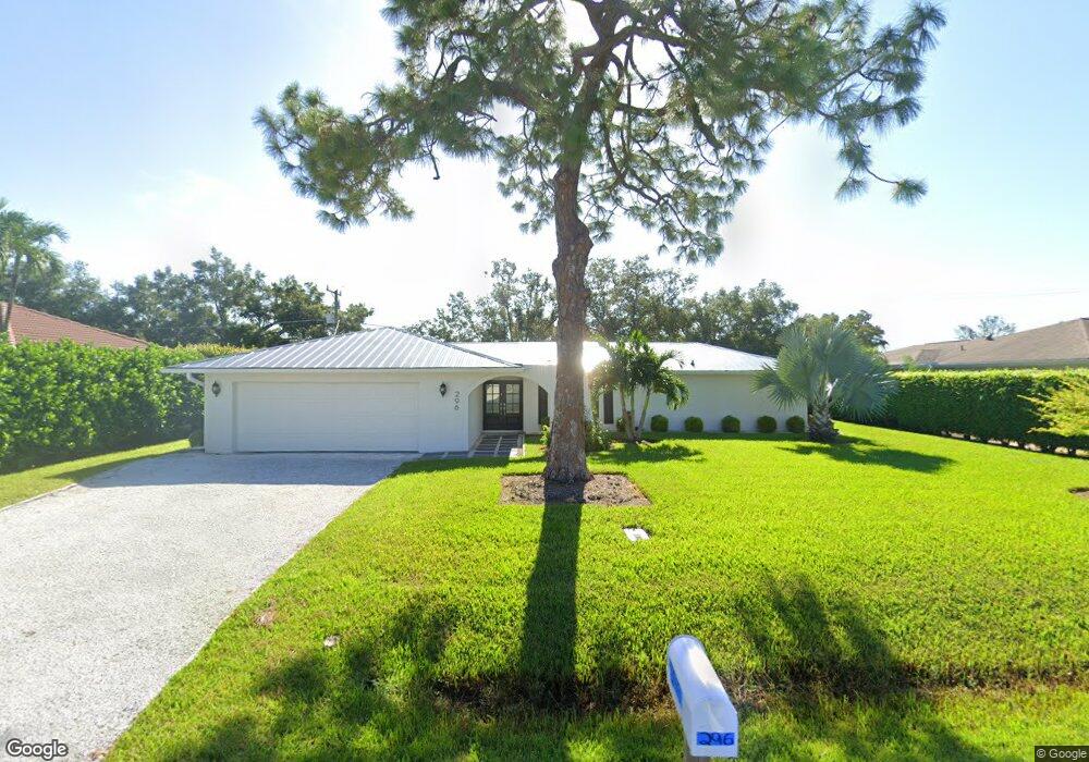
296 Burning Tree Dr Naples, FL 34105
Moorings Park-Hawks Ridge NeighborhoodEstimated Value: $879,081 - $1,245,000
3
Beds
2
Baths
1,684
Sq Ft
$620/Sq Ft
Est. Value
About This Home
This home is located at 296 Burning Tree Dr, Naples, FL 34105 and is currently estimated at $1,044,770, approximately $620 per square foot. 296 Burning Tree Dr is a home located in Collier County with nearby schools including Sea Gate Elementary School, Pine Ridge Middle School, and Barron Collier High School.
Ownership History
Date
Name
Owned For
Owner Type
Purchase Details
Closed on
May 14, 2021
Sold by
Savarese Joseph E and Savarese Mildred A
Bought by
Davison Lawrence J and Cosgrove Mary Beth
Current Estimated Value
Home Financials for this Owner
Home Financials are based on the most recent Mortgage that was taken out on this home.
Original Mortgage
$472,500
Outstanding Balance
$427,533
Interest Rate
3%
Mortgage Type
New Conventional
Estimated Equity
$617,237
Create a Home Valuation Report for This Property
The Home Valuation Report is an in-depth analysis detailing your home's value as well as a comparison with similar homes in the area
Home Values in the Area
Average Home Value in this Area
Purchase History
| Date | Buyer | Sale Price | Title Company |
|---|---|---|---|
| Davison Lawrence J | $630,000 | Attorney |
Source: Public Records
Mortgage History
| Date | Status | Borrower | Loan Amount |
|---|---|---|---|
| Open | Davison Lawrence J | $472,500 |
Source: Public Records
Tax History
| Year | Tax Paid | Tax Assessment Tax Assessment Total Assessment is a certain percentage of the fair market value that is determined by local assessors to be the total taxable value of land and additions on the property. | Land | Improvement |
|---|---|---|---|---|
| 2025 | $9,647 | $1,049,666 | -- | -- |
| 2024 | $10,512 | $1,020,084 | $796,415 | $223,669 |
| 2023 | $10,512 | $1,085,019 | $855,558 | $229,461 |
| 2022 | $7,242 | $670,063 | $536,590 | $133,473 |
| 2021 | $5,133 | $431,053 | $0 | $0 |
| 2020 | $4,457 | $391,866 | $270,000 | $121,866 |
| 2019 | $4,677 | $398,105 | $0 | $0 |
| 2018 | $4,621 | $361,914 | $0 | $0 |
| 2017 | $4,227 | $329,013 | $0 | $0 |
| 2016 | $4,169 | $299,103 | $0 | $0 |
| 2015 | $3,630 | $271,912 | $0 | $0 |
| 2014 | $3,168 | $247,193 | $0 | $0 |
Source: Public Records
Map
Nearby Homes
- 318 Burning Tree Dr
- 335 Burning Tree Dr
- 237 Burning Tree Dr
- 200 Burning Tree Dr
- 1723 Camelia Ln
- 1087 Forest Lakes Dr Unit 1-201
- 1087 Forest Lakes Dr Unit 309
- 1087 Forest Lakes Dr Unit 1-104
- 1087 Forest Lakes Dr Unit 1-309
- 1037 Forest Lakes Dr Unit 8D
- 201 Quail Forest Blvd Unit 109
- 201 Quail Forest Blvd Unit 103
- 151 Quail Forest Blvd Unit 202
- 267 Quail Forest Blvd Unit 209
- 1041 Forest Lakes Dr Unit 7-D
- 1086 Forest Lakes Dr Unit 9207
- 1086 Forest Lakes Dr Unit 102
- 1086 Forest Lakes Dr Unit 9305
- 1084 Forest Lakes Dr Unit 7304
- 1083 Forest Lakes Dr Unit 6304/6305
- 302 Burning Tree Dr
- 288 Burning Tree Dr
- 291 Burning Tree Dr
- 289 Burning Tree Dr
- 310 Burning Tree Dr
- 280 Burning Tree Dr
- 305 Burning Tree Dr
- 292 Mel Jen Dr Unit 2
- 313 Burning Tree Dr
- 284 Mel Jen Dr
- 272 Burning Tree Dr
- 300 Mel Jen Dr
- 277 Burning Tree Dr
- 321 Burning Tree Dr
- 308 Mel Jen Dr
- 326 Burning Tree Dr
- 264 Burning Tree Dr
- 267 Burning Tree Dr
- 316 Mel Jen Dr
- 293 Mel Jen Dr
Your Personal Tour Guide
Ask me questions while you tour the home.