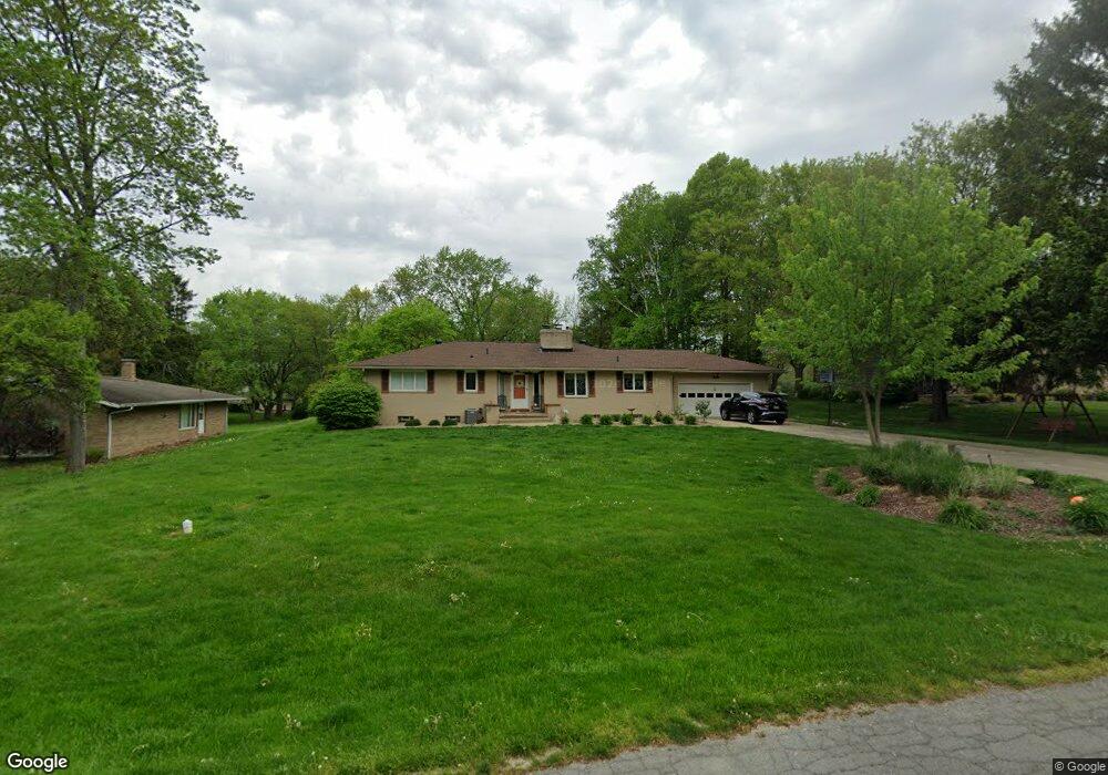
2969 Sherbrook Dr Uniontown, OH 44685
Estimated Value: $236,000 - $269,998
3
Beds
3
Baths
1,544
Sq Ft
$164/Sq Ft
Est. Value
About This Home
This home is located at 2969 Sherbrook Dr, Uniontown, OH 44685 and is currently estimated at $253,000, approximately $163 per square foot. 2969 Sherbrook Dr is a home located in Summit County with nearby schools including Springfield High School, Chapel Hill Christian School-Green Campus, and Lake Center Christian School.
Ownership History
Date
Name
Owned For
Owner Type
Purchase Details
Closed on
Sep 13, 2002
Sold by
Moneskey Connie S
Bought by
Mccormick Linda M
Current Estimated Value
Home Financials for this Owner
Home Financials are based on the most recent Mortgage that was taken out on this home.
Original Mortgage
$100,000
Interest Rate
6.32%
Create a Home Valuation Report for This Property
The Home Valuation Report is an in-depth analysis detailing your home's value as well as a comparison with similar homes in the area
Purchase History
| Date | Buyer | Sale Price | Title Company |
|---|---|---|---|
| Mccormick Linda M | $149,500 | Wigley Title |
Source: Public Records
Mortgage History
| Date | Status | Borrower | Loan Amount |
|---|---|---|---|
| Previous Owner | Mccormick Linda M | $100,000 |
Source: Public Records
Tax History
| Year | Tax Paid | Tax Assessment Tax Assessment Total Assessment is a certain percentage of the fair market value that is determined by local assessors to be the total taxable value of land and additions on the property. | Land | Improvement |
|---|---|---|---|---|
| 2024 | $4,232 | $76,724 | $13,815 | $62,909 |
| 2023 | $4,232 | $76,724 | $13,815 | $62,909 |
| 2022 | $3,886 | $61,002 | $10,878 | $50,124 |
| 2021 | $3,794 | $61,002 | $10,878 | $50,124 |
| 2020 | $3,740 | $61,000 | $10,880 | $50,120 |
| 2019 | $3,076 | $46,500 | $10,440 | $36,060 |
| 2018 | $2,954 | $46,500 | $10,440 | $36,060 |
| 2017 | $3,075 | $46,500 | $10,440 | $36,060 |
| 2016 | $3,104 | $46,500 | $10,440 | $36,060 |
| 2015 | $3,075 | $46,500 | $10,440 | $36,060 |
| 2014 | $3,037 | $46,500 | $10,440 | $36,060 |
| 2013 | $3,258 | $49,670 | $10,440 | $39,230 |
Source: Public Records
Map
Nearby Homes
- 3025 Killian Rd
- 2903 Northview Rd
- 2898 Canton Rd
- 2941 Sweitzer Rd
- 2190 Waterbury Dr
- 2512 Twin Lakes Dr
- 3411 Sweitzer St NW
- 2771 Superior Dr
- 1719 Wilson Rd
- 2575 Myersville Rd
- 13526 Glenvale Ave NW
- 3540 Bushwillow Dr
- 3544 Bushwillow Dr
- 2020 Myersville Rd
- 1464 Blair Dr
- V/L Westport Dr
- 3771 Edison St NW
- 1605 Pawnee Blvd
- 2958 E Turkeyfoot Lake Rd
- 2804 Osage Ave
- 2981 Sherbrook Dr
- 2957 Sherbrook Dr
- 2947 Sherbrook Dr
- 2991 Sherbrook Dr
- 2970 Sherbrook Dr
- 2958 Sherbrook Dr
- 2980 Sherbrook Dr
- 2935 Sherbrook Dr
- 2946 Sherbrook Dr
- 3002 Killian Rd
- 2990 Sherbrook Dr
- 3018 Killian Rd
- 2986 Killian Rd
- 3009 Sherbrook Dr
- 3030 Killian Rd
- 2934 Sherbrook Dr
- 2966 Killian Rd
- 2921 Sherbrook Dr
- 3008 Sherbrook Dr
- 3019 Sherbrook Dr
Your Personal Tour Guide
Ask me questions while you tour the home.