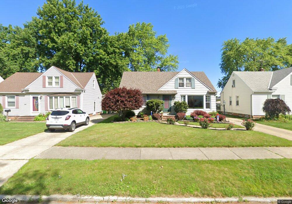
29711 Robert St Wickliffe, OH 44092
Estimated Value: $198,000 - $219,000
About This Home
This home is located at 29711 Robert St, Wickliffe, OH 44092 and is currently estimated at $209,452, approximately $200 per square foot. 29711 Robert St is a home located in Lake County with nearby schools including Wickliffe Elementary School, Wickliffe Middle School, and Wickliffe High School.
Ownership History
We collect this data history from publicly available records. To have your information removed, we recommend requesting removal directly through your county’s website.
Purchase Details
Purchase Details
Home Financials for this Owner
Home Financials are based on the most recent Mortgage that was taken out on this home.Home Values in the Area
Average Home Value in this Area
Purchase History
We collect this data history from publicly available records. To have your information removed, we recommend requesting removal directly through your county’s website.
| Date | Buyer | Sale Price | Title Company |
|---|---|---|---|
| -- | None Listed On Document | ||
| $105,500 | -- |
Mortgage History
We collect this data history from publicly available records. To have your information removed, we recommend requesting removal directly through your county’s website.
| Date | Status | Borrower | Loan Amount |
|---|---|---|---|
| Previous Owner | $105,150 |
Tax History
We collect this data history from publicly available records. To have your information removed, we recommend requesting removal directly through your county’s website.
| Year | Tax Paid | Tax Assessment Tax Assessment Total Assessment is a certain percentage of the fair market value that is determined by local assessors to be the total taxable value of land and additions on the property. | Land | Improvement |
|---|---|---|---|---|
| 2025 | -- | $70,640 | $13,210 | $57,430 |
| 2024 | -- | $70,640 | $13,210 | $57,430 |
| 2023 | $7,316 | $59,490 | $11,260 | $48,230 |
| 2022 | $4,808 | $59,490 | $11,260 | $48,230 |
| 2021 | $4,836 | $59,490 | $11,260 | $48,230 |
| 2020 | $4,561 | $48,760 | $9,230 | $39,530 |
| 2019 | $4,469 | $48,760 | $9,230 | $39,530 |
| 2018 | $3,825 | $46,110 | $15,740 | $30,370 |
| 2017 | $3,668 | $46,110 | $15,740 | $30,370 |
| 2016 | $3,629 | $46,110 | $15,740 | $30,370 |
| 2015 | $3,175 | $46,110 | $15,740 | $30,370 |
| 2014 | $2,797 | $46,110 | $15,740 | $30,370 |
| 2013 | $2,795 | $46,110 | $15,740 | $30,370 |
Map
- 29783 Robert St
- 29800 Robert St
- 29940 Phillips Ave
- 29468 Woodway Dr
- 29933 Enid Rd
- 29967 Regent Rd
- 29148 Barjode Rd
- 746 N Elmwood Ave
- 30104 Phillips Ave
- 415 Beechwood Dr
- 30125 Phillips Ave
- 28634 Forest Rd
- 28626 Forest Rd
- 339 Blissfield Dr
- 29108 Fuller Ave
- 29107 Fuller Ave
- 1440 Rockefeller Rd
- 29734 Euclid Ave
- 251 E 286th St
- 30121 Vineyard Rd
- 29703 Robert St
- 29719 Robert St
- 29727 Robert St
- 29695 Robert St
- 29735 Robert St
- 29712 Phillips Ave
- 29687 Robert St
- 29704 Phillips Ave
- 29720 Phillips Ave
- 29696 Phillips Ave
- 29728 Phillips Ave
- 29679 Robert St
- 29743 Robert St
- 29712 Robert St
- 29720 Robert St
- 29704 Robert St
- 29736 Phillips Ave
- 29696 Robert St
- 29728 Robert St
- 29668 Phillips Ave
Ask me questions while you tour the home.