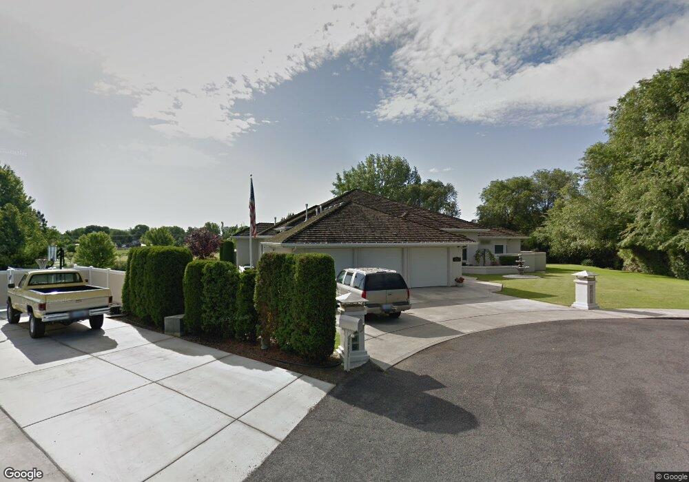
29831 Daisy Ln Hermiston, OR 97838
Estimated Value: $731,026 - $1,153,000
4
Beds
4
Baths
4,040
Sq Ft
$227/Sq Ft
Est. Value
About This Home
This home is located at 29831 Daisy Ln, Hermiston, OR 97838 and is currently estimated at $918,342, approximately $227 per square foot. 29831 Daisy Ln is a home located in Umatilla County with nearby schools including West Park Elementary School, Armand Larive Middle School, and Hermiston High School.
Ownership History
Date
Name
Owned For
Owner Type
Purchase Details
Closed on
Jan 8, 2021
Sold by
Lowary Gary C and Lowary Dorothy Ann
Bought by
Lowary Gary C and Gary C Lowry Revocable I Living Trust
Current Estimated Value
Home Financials for this Owner
Home Financials are based on the most recent Mortgage that was taken out on this home.
Original Mortgage
$200,000
Interest Rate
2.71%
Mortgage Type
New Conventional
Purchase Details
Closed on
Sep 11, 2009
Sold by
Lowary Gary C and Lowary Dorothy Ann
Bought by
Lowary Gary C and Lowary Dorothy Ann
Purchase Details
Closed on
Jun 19, 2009
Sold by
Lowary Gary C and Lowary Dorothy Ann
Bought by
Lowary Gary C and Lowary Dorothy Ann
Home Financials for this Owner
Home Financials are based on the most recent Mortgage that was taken out on this home.
Original Mortgage
$248,000
Interest Rate
4.83%
Mortgage Type
New Conventional
Create a Home Valuation Report for This Property
The Home Valuation Report is an in-depth analysis detailing your home's value as well as a comparison with similar homes in the area
Home Values in the Area
Average Home Value in this Area
Purchase History
| Date | Buyer | Sale Price | Title Company |
|---|---|---|---|
| Lowary Gary C | -- | None Available | |
| Lowary Gary C | -- | None Available | |
| Lowary Gary C | -- | Amerititle |
Source: Public Records
Mortgage History
| Date | Status | Borrower | Loan Amount |
|---|---|---|---|
| Closed | Lowary Gary C | $200,000 | |
| Closed | Lowary Gary C | $248,000 |
Source: Public Records
Tax History
| Year | Tax Paid | Tax Assessment Tax Assessment Total Assessment is a certain percentage of the fair market value that is determined by local assessors to be the total taxable value of land and additions on the property. | Land | Improvement |
|---|---|---|---|---|
| 2025 | $9,646 | $642,080 | $98,110 | $543,970 |
| 2023 | $9,436 | $605,230 | $92,470 | $512,760 |
| 2022 | $8,786 | $587,610 | $0 | $0 |
| 2021 | $8,756 | $570,500 | $87,150 | $483,350 |
| 2020 | $8,222 | $553,890 | $84,610 | $469,280 |
| 2018 | $7,478 | $502,110 | $65,280 | $436,830 |
| 2017 | $7,278 | $485,140 | $58,640 | $426,500 |
| 2016 | $7,471 | $500,220 | $41,240 | $458,980 |
| 2015 | $8,244 | $492,140 | $75,180 | $416,960 |
| 2014 | $7,722 | $492,140 | $75,180 | $416,960 |
Source: Public Records
Map
Nearby Homes
- 1307 Kimber Dr
- 1390 W Orchard Ave
- 1270 W Hartley Ave
- 1030 SW 11th St Unit 33
- 1375 SW 15th St
- 10 SW Sunrise Ct
- 725 SW 11th St
- 1092 W Linda Unit Lot 1
- 1464 NE Kenna Dr
- 1825 W Highland Ave
- 915 SW Coyote Dr
- 885 W Duane Ave
- 1003 SW Olive Ct
- 825 W Ridgeway Ave
- 78662 Lloyd Rd
- 773 W Tamarack Ave
- 235 NW Butte Dr
- 790 W Division Ave
- 827 E Autumn Ave
- 833 E Autumn Ave
- 29823 Daisy Ln
- 29843 Royce Ln
- 78849 Dickenson Dr
- 78861 Dickenson Dr
- 29827 Royce Ln
- 78846 Dickenson Dr
- 29787 Daisy Ln
- 0 Daisy Ln
- 78824 Dickenson Dr
- 78868 Dickenson Dr
- 78880 Dickenson Dr
- 29802 Royce Ln
- 29773 Daisy Ln
- 29755 Daisy Ln
- 29769 Royce Ln
- 29784 Royce Ln
- 505 SW 23rd St
- 410 Leaf Ln
- 565 SW 23rd St
- 29797 Bridge Rd
Your Personal Tour Guide
Ask me questions while you tour the home.