2988 Roanoke Rd Lagrange, GA 30240
Estimated Value: $483,000 - $707,003
About This Home
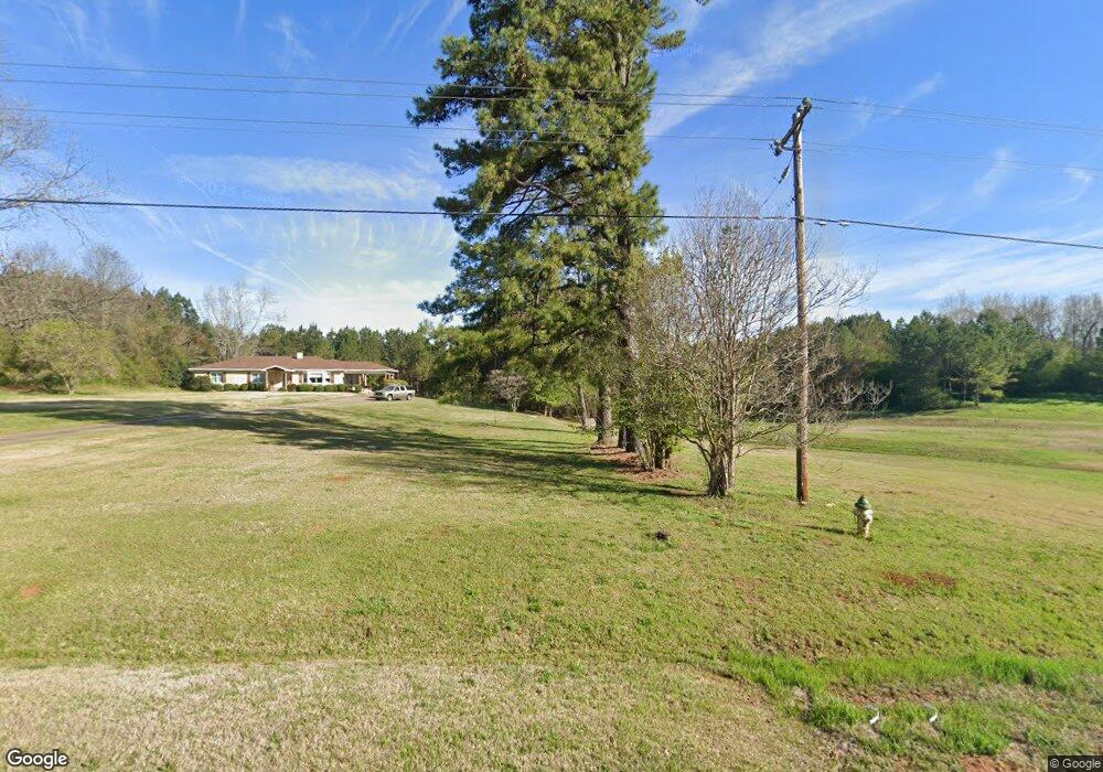
This home is located at 2988 Roanoke Rd, Lagrange, GA 30240 and is currently estimated at $592,001, approximately $225 per square foot. 2988 Roanoke Rd is a home located in Troup County with nearby schools including Ethel W. Kight Elementary School, Hollis Hand Elementary School, and Franklin Forest Elementary School.
Ownership History
We collect this data history from publicly available records. To have your information removed, we recommend requesting removal directly through your county’s website.
Purchase Details
Purchase Details
Purchase Details
Purchase History
We collect this data history from publicly available records. To have your information removed, we recommend requesting removal directly through your county’s website.
| Date | Buyer | Sale Price | Title Company |
|---|---|---|---|
| -- | -- | ||
| $10,000 | -- | ||
| -- | -- |
Tax History
We collect this data history from publicly available records. To have your information removed, we recommend requesting removal directly through your county’s website.
| Year | Tax Paid | Tax Assessment Tax Assessment Total Assessment is a certain percentage of the fair market value that is determined by local assessors to be the total taxable value of land and additions on the property. | Land | Improvement |
|---|---|---|---|---|
| 2025 | $4,332 | $260,772 | $136,640 | $124,132 |
| 2024 | $3,420 | $234,292 | $141,880 | $92,412 |
| 2023 | $3,078 | $222,612 | $141,880 | $80,732 |
| 2022 | $2,950 | $216,252 | $141,880 | $74,372 |
| 2021 | $2,983 | $186,128 | $116,760 | $69,368 |
| 2020 | $2,960 | $186,128 | $116,760 | $69,368 |
| 2019 | $2,805 | $181,728 | $116,760 | $64,968 |
| 2018 | $2,086 | $158,612 | $116,760 | $41,852 |
| 2017 | $2,065 | $158,612 | $116,760 | $41,852 |
| 2016 | $1,999 | $157,137 | $116,820 | $40,316 |
| 2015 | $1,983 | $157,137 | $116,820 | $40,316 |
| 2014 | $1,604 | $154,965 | $116,771 | $38,194 |
| 2013 | -- | $156,659 | $116,771 | $39,888 |
Map
- 300 Cheyenne Dr
- 419 Fling Rd
- 37 Overbrook Dr
- 36 Hill Rd
- 20 Hill Rd
- 245 Teaver Rd
- 227 W Lakeview Dr
- 108 Meadownland Trail
- LOT 3 Post Oak Dr
- 105 + - Acres On McCosh Mill Rd
- 0 Deming St Unit 10550189
- 53 Horace Carter Rd
- 214 Highland Trail
- 506 Riverside Dr
- 0 Bradfield Dr Unit 10568803
- 908 S Willowcrest Way
- 62 Maley Rd
- 134 N Lake Dr
- 1017 Riverside Dr
- 0 Unit 10514554
- 3019 Roanoke Rd
- 3044 Roanoke Rd
- 3047 Roanoke Rd
- 2987 Roanoke Rd
- 3068 Roanoke Rd
- 3059 Roanoke Rd
- 3075 Roanoke Rd
- 2907 Roanoke Rd
- 57 Tatum Heights Dr
- 3112 Roanoke Rd
- 3099 Roanoke Rd
- 2876 Roanoke Rd
- 3116 Roanoke Rd
- 75 Tatum Heights Dr
- 100 Tatum Heights Dr
- 2867 Roanoke Rd
- 52 Tatum Heights Dr
- 20 Tatum Heights Dr
- 32 Tatum Heights Dr
- 103 Tatum Heights Dr
Ask me questions while you tour the home.