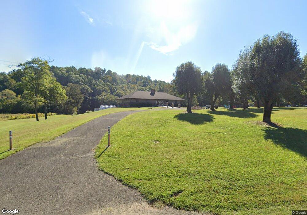
2994 Riverside Dr Mount Airy, NC 27030
Estimated Value: $338,265 - $441,000
2
Beds
2
Baths
4,928
Sq Ft
$79/Sq Ft
Est. Value
About This Home
This home is located at 2994 Riverside Dr, Mount Airy, NC 27030 and is currently estimated at $387,422, approximately $78 per square foot. 2994 Riverside Dr is a home located in Surry County with nearby schools including Bruce H. Tharrington Elementary School, Mount Airy Middle School, and Mount Airy High School.
Ownership History
Date
Name
Owned For
Owner Type
Purchase Details
Closed on
Nov 15, 2012
Sold by
Hower Robert W and Hower Gail R
Bought by
Mahaffey Richard A and Mahaffey Penny
Current Estimated Value
Home Financials for this Owner
Home Financials are based on the most recent Mortgage that was taken out on this home.
Original Mortgage
$75,000
Outstanding Balance
$51,665
Interest Rate
3.4%
Mortgage Type
Purchase Money Mortgage
Estimated Equity
$335,757
Create a Home Valuation Report for This Property
The Home Valuation Report is an in-depth analysis detailing your home's value as well as a comparison with similar homes in the area
Purchase History
| Date | Buyer | Sale Price | Title Company |
|---|---|---|---|
| Mahaffey Richard A | $275,000 | None Available |
Source: Public Records
Mortgage History
| Date | Status | Borrower | Loan Amount |
|---|---|---|---|
| Open | Mahaffey Richard A | $75,000 |
Source: Public Records
Tax History
| Year | Tax Paid | Tax Assessment Tax Assessment Total Assessment is a certain percentage of the fair market value that is determined by local assessors to be the total taxable value of land and additions on the property. | Land | Improvement |
|---|---|---|---|---|
| 2025 | $1,935 | $257,360 | $29,330 | $228,030 |
| 2024 | $1,713 | $214,720 | $29,330 | $185,390 |
| 2023 | $1,690 | $214,720 | $29,330 | $185,390 |
| 2022 | $1,701 | $214,720 | $29,330 | $185,390 |
| 2021 | $1,701 | $214,720 | $29,330 | $185,390 |
| 2020 | $1,672 | $201,600 | $29,330 | $172,270 |
| 2019 | $1,669 | $201,600 | $29,330 | $172,270 |
| 2018 | $1,669 | $201,600 | $0 | $0 |
| 2017 | $1,616 | $201,600 | $0 | $0 |
| 2016 | $1,605 | $201,600 | $0 | $0 |
| 2013 | -- | $225,270 | $0 | $0 |
Source: Public Records
Map
Nearby Homes
- 2638 Riverside Dr
- 166 Lynnewood Dr
- TBD Glen Terrace
- 106 Lynnewood Dr
- xx 44.93 Acres Stardust Trail
- 549 Ararat Hwy
- 663 Mcbride Rd
- 236 Badgett Ave
- 2160 Margaret Dr
- 263 Badgett Ave
- 2149 Margaret Dr
- 335 Badgett Ave
- 133 Salem Dr
- 2142 Elizabeth Dr
- 00 Jackson Rd Unit 8.64 Ac
- 0 Jackson Rd
- 329 Graystone Rd
- tbd Sable Ave
- 417 Fulton Ave
- 129 Oaklawn Rd
- 2960 Riverside Dr
- 3007 Riverside Dr
- 178 Laurel Wood Trail
- 226 Springview Ln
- 247 Springview Ln
- 226 Springview Ln
- 121 Springview Ln
- 221 Springview Ln
- 108 Springview Ln
- 133 Springview Ln
- 207 Springview Ln
- 128 Springview Ln
- 202 Springview Ln
- 149 Springview Ln
- 205 Willis Gap Rd
- 142 Springview Ln
- 3117 Riverside Dr
- 173 Springview Ln
- 188 Springview Ln
- 152 Springview Ln
Your Personal Tour Guide
Ask me questions while you tour the home.