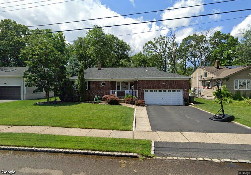
3 Craig Rd Springfield, NJ 07081
Estimated Value: $736,000 - $872,000
Studio
--
Bath
2,267
Sq Ft
$363/Sq Ft
Est. Value
About This Home
This home is located at 3 Craig Rd, Springfield, NJ 07081 and is currently estimated at $823,106, approximately $363 per square foot. 3 Craig Rd is a home located in Union County with nearby schools including Jonathan Dayton High School and St James The Apostle School.
Ownership History
Date
Name
Owned For
Owner Type
Purchase Details
Closed on
Mar 1, 2010
Sold by
Adler Alice
Bought by
Solomon Scott and Solomon Carrie
Current Estimated Value
Home Financials for this Owner
Home Financials are based on the most recent Mortgage that was taken out on this home.
Original Mortgage
$344,000
Outstanding Balance
$228,224
Interest Rate
5%
Mortgage Type
New Conventional
Estimated Equity
$594,882
Purchase Details
Closed on
Nov 4, 1996
Sold by
Frank Irene K
Bought by
Adler Lee and Adler Alice D
Home Financials for this Owner
Home Financials are based on the most recent Mortgage that was taken out on this home.
Original Mortgage
$176,000
Interest Rate
7.52%
Purchase Details
Closed on
Jan 3, 1995
Sold by
Bobis Daniel H
Bought by
Frank Irene K
Purchase Details
Closed on
Nov 22, 1994
Sold by
Bobis Daniel H
Bought by
Frank Irene K
Create a Home Valuation Report for This Property
The Home Valuation Report is an in-depth analysis detailing your home's value as well as a comparison with similar homes in the area
Home Values in the Area
Average Home Value in this Area
Purchase History
| Date | Buyer | Sale Price | Title Company |
|---|---|---|---|
| Solomon Scott | $430,000 | None Available | |
| Adler Lee | $220,000 | -- | |
| Frank Irene K | $105,000 | -- | |
| Frank Irene K | $105,000 | -- |
Source: Public Records
Mortgage History
| Date | Status | Borrower | Loan Amount |
|---|---|---|---|
| Open | Solomon Scott | $344,000 | |
| Previous Owner | Adler Lee | $176,000 |
Source: Public Records
Tax History
| Year | Tax Paid | Tax Assessment Tax Assessment Total Assessment is a certain percentage of the fair market value that is determined by local assessors to be the total taxable value of land and additions on the property. | Land | Improvement |
|---|---|---|---|---|
| 2025 | $14,108 | $594,000 | $261,000 | $333,000 |
| 2024 | $13,876 | $594,000 | $261,000 | $333,000 |
| 2023 | $13,876 | $594,000 | $261,000 | $333,000 |
| 2022 | $12,884 | $594,000 | $261,000 | $333,000 |
| 2021 | $14,347 | $192,700 | $85,300 | $107,400 |
| 2020 | $14,123 | $192,700 | $85,300 | $107,400 |
| 2019 | $13,932 | $192,700 | $85,300 | $107,400 |
| 2018 | $13,682 | $192,700 | $85,300 | $107,400 |
| 2017 | $13,306 | $192,700 | $85,300 | $107,400 |
| 2016 | $13,048 | $192,700 | $85,300 | $107,400 |
| 2015 | $12,895 | $192,700 | $85,300 | $107,400 |
| 2014 | $12,653 | $192,700 | $85,300 | $107,400 |
Source: Public Records
Map
Nearby Homes
- 20 Archbridge Ln
- 23 Smithfield Dr
- 28 Elmwood Rd
- 559 S Springfield Ave Unit 559
- 171 S Springfield Ave
- 32 Ruby St
- 23 Diven St
- 56 Diven St
- 167 Newbrook Ln
- 148 Locust Dr
- 294 Mountain Ave
- 20 Kew Dr
- 182 Meisel Ave
- 2705 Andrea Rd
- 27 Garden Oval
- 2469 Macarthur Dr
- 823 Pinewood Rd
- 105 Battle Hill Ave
- 16 Tooker Ave
- 14 Eton Place
Your Personal Tour Guide
Ask me questions while you tour the home.