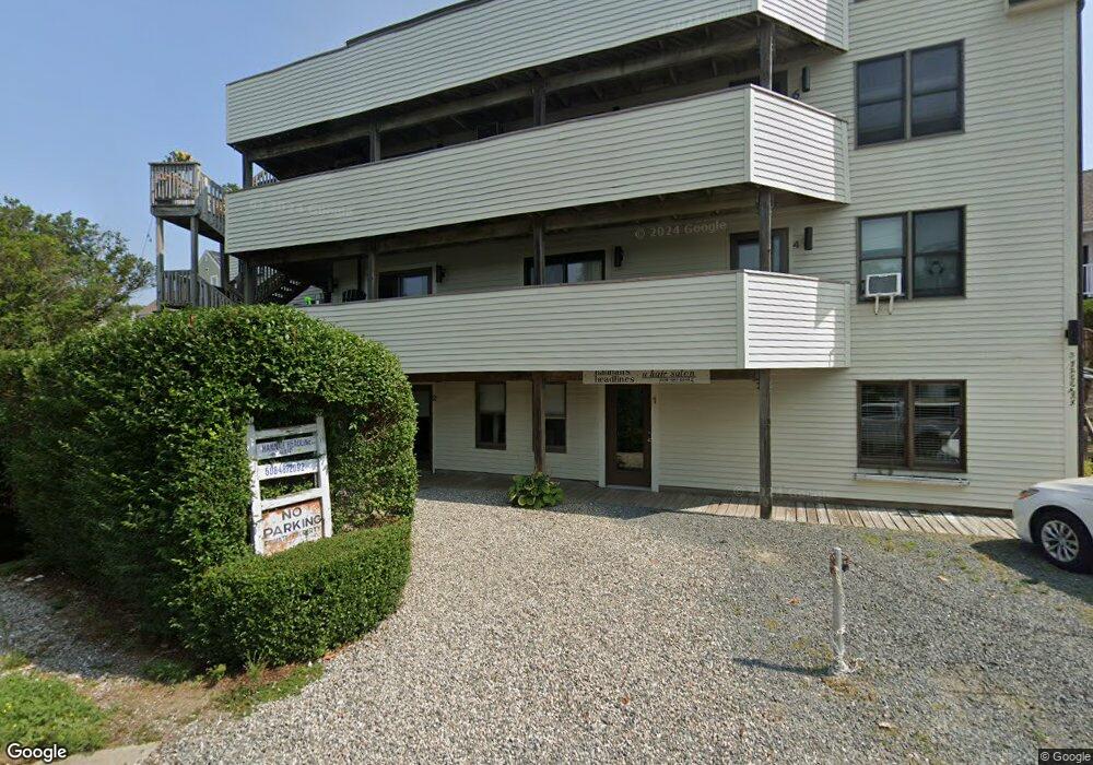
3 Freeman St Unit 9 Provincetown, MA 02657
Estimated Value: $661,000 - $846,000
1
Bed
1
Bath
455
Sq Ft
$1,597/Sq Ft
Est. Value
About This Home
This home is located at 3 Freeman St Unit 9, Provincetown, MA 02657 and is currently estimated at $726,579, approximately $1,596 per square foot. 3 Freeman St Unit 9 is a home located in Barnstable County with nearby schools including Provincetown Schools.
Ownership History
Date
Name
Owned For
Owner Type
Purchase Details
Closed on
Nov 6, 2017
Sold by
Carvelli-Sheehan Jayne and Murphy Janice C
Bought by
Jayne C Sheehan Lt and Murphy
Current Estimated Value
Purchase Details
Closed on
May 26, 1995
Sold by
Burns Michael A
Bought by
Murphy Janice C and Sheehan Jayne C
Home Financials for this Owner
Home Financials are based on the most recent Mortgage that was taken out on this home.
Original Mortgage
$48,800
Interest Rate
8.33%
Mortgage Type
Purchase Money Mortgage
Purchase Details
Closed on
Sep 16, 1994
Sold by
Day Brittian
Bought by
Burns Michael A
Home Financials for this Owner
Home Financials are based on the most recent Mortgage that was taken out on this home.
Original Mortgage
$45,000
Interest Rate
8.38%
Mortgage Type
Purchase Money Mortgage
Create a Home Valuation Report for This Property
The Home Valuation Report is an in-depth analysis detailing your home's value as well as a comparison with similar homes in the area
Home Values in the Area
Average Home Value in this Area
Purchase History
| Date | Buyer | Sale Price | Title Company |
|---|---|---|---|
| Jayne C Sheehan Lt | -- | -- | |
| Jayne C Sheehan Lt | -- | -- | |
| Murphy Janice C | $61,000 | -- | |
| Murphy Janice C | $61,000 | -- | |
| Burns Michael A | $65,000 | -- | |
| Burns Michael A | $65,000 | -- |
Source: Public Records
Mortgage History
| Date | Status | Borrower | Loan Amount |
|---|---|---|---|
| Previous Owner | Burns Michael A | $48,800 | |
| Previous Owner | Burns Michael A | $45,000 |
Source: Public Records
Tax History
| Year | Tax Paid | Tax Assessment Tax Assessment Total Assessment is a certain percentage of the fair market value that is determined by local assessors to be the total taxable value of land and additions on the property. | Land | Improvement |
|---|---|---|---|---|
| 2025 | $2,947 | $526,300 | $0 | $526,300 |
| 2024 | $2,800 | $501,800 | $0 | $501,800 |
| 2023 | $2,515 | $420,500 | $0 | $420,500 |
| 2022 | $2,401 | $360,500 | $0 | $360,500 |
| 2021 | $2,486 | $351,200 | $0 | $351,200 |
| 2020 | $2,257 | $340,900 | $0 | $340,900 |
| 2019 | $2,270 | $321,600 | $0 | $321,600 |
| 2018 | $2,061 | $276,700 | $0 | $276,700 |
| 2017 | $2,052 | $266,100 | $0 | $266,100 |
| 2016 | $1,733 | $222,200 | $0 | $222,200 |
| 2015 | $1,578 | $213,800 | $0 | $213,800 |
Source: Public Records
Map
Nearby Homes
- 333 Commercial St Unit 9
- 15 Center St
- 294 Commercial St
- 290 Commercial St Unit 3
- 290 Commercial St Unit 2B
- 19 Center St Unit 5
- 116 Bradford St Unit 1
- 381 Commercial St Unit 5
- 269-271 Commercial St
- 271 Commercial St
- 265 Commercial St
- 104 Bradford St Unit 15
- 9A Conwell St Unit 4
- 29 Cemetery Rd Unit 1
- 29 Cemetery Rd Unit 2
- 16 Conwell St Unit 3
- 5 Webster Place
- 234 Commercial St
- 421 Commercial St Unit F
- 36 Pearl St Unit 2
- 3 Freeman St Unit 8
- 3 Freeman St Unit 7
- 3 Freeman St Unit 6
- 3 Freeman St Unit 5
- 3 Freeman St Unit 4
- 3 Freeman St Unit 3
- 3 Freeman St Unit 2
- 3 Freeman St
- 3 Freeman St Unit 1
- 7 Freeman St
- 336 Commercial St Unit 5
- 336 Commercial St Unit 4
- 336 Commercial St Unit 1
- 336 Commercial St
- 334 Commercial St Unit U3
- 334 Commercial St
- 5 Freeman St
- 330 Commercial St
- 340-A Commercial St
- 338 Commercial St
Your Personal Tour Guide
Ask me questions while you tour the home.