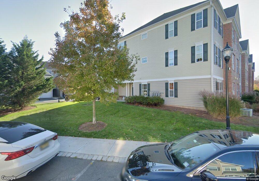
3 Patriots Path South Bound Brook, NJ 08880
Estimated Value: $433,000 - $476,000
Studio
--
Bath
1,640
Sq Ft
$273/Sq Ft
Est. Value
About This Home
This home is located at 3 Patriots Path, South Bound Brook, NJ 08880 and is currently estimated at $447,862, approximately $273 per square foot. 3 Patriots Path is a home located in Somerset County with nearby schools including Robert Morris School and Green Brook Academy.
Ownership History
Date
Name
Owned For
Owner Type
Purchase Details
Closed on
Oct 27, 2006
Sold by
Matzel & Mumford At South Boun
Bought by
Mahal Arjit S and Mahal Apara
Current Estimated Value
Home Financials for this Owner
Home Financials are based on the most recent Mortgage that was taken out on this home.
Original Mortgage
$118,000
Outstanding Balance
$70,814
Interest Rate
6.47%
Mortgage Type
New Conventional
Estimated Equity
$377,048
Create a Home Valuation Report for This Property
The Home Valuation Report is an in-depth analysis detailing your home's value as well as a comparison with similar homes in the area
Home Values in the Area
Average Home Value in this Area
Purchase History
| Date | Buyer | Sale Price | Title Company |
|---|---|---|---|
| Mahal Arjit S | $389,281 | -- | |
| Mahal Arjit S | $389,281 | None Available |
Source: Public Records
Mortgage History
| Date | Status | Borrower | Loan Amount |
|---|---|---|---|
| Open | Mahal Arjit S | $118,000 | |
| Closed | Mahal Arjit S | $118,000 |
Source: Public Records
Tax History
| Year | Tax Paid | Tax Assessment Tax Assessment Total Assessment is a certain percentage of the fair market value that is determined by local assessors to be the total taxable value of land and additions on the property. | Land | Improvement |
|---|---|---|---|---|
| 2025 | -- | $275,000 | $60,000 | $215,000 |
| 2024 | -- | $275,000 | $60,000 | $215,000 |
| 2023 | -- | $275,000 | $60,000 | $215,000 |
| 2022 | -- | $275,000 | $60,000 | $215,000 |
| 2021 | $0 | $275,000 | $60,000 | $215,000 |
| 2020 | $0 | $337,800 | $60,000 | $277,800 |
| 2019 | $0 | $337,800 | $60,000 | $277,800 |
| 2018 | $0 | $337,800 | $60,000 | $277,800 |
| 2017 | $0 | $337,800 | $60,000 | $277,800 |
| 2016 | $0 | $337,800 | $60,000 | $277,800 |
| 2015 | -- | $337,800 | $60,000 | $277,800 |
| 2014 | -- | $337,800 | $60,000 | $277,800 |
Source: Public Records
Map
Nearby Homes
- 8 Swing Bridge Ln Unit 904
- 105 Swing Bridge Ln Unit 1009
- 112 East St
- 120B Little Place
- 29-31 John St
- 315 East St
- 216 Chestnut St
- 17 Talmage Ave
- 311 Chestnut St
- 408 E Union Ave
- 308 Church St
- 125 Linden Ave
- 535 Madison Ave
- 130 Howard Ave
- 531 Chestnut St
- 151 Beechwood Ave
- 74 Marcy St
- 126 W High St
- 128 Hazelwood Ave
- 28 Fisher Ave
- 7 Patriots Path Unit 813
- 1 Patriots Path
- 5 Patriots Path
- 11 Patriots Path
- 9 Patriots Path
- 17 Patriots Path
- 15 Patriots Path
- 21 Patriots Path Unit 807
- 21 Patriots Path
- 12 Patriots Path
- 8 Patriots Path
- 19 Patriots Path Unit 808
- 4 Patriots Path
- 16 Patriots Path
- 65 Swing Bridge Ln Unit 1205
- 69 Swing Bridge Ln Unit 1203
- 61 Swing Bridge Ln Unit 1207
- 25 Patriots Path
- 73 Swing Bridge Ln
- 23 Patriots Path
Your Personal Tour Guide
Ask me questions while you tour the home.