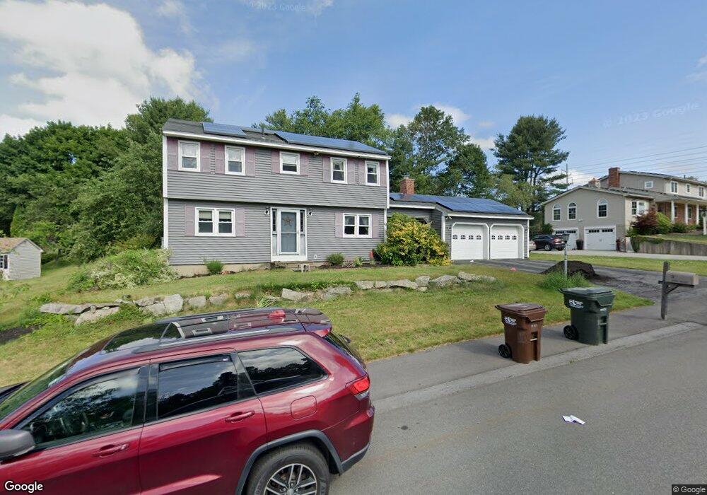
3 Rice Rd Auburn, MA 01501
Downtown Auburn NeighborhoodEstimated Value: $563,000 - $863,000
About This Home
This home is located at 3 Rice Rd, Auburn, MA 01501 and is currently estimated at $662,236, approximately $316 per square foot. 3 Rice Rd is a home located in Worcester County with nearby schools including Auburn Senior High School and Shrewsbury Montessori School - Auburn Campus.
Ownership History
We collect this data history from publicly available records. To have your information removed, we recommend requesting removal directly through your county’s website.
Purchase Details
Home Financials for this Owner
Home Financials are based on the most recent Mortgage that was taken out on this home.Home Values in the Area
Average Home Value in this Area
Purchase History
We collect this data history from publicly available records. To have your information removed, we recommend requesting removal directly through your county’s website.
| Date | Buyer | Sale Price | Title Company |
|---|---|---|---|
| $205,000 | -- |
Mortgage History
We collect this data history from publicly available records. To have your information removed, we recommend requesting removal directly through your county’s website.
| Date | Status | Borrower | Loan Amount |
|---|---|---|---|
| Closed | $89,000 | ||
| Closed | $100,000 | ||
| Closed | $135,000 |
Tax History
We collect this data history from publicly available records. To have your information removed, we recommend requesting removal directly through your county’s website.
| Year | Tax Paid | Tax Assessment Tax Assessment Total Assessment is a certain percentage of the fair market value that is determined by local assessors to be the total taxable value of land and additions on the property. | Land | Improvement |
|---|---|---|---|---|
| 2025 | $74 | $514,500 | $140,600 | $373,900 |
| 2024 | $7,567 | $506,800 | $135,400 | $371,400 |
| 2023 | $7,238 | $455,800 | $123,100 | $332,700 |
| 2022 | $6,733 | $400,300 | $123,100 | $277,200 |
| 2021 | $6,552 | $361,200 | $108,700 | $252,500 |
| 2020 | $6,494 | $361,200 | $108,700 | $252,500 |
| 2019 | $6,281 | $341,000 | $107,800 | $233,200 |
| 2018 | $320 | $332,400 | $100,800 | $231,600 |
| 2017 | $5,924 | $323,000 | $91,400 | $231,600 |
| 2016 | $5,704 | $315,300 | $94,300 | $221,000 |
| 2015 | $5,161 | $299,000 | $94,300 | $204,700 |
| 2014 | $4,999 | $289,100 | $89,800 | $199,300 |
Map
- 329 Pakachoag St
- 14 Goddard Dr
- 4 Victoria Dr Unit 1
- 25 Curtis St
- 36 Central St
- 204-212 Hampton St
- 48 Central St
- 41 Highland St
- 47 Washington St Unit 55
- 47 Washington St Unit 1
- 1 Rockland Road Ct
- 55 Old Common Rd
- 10 Park St
- 29 Winchester Ave
- 188 Auburn St
- 25 Vinal St Unit 28
- 25 Vinal St Unit 26
- 20 Rockaway Rd
- 9 Thayer Ave
- 88 Shore Dr
Ask me questions while you tour the home.