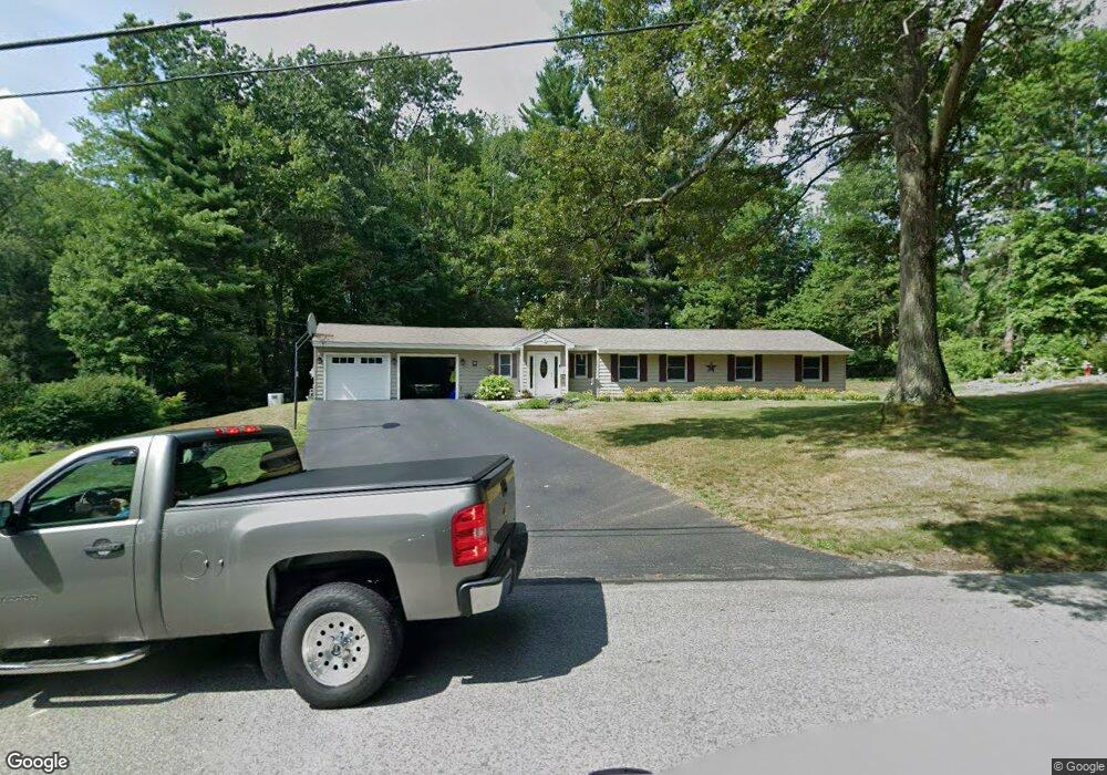
3 Samuel Rd Chelmsford, MA 01824
Estimated Value: $613,878 - $738,000
3
Beds
1
Bath
1,480
Sq Ft
$461/Sq Ft
Est. Value
About This Home
This home is located at 3 Samuel Rd, Chelmsford, MA 01824 and is currently estimated at $682,720, approximately $461 per square foot. 3 Samuel Rd is a home located in Middlesex County with nearby schools including South Row Elementary School, McCarthy Middle School, and Chelmsford High School.
Ownership History
Date
Name
Owned For
Owner Type
Purchase Details
Closed on
Oct 27, 1992
Sold by
Destefano Wayne and Destefano Margaret
Bought by
Norris David B and Norris Lisa J
Current Estimated Value
Home Financials for this Owner
Home Financials are based on the most recent Mortgage that was taken out on this home.
Original Mortgage
$115,000
Interest Rate
7.79%
Mortgage Type
Purchase Money Mortgage
Create a Home Valuation Report for This Property
The Home Valuation Report is an in-depth analysis detailing your home's value as well as a comparison with similar homes in the area
Purchase History
We collect this data history from publicly available records. To have your information removed, we recommend requesting removal directly through your county’s website.
| Date | Buyer | Sale Price | Title Company |
|---|---|---|---|
| Norris David B | $125,000 | -- | |
| Norris David B | $125,000 | -- |
Source: Public Records
Mortgage History
We collect this data history from publicly available records. To have your information removed, we recommend requesting removal directly through your county’s website.
| Date | Status | Borrower | Loan Amount |
|---|---|---|---|
| Open | Norris David B | $210,000 | |
| Closed | Norris David B | $115,000 |
Source: Public Records
Tax History
| Year | Tax Paid | Tax Assessment Tax Assessment Total Assessment is a certain percentage of the fair market value that is determined by local assessors to be the total taxable value of land and additions on the property. | Land | Improvement |
|---|---|---|---|---|
| 2025 | $7,264 | $522,600 | $314,700 | $207,900 |
| 2024 | $7,055 | $518,000 | $314,700 | $203,300 |
| 2023 | $7,069 | $491,900 | $338,400 | $153,500 |
| 2022 | $6,873 | $435,800 | $290,400 | $145,400 |
| 2021 | $6,246 | $396,800 | $266,400 | $130,400 |
| 2020 | $6,267 | $381,000 | $228,600 | $152,400 |
| 2019 | $6,056 | $370,400 | $226,400 | $144,000 |
| 2018 | $6,185 | $344,400 | $203,900 | $140,500 |
| 2017 | $5,768 | $321,900 | $191,000 | $130,900 |
| 2016 | $5,238 | $290,500 | $186,500 | $104,000 |
| 2015 | $5,090 | $272,200 | $169,500 | $102,700 |
| 2014 | $4,908 | $258,600 | $160,300 | $98,300 |
Source: Public Records
Map
Nearby Homes
- 40 Ruthellen Rd
- 11 Arthur Ave
- 215 Rangeway Rd Unit 12
- 175 Rangeway Rd
- 20 Donna Rd
- 15 R Warren Ave Unit 15R
- 13 Warren Ave Unit B
- 45 First St
- 9 Plum St Unit 9
- 218 Rangeway Rd Unit 232
- 218 Rangeway Rd Unit 292
- 41 Boston Rd Unit 482
- 41 Boston Rd Unit 445
- 41 Boston Rd Unit 464
- 8 Topeka Rd
- 9 Acton Rd Unit 6
- 9 Acton Rd Unit 8
- 10 Meadowglen Rd
- 26 Sprague Ave
- 15 Dakota Dr
Your Personal Tour Guide
Ask me questions while you tour the home.