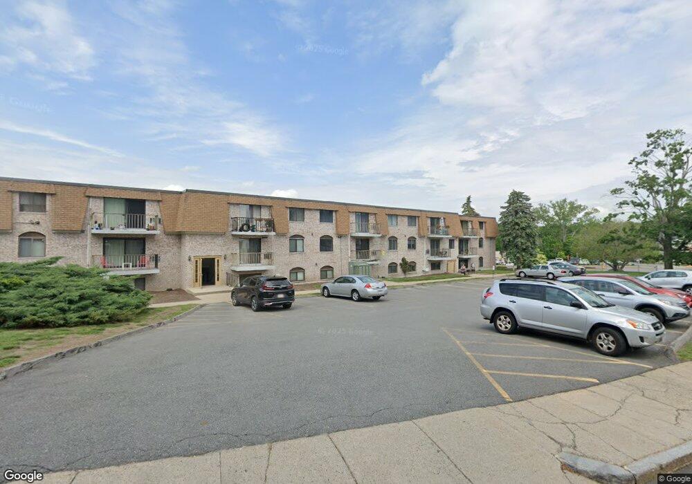
30 High St Unit 7 Dedham, MA 02026
Oakdale NeighborhoodEstimated Value: $376,000 - $404,718
2
Beds
1
Bath
920
Sq Ft
$422/Sq Ft
Est. Value
About This Home
This home is located at 30 High St Unit 7, Dedham, MA 02026 and is currently estimated at $388,180, approximately $421 per square foot. 30 High St Unit 7 is a home located in Norfolk County with nearby schools including Avery, Dedham Middle School, and Dedham High School.
Ownership History
Date
Name
Owned For
Owner Type
Purchase Details
Closed on
Apr 25, 2022
Sold by
Potapchuk Mykhailo
Bought by
Potapchuk Mykhailo and Potapchuk Inna
Current Estimated Value
Home Financials for this Owner
Home Financials are based on the most recent Mortgage that was taken out on this home.
Original Mortgage
$171,000
Outstanding Balance
$159,300
Interest Rate
4.42%
Mortgage Type
New Conventional
Estimated Equity
$228,880
Purchase Details
Closed on
Sep 15, 2016
Sold by
Johnson Sarah
Bought by
Potapchuk Mykehailo
Purchase Details
Closed on
Jun 5, 2015
Sold by
Ford Edward
Bought by
Johnson Sarah
Home Financials for this Owner
Home Financials are based on the most recent Mortgage that was taken out on this home.
Original Mortgage
$202,730
Interest Rate
3.62%
Mortgage Type
New Conventional
Create a Home Valuation Report for This Property
The Home Valuation Report is an in-depth analysis detailing your home's value as well as a comparison with similar homes in the area
Home Values in the Area
Average Home Value in this Area
Purchase History
| Date | Buyer | Sale Price | Title Company |
|---|---|---|---|
| Potapchuk Mykhailo | -- | None Available | |
| Potapchuk Mykhailo | -- | None Available | |
| Potapchuk Mykehailo | $221,500 | -- | |
| Johnson Sarah | $209,000 | -- |
Source: Public Records
Mortgage History
| Date | Status | Borrower | Loan Amount |
|---|---|---|---|
| Open | Potapchuk Mykhailo | $171,000 | |
| Closed | Potapchuk Mykhailo | $171,000 | |
| Previous Owner | Johnson Sarah | $202,730 |
Source: Public Records
Tax History
| Year | Tax Paid | Tax Assessment Tax Assessment Total Assessment is a certain percentage of the fair market value that is determined by local assessors to be the total taxable value of land and additions on the property. | Land | Improvement |
|---|---|---|---|---|
| 2025 | $4,470 | $354,200 | $0 | $354,200 |
| 2024 | $3,979 | $318,300 | $0 | $318,300 |
| 2023 | $3,799 | $295,900 | $0 | $295,900 |
| 2022 | $3,474 | $260,200 | $0 | $260,200 |
| 2021 | $3,478 | $254,400 | $0 | $254,400 |
| 2020 | $3,367 | $245,400 | $0 | $245,400 |
| 2019 | $3,409 | $240,900 | $0 | $240,900 |
| 2018 | $2,959 | $203,400 | $0 | $203,400 |
| 2017 | $2,872 | $194,600 | $0 | $194,600 |
| 2016 | $2,793 | $180,300 | $0 | $180,300 |
| 2015 | $2,673 | $168,400 | $0 | $168,400 |
| 2014 | -- | $160,800 | $0 | $160,800 |
Source: Public Records
Map
Nearby Homes
- 30 High St ( Cass St Entrance) Unit 209
- 90 High St Unit 309
- 108 High St
- 73 Walnut St
- 7 S Stone Mill Dr Unit 412
- 7 S Stone Mill Dr Unit 403
- 19 Lewis Ln
- 22 N Stone Mill Dr Unit 1111
- 187 Colburn St Unit 187
- 16 N Stone Mill Dr Unit 1014
- 153 Colburn St
- 38 Fleming St
- 213 River St
- 49 Greenhood St
- 56 Mount Vernon St
- 105 Oakdale Ave
- 22 Greenhood St Unit 22
- 132 Whitehall St
- 28 Linden Place
- 147 Mount Vernon St
- 30 High St Unit 103
- 30 High St Unit 9
- 30 High St Unit 8
- 30 High St Unit 6
- 30 High St Unit 5
- 30 High St Unit 4
- 30 High St Unit 3
- 30 High St Unit 2
- 30 High St Unit 13
- 30 High St Unit 12
- 30 High St Unit 11
- 30 High St Unit 10
- 30 High St Unit 1
- 30 High St Unit 304
- 30 High St Unit 209
- 30 High St Unit 303
- 30 High St Unit 202
- 30 High St Unit 19a,30
- 30 High St Unit 201
- 30 High St Unit 302
Your Personal Tour Guide
Ask me questions while you tour the home.