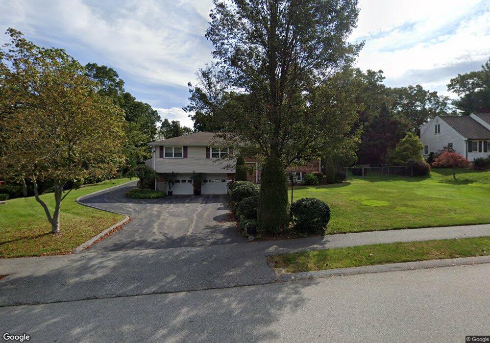
30 Hobbs Brook Rd Waltham, MA 02451
North Waltham NeighborhoodEstimated Value: $941,000 - $1,083,000
2
Beds
2
Baths
2,412
Sq Ft
$424/Sq Ft
Est. Value
About This Home
This home is located at 30 Hobbs Brook Rd, Waltham, MA 02451 and is currently estimated at $1,022,703, approximately $424 per square foot. 30 Hobbs Brook Rd is a home located in Middlesex County with nearby schools including Douglas Macarthur Elementary School, John F Kennedy Middle School, and Waltham Sr High School.
Ownership History
Date
Name
Owned For
Owner Type
Purchase Details
Closed on
Mar 1, 2024
Sold by
Mola Liliana
Bought by
Liliana Mola T and Liliana Mola
Current Estimated Value
Purchase Details
Closed on
Dec 15, 2003
Sold by
Navillus Rlty Corp
Bought by
Mola Joseph and Mola Liliana
Home Financials for this Owner
Home Financials are based on the most recent Mortgage that was taken out on this home.
Original Mortgage
$350,000
Interest Rate
5.9%
Mortgage Type
Purchase Money Mortgage
Create a Home Valuation Report for This Property
The Home Valuation Report is an in-depth analysis detailing your home's value as well as a comparison with similar homes in the area
Home Values in the Area
Average Home Value in this Area
Purchase History
We collect this data history from publicly available records. To have your information removed, we recommend requesting removal directly through your county’s website.
| Date | Buyer | Sale Price | Title Company |
|---|---|---|---|
| Liliana Mola T | -- | None Available | |
| Mola Joseph | $450,000 | -- |
Source: Public Records
Mortgage History
We collect this data history from publicly available records. To have your information removed, we recommend requesting removal directly through your county’s website.
| Date | Status | Borrower | Loan Amount |
|---|---|---|---|
| Previous Owner | Mola Joseph | $350,000 |
Source: Public Records
Tax History
| Year | Tax Paid | Tax Assessment Tax Assessment Total Assessment is a certain percentage of the fair market value that is determined by local assessors to be the total taxable value of land and additions on the property. | Land | Improvement |
|---|---|---|---|---|
| 2025 | $8,845 | $900,700 | $530,000 | $370,700 |
| 2024 | $8,385 | $869,800 | $505,000 | $364,800 |
| 2023 | $8,316 | $805,800 | $460,000 | $345,800 |
| 2022 | $8,599 | $771,900 | $440,000 | $331,900 |
| 2021 | $8,549 | $755,200 | $440,000 | $315,200 |
| 2020 | $8,121 | $679,600 | $410,000 | $269,600 |
| 2019 | $8,428 | $665,700 | $406,000 | $259,700 |
| 2018 | $7,343 | $582,300 | $376,000 | $206,300 |
| 2017 | $6,799 | $541,300 | $335,000 | $206,300 |
| 2016 | $6,014 | $491,300 | $285,000 | $206,300 |
| 2015 | $6,451 | $491,300 | $285,000 | $206,300 |
Source: Public Records
Map
Nearby Homes
- 197 Smith St
- 31 Huckleberry Hill Rd
- 8 Stratford Way
- 69 Page Rd
- 24 Barberry Rd
- 84 Davison Dr
- 44 Lakeview Terrace
- 9 Woodcliffe Rd
- 22 Fairbanks Rd
- 89 Hardy Pond Rd
- 30 Fairbanks Rd
- 70 Spring St
- 123 Pine Hill Cir
- 65 Spring St
- 10 Reiling Pond Rd
- 24 Normandy Rd
- 81 Princeton Ave
- 28 Blossom St
- 37 Woodcliffe Rd
- 1 Munroe Rd
- 20 Hobbs Brook Rd
- 40 Hobbs Brook Rd
- 33 Hobbs Brook Rd
- 1 Leslie Rd
- 21 Hobbs Brook Rd
- 17 Hobbs Brook Rd Unit 8
- 17 Hobbs Brook Rd Unit Lot 8
- 15 Hobbs Brook Rd Unit Lot 7
- 1710 Trapelo Rd
- 1710 Trapelo Rd Unit 1
- 10 Hobbs Brook Rd
- 50 Hobbs Brook Rd
- 50 Hobbs Brook Rd Unit 50
- 1704 Trapelo Rd
- 45 Hobbs Brook Rd
- 35 Melody Ln
- 42 Agrillo Cir
- 1738 Trapelo Rd
- 36 Agrillo Cir
- 1700 Trapelo Rd
Your Personal Tour Guide
Ask me questions while you tour the home.