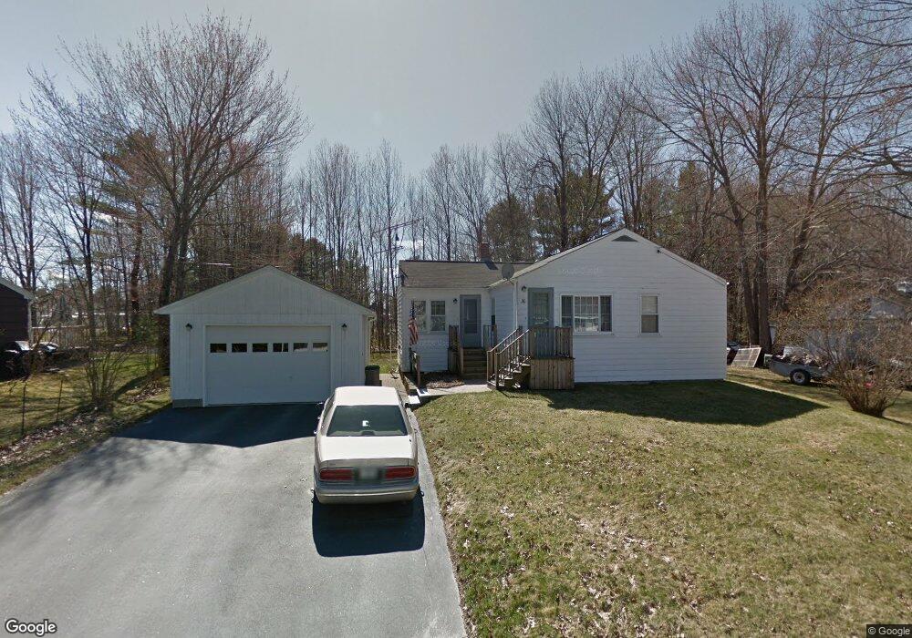
30 Maple Point Auburn, ME 04210
Estimated Value: $225,288 - $259,000
2
Beds
1
Bath
869
Sq Ft
$273/Sq Ft
Est. Value
About This Home
This home is located at 30 Maple Point, Auburn, ME 04210 and is currently estimated at $236,822, approximately $272 per square foot. 30 Maple Point is a home located in Androscoggin County with nearby schools including Fairview School, Auburn Middle School, and Edward Little High School.
Ownership History
Date
Name
Owned For
Owner Type
Purchase Details
Closed on
Dec 28, 2020
Sold by
Turgeon Robert L and Turgeon Vicki L
Bought by
Sewall Timothy A and Sewall Kimberley S
Current Estimated Value
Home Financials for this Owner
Home Financials are based on the most recent Mortgage that was taken out on this home.
Original Mortgage
$120,650
Outstanding Balance
$106,377
Interest Rate
2.8%
Mortgage Type
New Conventional
Estimated Equity
$130,445
Purchase Details
Closed on
Nov 9, 2020
Sold by
Lebel Eva M Est
Bought by
Turgeon Robert R and Turgeon Vicki L
Home Financials for this Owner
Home Financials are based on the most recent Mortgage that was taken out on this home.
Original Mortgage
$120,650
Outstanding Balance
$106,377
Interest Rate
2.8%
Mortgage Type
New Conventional
Estimated Equity
$130,445
Create a Home Valuation Report for This Property
The Home Valuation Report is an in-depth analysis detailing your home's value as well as a comparison with similar homes in the area
Home Values in the Area
Average Home Value in this Area
Purchase History
| Date | Buyer | Sale Price | Title Company |
|---|---|---|---|
| Sewall Timothy A | -- | None Available | |
| Turgeon Robert R | -- | None Available |
Source: Public Records
Mortgage History
| Date | Status | Borrower | Loan Amount |
|---|---|---|---|
| Open | Sewall Timothy A | $120,650 |
Source: Public Records
Tax History
| Year | Tax Paid | Tax Assessment Tax Assessment Total Assessment is a certain percentage of the fair market value that is determined by local assessors to be the total taxable value of land and additions on the property. | Land | Improvement |
|---|---|---|---|---|
| 2025 | $3,128 | $136,700 | $34,900 | $101,800 |
| 2024 | $3,042 | $136,700 | $34,900 | $101,800 |
| 2023 | $2,787 | $122,500 | $31,000 | $91,500 |
| 2022 | $2,787 | $122,500 | $31,000 | $91,500 |
| 2021 | $2,470 | $103,700 | $25,900 | $77,800 |
| 2020 | $2,463 | $103,700 | $25,900 | $77,800 |
| 2019 | $1,845 | $103,700 | $25,900 | $77,800 |
| 2018 | $1,840 | $103,700 | $25,900 | $77,800 |
| 2017 | $1,786 | $103,700 | $25,900 | $77,800 |
| 2016 | $1,851 | $103,800 | $25,900 | $77,900 |
| 2015 | $1,866 | $103,800 | $25,900 | $77,900 |
| 2013 | -- | $104,400 | $25,900 | $78,500 |
Source: Public Records
Map
Nearby Homes
- 288 Manley Rd
- 867 Minot Ave
- 89 Pride Rd
- lot 11 Minot Ave
- 912 Washington St N
- 510 Minot Ave
- 44 Towle St
- 113 Taft Ave
- 160 Fairway Dr
- 44 Poland Rd
- 368 Beech Hill Rd
- 1315 Minot Ave
- 14 Briarcliff Knoll
- 3 Freedom Farm Rd Unit 3
- 599 Fletcher
- 61 Roy Ave
- 120 Brentwood Dr
- 44 Chicoine Ave
- 23 Reginald St
- 15 Country Club Dr
Your Personal Tour Guide
Ask me questions while you tour the home.