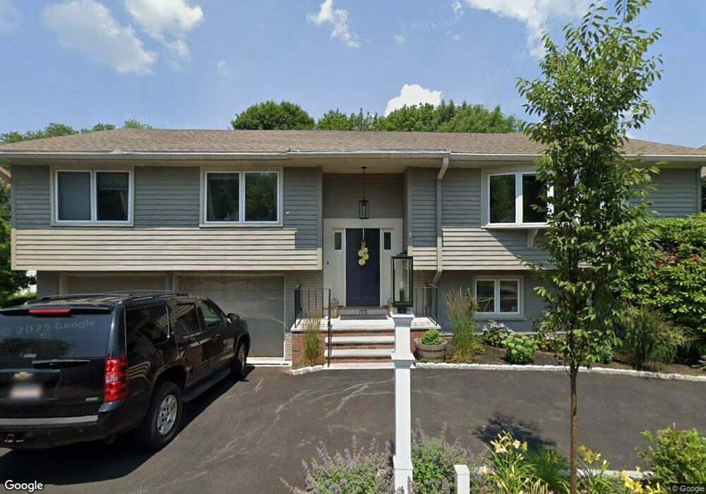
30 Phillips Beach Ave Swampscott, MA 01907
Estimated Value: $1,050,000 - $1,441,000
4
Beds
4
Baths
2,810
Sq Ft
$454/Sq Ft
Est. Value
About This Home
This home is located at 30 Phillips Beach Ave, Swampscott, MA 01907 and is currently estimated at $1,274,447, approximately $453 per square foot. 30 Phillips Beach Ave is a home located in Essex County with nearby schools including Swampscott Middle School, Swampscott High School, and Epstein Hillel School.
Ownership History
Date
Name
Owned For
Owner Type
Purchase Details
Closed on
Jun 22, 2012
Sold by
Eljanoudi Sahar
Bought by
Dudevoir Michael and Dudevoir Jenna
Current Estimated Value
Purchase Details
Closed on
Jul 14, 2011
Sold by
Scott Gary and Deutsche Bank Natl T C
Bought by
Eljanoudi Sahar
Purchase Details
Closed on
Sep 15, 2006
Sold by
Weinsberg Edgar and Weinsberg Yvonne R
Bought by
Scott Gary
Purchase Details
Closed on
Oct 2, 1990
Sold by
Gurman Steven
Bought by
Gurman Claire
Create a Home Valuation Report for This Property
The Home Valuation Report is an in-depth analysis detailing your home's value as well as a comparison with similar homes in the area
Home Values in the Area
Average Home Value in this Area
Purchase History
| Date | Buyer | Sale Price | Title Company |
|---|---|---|---|
| Dudevoir Michael | $550,000 | -- | |
| Dudevoir Michael | $550,000 | -- | |
| Eljanoudi Sahar | $350,000 | -- | |
| Eljanoudi Sahar | $350,000 | -- | |
| Scott Gary | $679,000 | -- | |
| Scott Gary | $679,000 | -- | |
| Gurman Claire | $70,000 | -- | |
| Gurman Claire | $70,000 | -- |
Source: Public Records
Mortgage History
| Date | Status | Borrower | Loan Amount |
|---|---|---|---|
| Open | Gurman Claire | $100,000 |
Source: Public Records
Tax History
| Year | Tax Paid | Tax Assessment Tax Assessment Total Assessment is a certain percentage of the fair market value that is determined by local assessors to be the total taxable value of land and additions on the property. | Land | Improvement |
|---|---|---|---|---|
| 2025 | $11,859 | $1,033,900 | $451,500 | $582,400 |
| 2024 | $12,277 | $1,068,500 | $432,700 | $635,800 |
| 2023 | $10,763 | $916,800 | $395,100 | $521,700 |
| 2022 | $10,159 | $791,800 | $338,600 | $453,200 |
| 2021 | $9,794 | $709,700 | $282,200 | $427,500 |
| 2020 | $10,147 | $709,600 | $282,200 | $427,400 |
| 2019 | $9,530 | $627,000 | $254,000 | $373,000 |
| 2018 | $9,930 | $620,600 | $254,000 | $366,600 |
| 2017 | $10,257 | $587,800 | $239,900 | $347,900 |
| 2016 | $9,788 | $564,800 | $239,900 | $324,900 |
| 2015 | $9,686 | $564,800 | $239,900 | $324,900 |
| 2014 | $10,203 | $545,600 | $218,700 | $326,900 |
Source: Public Records
Map
Nearby Homes
- 35 Alden Rd
- 45 Forest Ave
- 26 Forest Ave
- 22 Hemenway Rd
- 2 Ocean Ave
- 110 Galloupes Point Rd
- 315 Puritan Rd
- 22 Pine Hill Rd
- 38 Puritan Rd
- 31 Lincoln House Point
- 71 Greenwood Ave Unit 202
- 11 Elbridge Ln Unit 11
- 7 Sapphire Ave
- 48 Mountwood Rd
- 212 Humphrey St Unit 205
- 167-169 Walker Rd
- 411 Atlantic Ave Unit 2
- 22 Brookhouse Dr
- 3 Didio Dr
- 63 Walker Rd
- 34 Phillips Beach Ave
- 26 Phillips Beach Ave
- 65 Atlantic Rd
- 38 Phillips Beach Ave
- 37 Phillips Beach Ave
- 57 Atlantic Rd
- 22 Phillips Beach Ave
- 70 Atlantic Rd
- 31 Phillips Beach Ave
- 45 Phillips Beach Ave
- 45 Phillips Beach Ave
- 18 Phillips Beach Ave
- 45 Phillips Beachavenue
- 60 Atlantic Rd
- 27 Phillips Beach Ave
- 49 Atlantic Rd
- 37 Puritan Ave
- 54 Atlantic Rd
- 48 Atlantic Rd
- 29 Puritan Ave
Your Personal Tour Guide
Ask me questions while you tour the home.