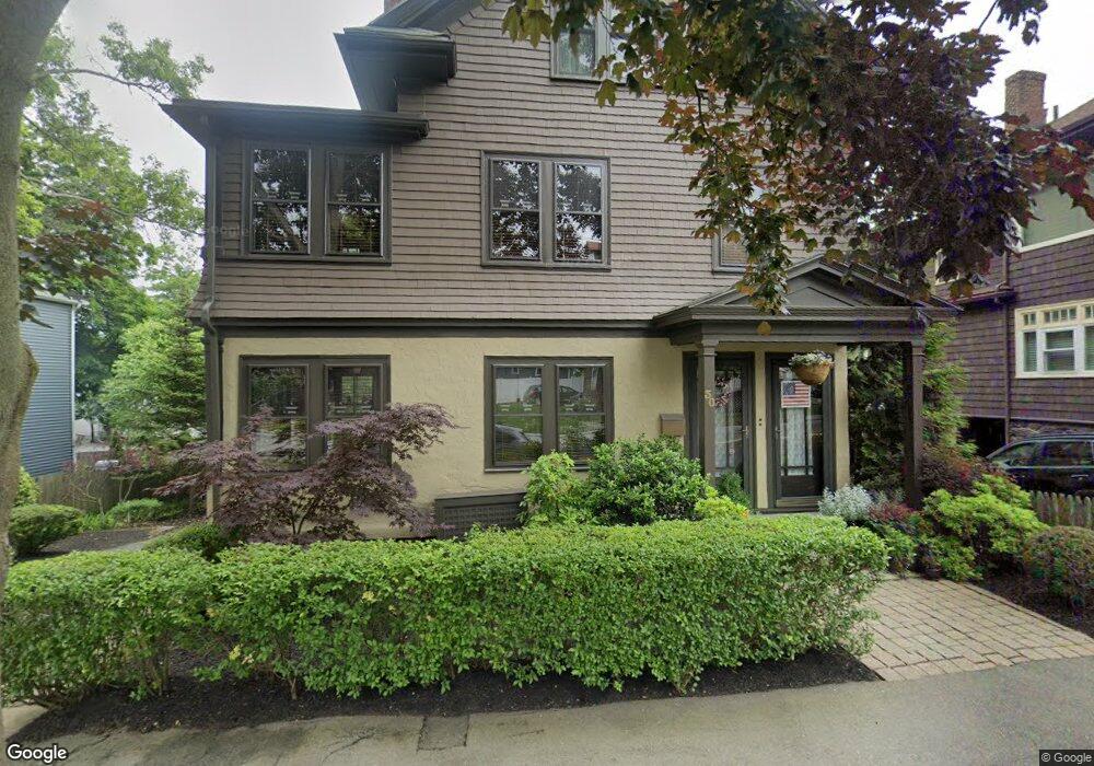
30 Phillips St Swampscott, MA 01907
Estimated Value: $1,039,000 - $1,157,178
6
Beds
4
Baths
3,423
Sq Ft
$314/Sq Ft
Est. Value
About This Home
This home is located at 30 Phillips St, Swampscott, MA 01907 and is currently estimated at $1,075,295, approximately $314 per square foot. 30 Phillips St is a home located in Essex County with nearby schools including Swampscott Middle School and Swampscott High School.
Ownership History
Date
Name
Owned For
Owner Type
Purchase Details
Closed on
Mar 2, 2024
Sold by
Clark Ellen L
Bought by
30 Phillips St Ret and Clark
Current Estimated Value
Purchase Details
Closed on
Aug 26, 2015
Sold by
Vinard Paul F and Vinard Ellen L
Bought by
Vinard Ellen L
Purchase Details
Closed on
Aug 30, 1993
Sold by
Small Irene and Pyer Kathleen
Bought by
Vinard Paul F and Vinard Ellen
Purchase Details
Closed on
Dec 2, 1991
Sold by
Gurman Claire
Bought by
Weinsberg Edgar J and Weinsberg Yvonne
Create a Home Valuation Report for This Property
The Home Valuation Report is an in-depth analysis detailing your home's value as well as a comparison with similar homes in the area
Home Values in the Area
Average Home Value in this Area
Purchase History
| Date | Buyer | Sale Price | Title Company |
|---|---|---|---|
| 30 Phillips St Ret | -- | None Available | |
| 30 Phillips St Ret | -- | None Available | |
| 30 Phillips St Ret | -- | None Available | |
| Vinard Ellen L | -- | -- | |
| Vinard Ellen L | -- | -- | |
| Vinard Paul F | $180,000 | -- | |
| Vinard Paul F | $180,000 | -- | |
| Weinsberg Edgar J | $330,000 | -- | |
| Weinsberg Edgar J | $330,000 | -- |
Source: Public Records
Mortgage History
| Date | Status | Borrower | Loan Amount |
|---|---|---|---|
| Previous Owner | Weinsberg Edgar J | $25,000 | |
| Previous Owner | Weinsberg Edgar J | $330,000 |
Source: Public Records
Tax History
| Year | Tax Paid | Tax Assessment Tax Assessment Total Assessment is a certain percentage of the fair market value that is determined by local assessors to be the total taxable value of land and additions on the property. | Land | Improvement |
|---|---|---|---|---|
| 2025 | $10,526 | $917,700 | $412,000 | $505,700 |
| 2024 | $10,224 | $889,800 | $391,900 | $497,900 |
| 2023 | $8,998 | $766,400 | $351,700 | $414,700 |
| 2022 | $8,881 | $692,200 | $301,500 | $390,700 |
| 2021 | $8,820 | $639,100 | $281,400 | $357,700 |
| 2020 | $7,926 | $554,300 | $251,200 | $303,100 |
| 2019 | $8,044 | $529,200 | $226,100 | $303,100 |
| 2018 | $7,970 | $498,100 | $206,000 | $292,100 |
| 2017 | $8,161 | $467,700 | $192,900 | $274,800 |
| 2016 | $7,915 | $456,700 | $192,900 | $263,800 |
| 2015 | $7,832 | $456,700 | $192,900 | $263,800 |
| 2014 | $7,529 | $402,600 | $160,800 | $241,800 |
Source: Public Records
Map
Nearby Homes
- 28 Claremont Terrace Unit 6
- 100 Burrill St Unit 3
- 100 Burrill St Unit 6
- 6 Elmwood Rd
- 11 Boynton St Unit 104
- 11 Boynton St Unit 101
- 11 Boynton St Unit 103
- 11 Boynton St Unit 201
- 143 Burrill St Unit 301
- 168 Humphrey St Unit PH
- 146 Burrill St
- 49 Blaney St
- 133 Elmwood Rd Unit 2
- 7 King St
- 27 Rockland St
- 245 Humphrey St Unit 205
- 97 Seymour Ave
- 80 Norfolk Ave Unit 1
- 106 Norfolk Ave
- 11 Phillips Ave
- 24 Phillips St
- 24 Phillips St Unit 1
- 24 Phillips St Unit 2
- 34 Phillips St
- 14 Claremont Terrace
- 22 Claremont Terrace
- 52 Humphrey St Unit 3
- 52 Humphrey St Unit PH3
- 52 Humphrey St
- 52 Humphrey St Unit 1
- 52 Humphrey St Unit 2
- 10 Phillips St
- 33 Phillips St
- 50 Humphrey St Unit 4
- 50 Humphrey St Unit 7
- 50 Humphrey St Unit 3
- 50 Humphrey St Unit 2
- 50 Humphrey St Unit 1
- 50 Humphrey St
- 50 Humphrey St Unit 6
Your Personal Tour Guide
Ask me questions while you tour the home.