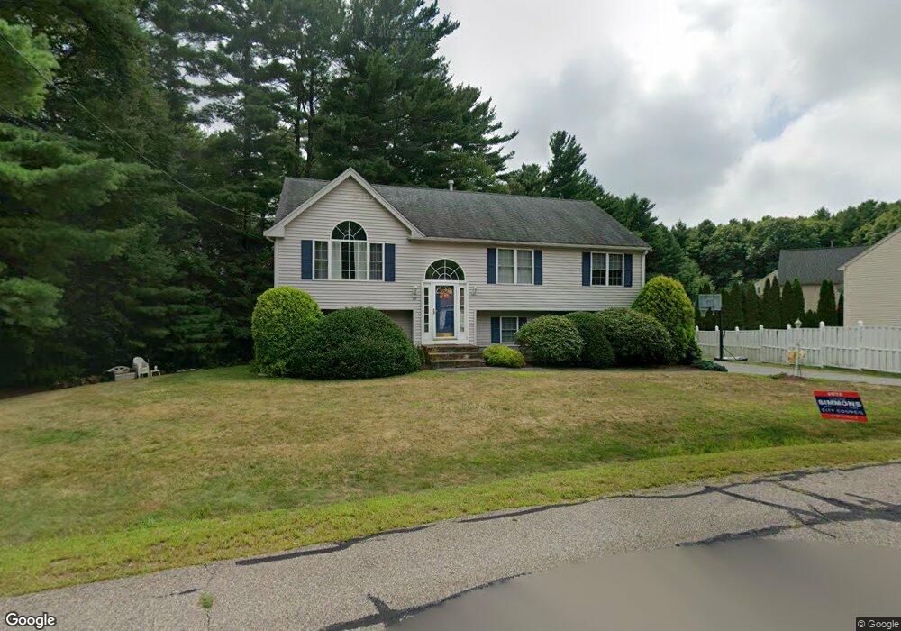
30 Pine Tree Ln Taunton, MA 02780
Weir Village NeighborhoodEstimated Value: $487,000 - $575,000
3
Beds
2
Baths
1,210
Sq Ft
$445/Sq Ft
Est. Value
About This Home
This home is located at 30 Pine Tree Ln, Taunton, MA 02780 and is currently estimated at $538,826, approximately $445 per square foot. 30 Pine Tree Ln is a home located in Bristol County with nearby schools including Elizabeth Pole School, Taunton High School, and John F. Parker Middle School.
Ownership History
Date
Name
Owned For
Owner Type
Purchase Details
Closed on
Jul 19, 1999
Sold by
Clarewood Homes Inc
Bought by
Macdougall James D and Doulette Lisa J
Current Estimated Value
Home Financials for this Owner
Home Financials are based on the most recent Mortgage that was taken out on this home.
Original Mortgage
$134,800
Outstanding Balance
$37,252
Interest Rate
7.39%
Mortgage Type
Purchase Money Mortgage
Estimated Equity
$501,574
Create a Home Valuation Report for This Property
The Home Valuation Report is an in-depth analysis detailing your home's value as well as a comparison with similar homes in the area
Home Values in the Area
Average Home Value in this Area
Purchase History
| Date | Buyer | Sale Price | Title Company |
|---|---|---|---|
| Macdougall James D | $152,450 | -- |
Source: Public Records
Mortgage History
| Date | Status | Borrower | Loan Amount |
|---|---|---|---|
| Open | Macdougall James D | $134,800 |
Source: Public Records
Tax History
| Year | Tax Paid | Tax Assessment Tax Assessment Total Assessment is a certain percentage of the fair market value that is determined by local assessors to be the total taxable value of land and additions on the property. | Land | Improvement |
|---|---|---|---|---|
| 2025 | $5,298 | $484,300 | $139,700 | $344,600 |
| 2024 | $5,047 | $451,000 | $158,700 | $292,300 |
| 2023 | $5,130 | $425,700 | $158,700 | $267,000 |
| 2022 | $5,007 | $379,900 | $137,500 | $242,400 |
| 2021 | $4,665 | $328,500 | $120,200 | $208,300 |
| 2020 | $4,572 | $307,700 | $120,200 | $187,500 |
| 2019 | $4,859 | $308,300 | $126,000 | $182,300 |
| 2018 | $4,641 | $295,200 | $127,300 | $167,900 |
| 2017 | $4,286 | $272,800 | $120,600 | $152,200 |
| 2016 | $4,161 | $265,400 | $117,100 | $148,300 |
| 2015 | $3,967 | $264,300 | $117,600 | $146,700 |
| 2014 | $3,838 | $262,700 | $116,700 | $146,000 |
Source: Public Records
Map
Nearby Homes
- 174 Ashleigh Terrace
- 0 Hart St Unit 73474079
- 600 County St
- 28 Barbara Rd
- 29 Johnson St Unit C
- 29 Johnson St Unit A
- 29 Johnson St Unit B
- 27 Johnson St Unit C
- 27 Johnson St Unit A
- 27 Johnson St Unit B
- 3 Karena Dr Unit 4-21
- 816 County St Unit 1-12
- 816 County St Unit 11
- 28 Linden St
- 36 Linden St
- 5 Parcels Cape Highway Route 44
- 0 Cape Highway Route 44 Unit 73474847
- 59 Linden St Unit 307
- 212 Carriage Ln Unit 212
- 1316 Carriage Ln Unit 1316
- 40 Pine Tree Ln
- 56 Pine Tree Ln
- 35 Pine Tree Ln
- 145 Williams St
- 45 Pine Tree Ln
- 60 Pine Tree Ln
- 49 Pine Tree Ln
- 143 Williams St
- 53 Pine Tree Ln
- 39 Deertrack Dr
- 29 Deertrack Dr
- 49 Deertrack Dr
- 64 Pine Tree Ln
- 57 Pine Tree Ln
- 61 Pine Tree Ln
- 61 Deertrack Dr
- 28 Deertrack Dr
- 19 Deertrack Dr
- 141 1/2 Williams St Unit B
- 141 1/2 Williams St Unit A
Your Personal Tour Guide
Ask me questions while you tour the home.