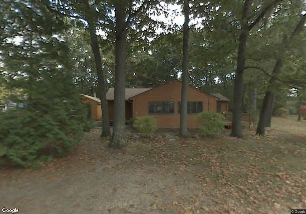
30 Schumann Dr Westfield, MA 01085
Estimated Value: $356,125 - $519,000
4
Beds
2
Baths
1,440
Sq Ft
$287/Sq Ft
Est. Value
About This Home
This home is located at 30 Schumann Dr, Westfield, MA 01085 and is currently estimated at $413,531, approximately $287 per square foot. 30 Schumann Dr is a home located in Hampden County with nearby schools including Westfield High School, Blessed Sacrament School, and Westfield Christian Academy.
Ownership History
Date
Name
Owned For
Owner Type
Purchase Details
Closed on
Feb 24, 2017
Sold by
Hsbc Bank Usa Na Tr
Bought by
Banar Timofey and Banar Marina
Current Estimated Value
Home Financials for this Owner
Home Financials are based on the most recent Mortgage that was taken out on this home.
Original Mortgage
$183,697
Outstanding Balance
$149,520
Interest Rate
4.12%
Mortgage Type
FHA
Estimated Equity
$264,011
Purchase Details
Closed on
Oct 13, 2016
Sold by
Plante George and Hsbc Bank Usa Na
Bought by
Hsbc Bank Usa Na Tr
Purchase Details
Closed on
Jun 26, 2002
Sold by
Plante George and Plante Janet Ann
Bought by
Plante George
Home Financials for this Owner
Home Financials are based on the most recent Mortgage that was taken out on this home.
Original Mortgage
$130,000
Interest Rate
6.92%
Mortgage Type
Purchase Money Mortgage
Create a Home Valuation Report for This Property
The Home Valuation Report is an in-depth analysis detailing your home's value as well as a comparison with similar homes in the area
Home Values in the Area
Average Home Value in this Area
Purchase History
| Date | Buyer | Sale Price | Title Company |
|---|---|---|---|
| Banar Timofey | $160,000 | -- | |
| Hsbc Bank Usa Na Tr | $246,000 | -- | |
| Plante George | $10,000 | -- |
Source: Public Records
Mortgage History
| Date | Status | Borrower | Loan Amount |
|---|---|---|---|
| Open | Banar Timofey | $183,697 | |
| Previous Owner | Plante George | $130,000 | |
| Previous Owner | Plante George | $26,000 |
Source: Public Records
Tax History
| Year | Tax Paid | Tax Assessment Tax Assessment Total Assessment is a certain percentage of the fair market value that is determined by local assessors to be the total taxable value of land and additions on the property. | Land | Improvement |
|---|---|---|---|---|
| 2025 | $4,641 | $305,700 | $120,000 | $185,700 |
| 2024 | $4,710 | $294,900 | $109,200 | $185,700 |
| 2023 | $44 | $268,200 | $104,100 | $164,100 |
| 2022 | $4,406 | $238,300 | $92,500 | $145,800 |
| 2021 | $4,273 | $226,300 | $87,100 | $139,200 |
| 2020 | $4,164 | $216,300 | $87,100 | $129,200 |
| 2019 | $4,076 | $207,200 | $83,000 | $124,200 |
| 2018 | $4,011 | $207,200 | $83,000 | $124,200 |
| 2017 | $3,952 | $203,500 | $84,300 | $119,200 |
| 2016 | $3,956 | $203,500 | $84,300 | $119,200 |
| 2015 | $3,773 | $203,500 | $84,300 | $119,200 |
| 2014 | $2,821 | $203,500 | $84,300 | $119,200 |
Source: Public Records
Map
Nearby Homes
- 288 Buck Pond Rd
- 0 Char Dr
- 15 Blue Sky Dr
- 71 Sun Valley Rd
- 19 Cottage Ave
- 24 Jaeger Dr
- 45 Jaeger Dr
- 23 Susan Dr
- 57 White Loaf Rd
- 16 Cranberry Dr
- 713 Holyoke Rd
- 244 Lower Westfield Rd
- 258 Rock Valley Rd
- 182 Lockhouse Rd
- 289 Holyoke Rd
- 19 Arch Rd
- 4 Deer Run
- 68 Warfield Dr
- 0 Lockhouse Rd Unit 73496193
- Lot 5 Brickyard Rd
- 8 Schumann Dr
- 31 Schumann Dr
- 36 Schumann Dr
- 35 Schumann Dr
- 15 Schumann Dr
- 39 Schumann Dr
- 289 Buck Pond Rd
- 279 Buck Pond Rd
- 281 Buck Pond Rd
- 277 Buck Pond Rd
- 287 Buck Pond Rd
- 0 Buck Pond Rd
- 284 Buck Pond Rd
- 280 Buck Pond Rd
- 276 Buck Pond Rd
- 272 Buck Pond Rd
- 291 Buck Pond Rd
- 263 Buck Pond Rd
- 261 Saunder St
- 266 Buck Pond Rd
Your Personal Tour Guide
Ask me questions while you tour the home.