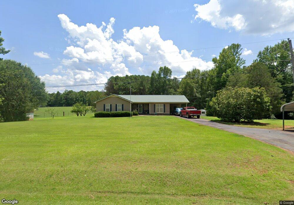
30 Woodyard Rd Lagrange, GA 30240
Estimated Value: $201,035 - $229,000
About This Home
This home is located at 30 Woodyard Rd, Lagrange, GA 30240 and is currently estimated at $215,259, approximately $157 per square foot. 30 Woodyard Rd is a home located in Troup County with nearby schools including Long Cane Elementary School, Whitesville Road Elementary School, and West Point Elementary School.
Ownership History
We collect this data history from publicly available records. To have your information removed, we recommend requesting removal directly through your county’s website.
Purchase Details
Purchase Details
Purchase Details
Purchase Details
Purchase Details
Purchase Details
Purchase History
We collect this data history from publicly available records. To have your information removed, we recommend requesting removal directly through your county’s website.
| Date | Buyer | Sale Price | Title Company |
|---|---|---|---|
| -- | -- | ||
| -- | -- | ||
| $50,000 | -- | ||
| $18,000 | -- | ||
| -- | -- | ||
| -- | -- |
Tax History
We collect this data history from publicly available records. To have your information removed, we recommend requesting removal directly through your county’s website.
| Year | Tax Paid | Tax Assessment Tax Assessment Total Assessment is a certain percentage of the fair market value that is determined by local assessors to be the total taxable value of land and additions on the property. | Land | Improvement |
|---|---|---|---|---|
| 2025 | $1,728 | $63,372 | $10,520 | $52,852 |
| 2024 | $1,271 | $54,416 | $10,520 | $43,896 |
| 2023 | $1,114 | $48,676 | $10,520 | $38,156 |
| 2022 | $1,094 | $46,916 | $10,520 | $36,396 |
| 2021 | $932 | $38,652 | $8,520 | $30,132 |
| 2020 | $932 | $38,652 | $8,520 | $30,132 |
| 2019 | $901 | $37,612 | $8,520 | $29,092 |
| 2018 | $821 | $34,980 | $8,520 | $26,460 |
| 2017 | $821 | $34,980 | $8,520 | $26,460 |
| 2016 | $824 | $35,078 | $8,528 | $26,549 |
| 2015 | $824 | $35,078 | $8,528 | $26,549 |
| 2014 | $782 | $33,680 | $8,528 | $25,152 |
| 2013 | -- | $35,306 | $8,528 | $26,778 |
Map
- 304 Baughs Cross Rd
- 221 Harris Walk
- 1559 Bartley Rd
- 145 Jarrell Hogg Rd
- 0 Whitesville Burkes Chapel Rd Unit 10730993
- 3873 Bartley Rd
- 231 Murphy Rd
- 101 Garden Walk Unit 85
- 1408 New Hutchinson Mill Rd
- 4172 Bartley Rd
- 648 Warner Rd
- 0 Warner Rd Unit 10758748
- 620 Old Hutchinson Mill Rd
- 660 Bartley Rd
- 0 Whitesville Rd Unit 10773389
- 0 New Hutchinson Mill Rd Unit 26388145
- 11.59+/- AC Hunt Rd
- 23 Tucker Cir
- 23 Tucker Cir Unit LOT 23
- 0 Adams Rd Unit 10772389
Ask me questions while you tour the home.