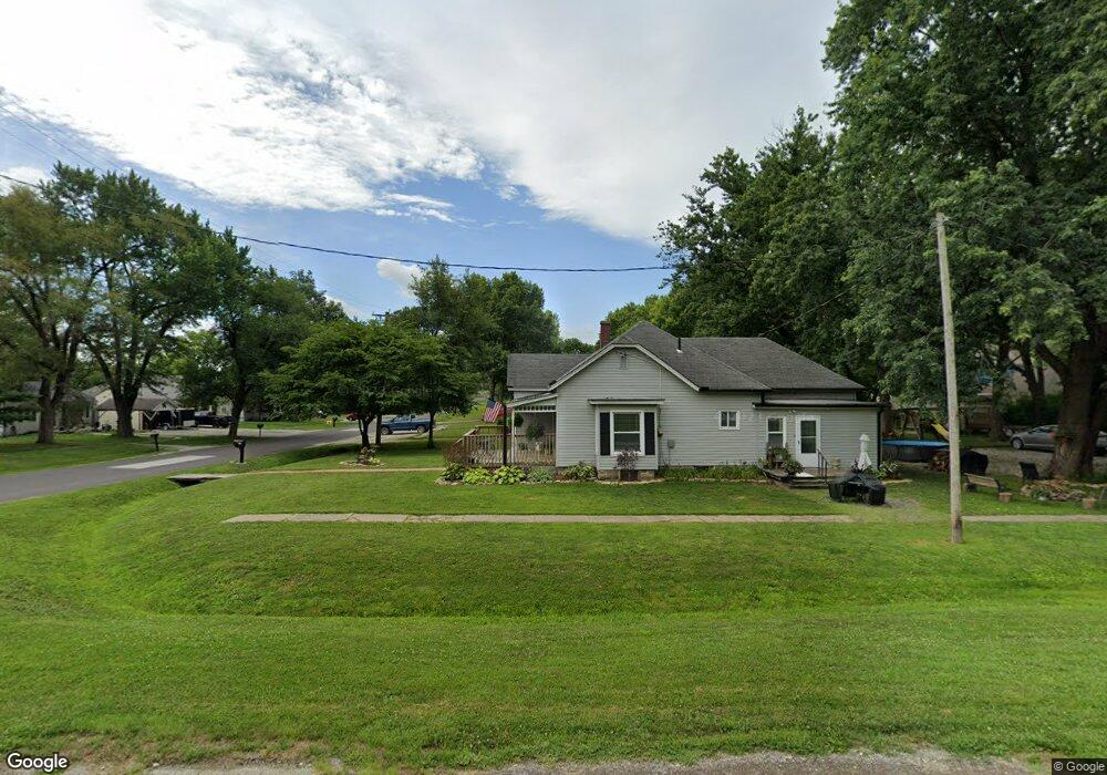
300 Maple St Lathrop, MO 64465
Estimated Value: $177,000 - $279,000
3
Beds
1
Bath
1,145
Sq Ft
$192/Sq Ft
Est. Value
About This Home
This home is located at 300 Maple St, Lathrop, MO 64465 and is currently estimated at $219,422, approximately $191 per square foot. 300 Maple St is a home located in Clinton County with nearby schools including Lathrop Elementary School, Lathrop Middle School, and Lathrop High School.
Create a Home Valuation Report for This Property
The Home Valuation Report is an in-depth analysis detailing your home's value as well as a comparison with similar homes in the area
Home Values in the Area
Average Home Value in this Area
Tax History
We collect this data history from publicly available records. To have your information removed, we recommend requesting removal directly through your county’s website.
| Year | Tax Paid | Tax Assessment Tax Assessment Total Assessment is a certain percentage of the fair market value that is determined by local assessors to be the total taxable value of land and additions on the property. | Land | Improvement |
|---|---|---|---|---|
| 2025 | $1,238 | $15,318 | $4,427 | $10,891 |
| 2024 | $1,238 | $13,677 | $3,952 | $9,725 |
| 2023 | $1,131 | $13,677 | $3,952 | $9,725 |
| 2022 | $1,043 | $12,793 | $3,952 | $8,841 |
| 2021 | $1,019 | $12,793 | $3,952 | $8,841 |
| 2020 | $972 | $11,630 | $3,593 | $8,037 |
| 2019 | $802 | $9,709 | $1,672 | $8,037 |
| 2018 | $795 | $9,709 | $1,672 | $8,037 |
| 2017 | $801 | $9,709 | $1,672 | $8,037 |
| 2016 | $814 | $9,709 | $1,672 | $8,037 |
| 2013 | -- | $9,710 | $0 | $0 |
Source: Public Records
Map
Nearby Homes
- 406 Maple St
- 203 Valley St
- 1100 Colonial Dr
- 111 Elm St
- 604 Short St
- 606 Ash St
- 601 Mark St
- 25 NE Stonum Rd
- 0 NE Stonum Rd
- 8165 Missouri 116
- Lot 4 NE 280th St
- Lot 6 NE 280th St
- Lot 5 NE 280th St
- Lot 3 NE 280th St
- Lot 1 NE 280th St
- 8500 E 116 Hwy
- Track 2 SE 240th St
- Track 1 SE 240th St
- 810 SE 240th St
- 6375 SE Vollmer Dr
Your Personal Tour Guide
Ask me questions while you tour the home.