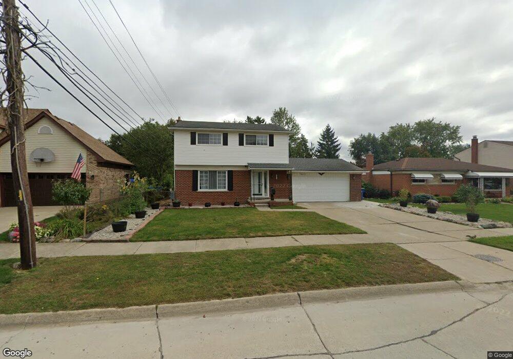
30072 Merrick Ave Unit Bldg-Unit Warren, MI 48092
Northwest Warren NeighborhoodEstimated Value: $242,000 - $296,000
4
Beds
2
Baths
1,348
Sq Ft
$193/Sq Ft
Est. Value
About This Home
This home is located at 30072 Merrick Ave Unit Bldg-Unit, Warren, MI 48092 and is currently estimated at $260,031, approximately $192 per square foot. 30072 Merrick Ave Unit Bldg-Unit is a home located in Macomb County with nearby schools including Lean Elementary School, Beer Middle School, and Warren Mott High School.
Ownership History
Date
Name
Owned For
Owner Type
Purchase Details
Closed on
Mar 1, 2018
Sold by
Sucaet Marcel A and Sucaet Joanne E
Bought by
Rezk Ramz S and Naroz Enas Rezk
Current Estimated Value
Home Financials for this Owner
Home Financials are based on the most recent Mortgage that was taken out on this home.
Original Mortgage
$161,990
Outstanding Balance
$137,738
Interest Rate
4.15%
Mortgage Type
New Conventional
Estimated Equity
$122,293
Create a Home Valuation Report for This Property
The Home Valuation Report is an in-depth analysis detailing your home's value as well as a comparison with similar homes in the area
Home Values in the Area
Average Home Value in this Area
Purchase History
We collect this data history from publicly available records. To have your information removed, we recommend requesting removal directly through your county’s website.
| Date | Buyer | Sale Price | Title Company |
|---|---|---|---|
| Rezk Ramz S | $170,250 | None Available |
Source: Public Records
Mortgage History
We collect this data history from publicly available records. To have your information removed, we recommend requesting removal directly through your county’s website.
| Date | Status | Borrower | Loan Amount |
|---|---|---|---|
| Open | Rezk Ramz S | $161,990 |
Source: Public Records
Tax History
| Year | Tax Paid | Tax Assessment Tax Assessment Total Assessment is a certain percentage of the fair market value that is determined by local assessors to be the total taxable value of land and additions on the property. | Land | Improvement |
|---|---|---|---|---|
| 2025 | $4,435 | $115,690 | $0 | $0 |
| 2024 | $43 | $111,470 | $0 | $0 |
| 2023 | $4,114 | $99,330 | $0 | $0 |
| 2022 | $3,975 | $86,710 | $0 | $0 |
| 2021 | $4,044 | $82,050 | $0 | $0 |
| 2020 | $3,900 | $78,920 | $0 | $0 |
| 2019 | $3,760 | $70,700 | $0 | $0 |
| 2018 | $0 | $66,170 | $0 | $0 |
| 2017 | $2,436 | $61,260 | $10,380 | $50,880 |
| 2016 | $2,434 | $61,260 | $0 | $0 |
| 2015 | -- | $53,360 | $0 | $0 |
| 2012 | -- | $42,930 | $0 | $0 |
Source: Public Records
Map
Nearby Homes
- 30016 Holly Ct
- 30041 Warner Ave
- 30507 Austin Dr
- 2052 Roman Ct
- 1579 Dulong Ave
- 29355 Westbrook Ave
- 30320 Woodhouse Dr
- 1584 Beaupre Ave
- 1812 E Thirteen Mile Rd
- 29277 Merrick Ave
- 1405 Dulong Ave
- 30885 Lee Frank Ln
- 30809 Elmhurst Dr
- 1333 Fontaine Ave
- 3458 Common Rd
- 30615 Scrivo Dr
- 31227 Dequindre Rd
- 29242 Shirley Ave
- 1274 Fontaine Ave
- 28780 Norwood Ave
- 30072 Merrick Ave
- 30060 Merrick Ave
- 30080 Merrick Ave
- 30048 Merrick Ave
- 30045 Paul Ct
- 30084 Merrick Ave
- 30057 Paul Ct
- 30071 Merrick Ave
- 30024 Merrick Ave
- 30033 Paul Ct
- 30083 Merrick Ave
- 30059 Merrick Ave
- 30047 Merrick Ave
- 30089 Merrick Ave
- 2430 Cromie Dr
- 30021 Paul Ct
- 2416 Cromie Dr
- 2243 Common Rd
- 30058 Paul Ct
- 2103 Shady Dr
Your Personal Tour Guide
Ask me questions while you tour the home.