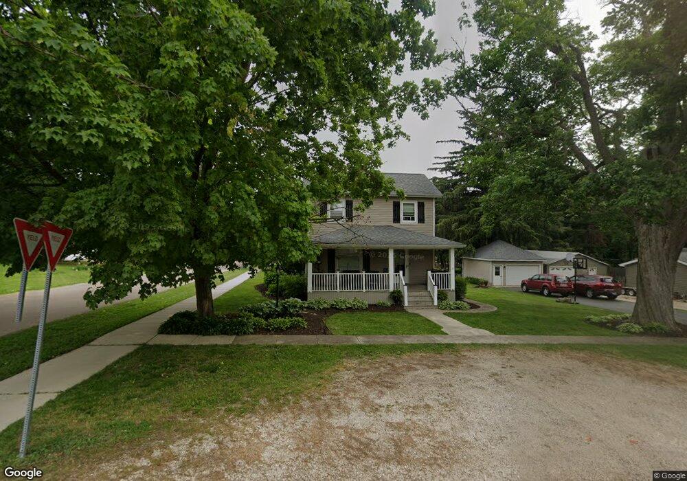
301 E Front St Newark, IL 60541
Estimated Value: $251,000 - $261,000
3
Beds
--
Bath
1,840
Sq Ft
$139/Sq Ft
Est. Value
About This Home
This home is located at 301 E Front St, Newark, IL 60541 and is currently estimated at $255,919, approximately $139 per square foot. 301 E Front St is a home located in Kendall County with nearby schools including Newark Elementary School, Millbrook Junior High School, and Newark Community High School.
Ownership History
Date
Name
Owned For
Owner Type
Purchase Details
Closed on
Jan 4, 2022
Sold by
Davidson Sigrid A
Bought by
Sigrid A Davidson Declaration Of Trust
Current Estimated Value
Purchase Details
Closed on
Jan 1, 1989
Create a Home Valuation Report for This Property
The Home Valuation Report is an in-depth analysis detailing your home's value as well as a comparison with similar homes in the area
Home Values in the Area
Average Home Value in this Area
Purchase History
| Date | Buyer | Sale Price | Title Company |
|---|---|---|---|
| Sigrid A Davidson Declaration Of Trust | -- | Neuenkirchen John P | |
| -- | $44,000 | -- |
Source: Public Records
Tax History
| Year | Tax Paid | Tax Assessment Tax Assessment Total Assessment is a certain percentage of the fair market value that is determined by local assessors to be the total taxable value of land and additions on the property. | Land | Improvement |
|---|---|---|---|---|
| 2024 | $5,927 | $78,654 | $18,435 | $60,219 |
| 2023 | $4,968 | $70,630 | $16,554 | $54,076 |
| 2022 | $4,968 | $63,964 | $16,542 | $47,422 |
| 2021 | $4,848 | $60,089 | $15,540 | $44,549 |
| 2020 | $4,251 | $59,044 | $15,270 | $43,774 |
| 2019 | $4,336 | $59,044 | $15,270 | $43,774 |
| 2018 | $4,310 | $58,352 | $15,201 | $43,151 |
| 2017 | $4,299 | $57,580 | $15,000 | $42,580 |
| 2016 | $4,092 | $54,837 | $15,168 | $39,669 |
| 2015 | $3,732 | $54,230 | $15,000 | $39,230 |
| 2014 | -- | $52,871 | $17,049 | $35,822 |
| 2013 | -- | $52,871 | $17,049 | $35,822 |
Source: Public Records
Map
Nearby Homes
- 2 N Van Buren St
- 502 E Benton St
- 11071 Crimmin Rd
- 10978 Crimmin Rd
- 115 Belle Rive Dr
- 2833 N 4201st Rd
- 000 W County Line Rd
- 4322 E 2859th Rd
- 003 N 4201st Rd
- 001 N 4201st Rd
- 004 N 4201st Rd
- 2853 N 4360th Rd
- 16011 Indian Rd
- 2989 N 4459th Rd
- 4452 E 2969th Rd
- 4456 E 2969th Rd
- 4455 E 2969th Rd
- 4462 E 2979th Rd
- 4460 N 4459th Rd
- 15725 Stonewall Dr
Your Personal Tour Guide
Ask me questions while you tour the home.