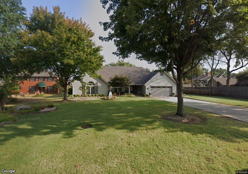
3010 Bacon Rd Muskogee, OK 74403
Country Club NeighborhoodEstimated Value: $309,379 - $374,000
3
Beds
3
Baths
3,255
Sq Ft
$103/Sq Ft
Est. Value
About This Home
This home is located at 3010 Bacon Rd, Muskogee, OK 74403 and is currently estimated at $335,095, approximately $102 per square foot. 3010 Bacon Rd is a home located in Muskogee County with nearby schools including 8th & 9th Grade Academy @ Alice Robertson, Muskogee High School, and St Joseph Catholic School.
Ownership History
Date
Name
Owned For
Owner Type
Purchase Details
Closed on
Jun 9, 2017
Sold by
Plunkett Kenneth C and Plunkett Lorene
Bought by
Plunkett Kenneth C and Plunkett Lean Lorene
Current Estimated Value
Purchase Details
Closed on
Mar 13, 2013
Sold by
Scott Juanita and Samuel Dale Scott Trust
Bought by
Scott Juanita and Samuel Dale Scott Marital Trus
Purchase Details
Closed on
Sep 1, 1992
Bought by
Scott Samuel Dale Trust
Purchase Details
Closed on
Jul 1, 1988
Create a Home Valuation Report for This Property
The Home Valuation Report is an in-depth analysis detailing your home's value as well as a comparison with similar homes in the area
Home Values in the Area
Average Home Value in this Area
Purchase History
| Date | Buyer | Sale Price | Title Company |
|---|---|---|---|
| Plunkett Kenneth C | -- | None Available | |
| Scott Juanita | -- | None Available | |
| Scott Samuel Dale Trust | -- | -- | |
| -- | $140,000 | -- |
Source: Public Records
Tax History
| Year | Tax Paid | Tax Assessment Tax Assessment Total Assessment is a certain percentage of the fair market value that is determined by local assessors to be the total taxable value of land and additions on the property. | Land | Improvement |
|---|---|---|---|---|
| 2025 | $3,578 | $31,987 | $1,742 | $30,245 |
| 2024 | $3,376 | $31,987 | $1,742 | $30,245 |
| 2023 | $3,376 | $31,744 | $1,568 | $30,176 |
| 2022 | $2,905 | $31,056 | $1,568 | $29,488 |
| 2021 | $2,830 | $29,273 | $2,273 | $27,000 |
| 2020 | $2,835 | $29,273 | $2,273 | $27,000 |
| 2019 | $2,813 | $29,273 | $2,273 | $27,000 |
| 2018 | $2,745 | $29,273 | $2,273 | $27,000 |
| 2017 | $2,574 | $28,315 | $2,273 | $26,042 |
| 2016 | $2,523 | $27,490 | $2,273 | $25,217 |
| 2015 | $2,499 | $27,490 | $2,273 | $25,217 |
| 2014 | $2,545 | $27,490 | $2,273 | $25,217 |
Source: Public Records
Map
Nearby Homes
- 3002 Kimberlea Dr
- 3008 Shelby Cir
- 2817 Kimberlea Dr
- 2901 Robin Ln
- 2839 Hickory Creek Rd
- 3601 Country Club Dr
- 3423 River Bend Rd
- 3611 N Country Club Cir
- 3404 Park Place N
- 0 SW Shawnee Rd Unit 2612617
- 3401 E Shawnee Bypass
- 0 Old Shawnee Rd Unit 2546014
- 3205 E Shawnee
- 3806 Club View Dr
- 3821 N Country Club Cir
- 1813 N York St
- 0 N York St Unit 2545885
- 000 Ward St
- 1622 Maple St
- 4006 Eufaula Ave
- 2605 Fort Davis Dr
- 3011 Bacon Rd
- 2607 Fort Davis Dr
- 3006 Bacon Rd
- 3105 Kimberlea Dr
- 2601 Fort Davis Dr
- 2609 Fort Davis Dr
- 3103 Kimberlea Dr
- 3003 Bacon Rd
- 2604 Fort Davis Dr
- 3004 Bacon Rd
- 3101 Kimberlea Dr
- 3009 Kimberlea Dr
- 2500 Shelby Ct
- 2602 Fort Davis Dr
- 2600 Fort Davis Dr
- 2503 Shelby Ct
- 3011 Kimberlea Dr
- 3201 Kimberlea Dr
- 2501 Shelby Ct
Your Personal Tour Guide
Ask me questions while you tour the home.