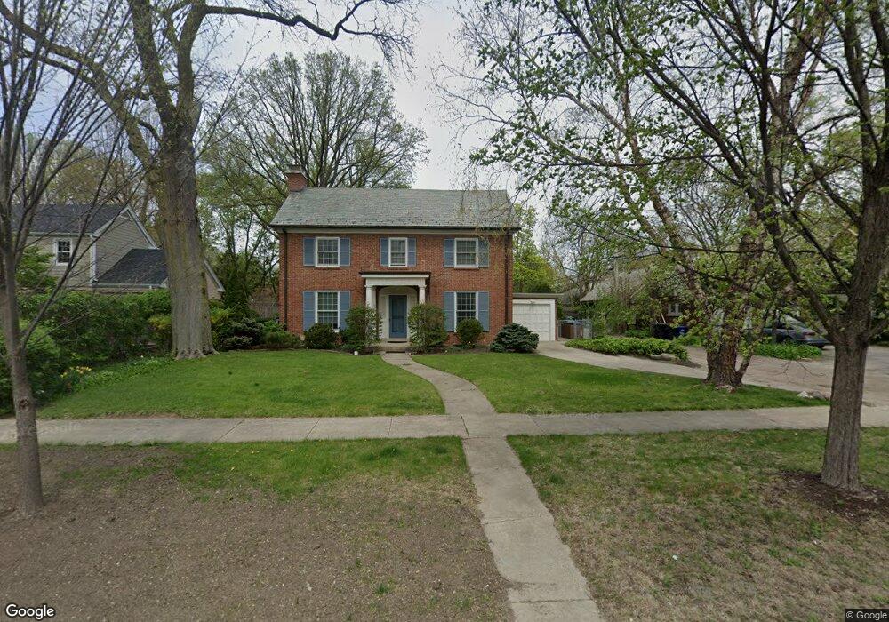
3015 Simpson St Evanston, IL 60201
North Evanston NeighborhoodEstimated Value: $1,029,000 - $1,523,860
About This Home
This home is located at 3015 Simpson St, Evanston, IL 60201 and is currently estimated at $1,235,715, approximately $458 per square foot. 3015 Simpson St is a home located in Cook County with nearby schools including Lincolnwood Elementary School, Haven Middle School, and Evanston Township High School.
Ownership History
We collect this data history from publicly available records. To have your information removed, we recommend requesting removal directly through your county’s website.
Purchase Details
Purchase Details
Purchase Details
Home Financials for this Owner
Home Financials are based on the most recent Mortgage that was taken out on this home.Home Values in the Area
Average Home Value in this Area
Purchase History
We collect this data history from publicly available records. To have your information removed, we recommend requesting removal directly through your county’s website.
| Date | Buyer | Sale Price | Title Company |
|---|---|---|---|
| $572,500 | Cti | ||
| -- | -- | ||
| -- | -- | ||
| $500,000 | -- |
Mortgage History
We collect this data history from publicly available records. To have your information removed, we recommend requesting removal directly through your county’s website.
| Date | Status | Borrower | Loan Amount |
|---|---|---|---|
| Previous Owner | $300,000 | ||
| Closed | $100,000 |
Tax History
We collect this data history from publicly available records. To have your information removed, we recommend requesting removal directly through your county’s website.
| Year | Tax Paid | Tax Assessment Tax Assessment Total Assessment is a certain percentage of the fair market value that is determined by local assessors to be the total taxable value of land and additions on the property. | Land | Improvement |
|---|---|---|---|---|
| 2025 | $25,585 | $126,176 | $37,307 | $88,869 |
| 2024 | $25,585 | $110,270 | $31,416 | $78,854 |
| 2023 | $24,525 | $110,270 | $31,416 | $78,854 |
| 2022 | $24,525 | $110,270 | $31,416 | $78,854 |
| 2021 | $17,596 | $69,637 | $18,980 | $50,657 |
| 2020 | $17,421 | $69,637 | $18,980 | $50,657 |
| 2019 | $17,146 | $76,609 | $18,980 | $57,629 |
| 2018 | $16,665 | $64,263 | $15,708 | $48,555 |
| 2017 | $16,246 | $64,263 | $15,708 | $48,555 |
| 2016 | $15,631 | $64,263 | $15,708 | $48,555 |
| 2015 | $14,143 | $55,370 | $13,090 | $42,280 |
| 2014 | $13,749 | $54,338 | $13,090 | $41,248 |
| 2013 | $13,417 | $54,338 | $13,090 | $41,248 |
Map
- 3029 Simpson St
- 9550 Central Park Ave
- 2201 Lincolnwood Dr
- 2100 Forestview Rd
- 9435 Central Park Ave
- 2724 Simpson St
- 9360 Ridgeway Ave
- 2422 Ridgeway Ave
- 9530 Harding Ave
- 2433 Hastings Ave
- 2026 Mcdaniel Ave
- 9242 Ridgeway Ave
- 3618 Church St
- 3046 Central St
- 9222 Ewing Ave Unit 102
- 9701 Kedvale Ave
- 1915 - 2 Grant St
- 3363 Church St
- 3233 Central St
- 3233 Central St Unit 2
- 3022 Payne St
- 3026 Payne St
- 3014 Payne St
- 3030 Payne St
- 2122 Central Park Ave
- 2130 Central Park Ave
- 3040 Payne St
- 3021 Simpson St
- 2116 Central Park Ave
- 3021 Simpson St
- 3023 Payne St
- 3027 Payne St
- 3015 Payne St
- 3033 Simpson St
- 2110 Central Park Ave
- 3033 Payne St
- 3042 Payne St
- 2111 Lawndale Ave
- 2140 Central Park Ave
- 2100 Central Park Ave
Ask me questions while you tour the home.