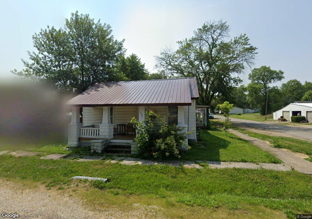
302 E Park St Vandalia, MO 63382
Estimated Value: $72,297 - $118,000
Studio
--
Bath
1,159
Sq Ft
$81/Sq Ft
Est. Value
About This Home
This home is located at 302 E Park St, Vandalia, MO 63382 and is currently estimated at $93,824, approximately $80 per square foot. 302 E Park St is a home located in Audrain County with nearby schools including Van-Far Elementary School and Van-Far Junior/Senior High School.
Ownership History
Date
Name
Owned For
Owner Type
Purchase Details
Closed on
Aug 14, 2025
Sold by
Howdeshell Living Trust and Howdeshell Virginia I
Bought by
Owens Matthew R and Owens Amber D
Current Estimated Value
Home Financials for this Owner
Home Financials are based on the most recent Mortgage that was taken out on this home.
Original Mortgage
$62,500
Outstanding Balance
$62,338
Interest Rate
6.75%
Mortgage Type
New Conventional
Estimated Equity
$31,486
Purchase Details
Closed on
Jan 14, 2020
Sold by
Larry Kronk
Bought by
Howdeshell Virginia I Te
Create a Home Valuation Report for This Property
The Home Valuation Report is an in-depth analysis detailing your home's value as well as a comparison with similar homes in the area
Home Values in the Area
Average Home Value in this Area
Purchase History
| Date | Buyer | Sale Price | Title Company |
|---|---|---|---|
| Owens Matthew R | -- | None Listed On Document | |
| Howdeshell Virginia I Te | -- | -- | |
| Wehmeier Russell S | -- | -- |
Source: Public Records
Mortgage History
| Date | Status | Borrower | Loan Amount |
|---|---|---|---|
| Open | Owens Matthew R | $62,500 |
Source: Public Records
Tax History
| Year | Tax Paid | Tax Assessment Tax Assessment Total Assessment is a certain percentage of the fair market value that is determined by local assessors to be the total taxable value of land and additions on the property. | Land | Improvement |
|---|---|---|---|---|
| 2025 | $210 | $2,780 | $860 | $1,920 |
| 2024 | $213 | $2,780 | $860 | $1,920 |
| 2023 | $210 | $2,780 | $860 | $1,920 |
| 2022 | $215 | $2,780 | $860 | $1,920 |
| 2021 | $188 | $2,490 | $860 | $1,630 |
| 2020 | $187 | $2,490 | $860 | $1,630 |
| 2019 | $187 | $2,490 | $860 | $1,630 |
| 2018 | $157 | $0 | $0 | $0 |
| 2017 | $173 | $0 | $0 | $0 |
| 2012 | $173 | $2,490 | $0 | $0 |
Source: Public Records
Map
Nearby Homes
- 114 W Union St
- 406 S Utterback St
- 903 S Clark St
- 1001 S Monroe St
- 514 W US Highway 54
- 614 N Oak St
- 710 N Maple St
- 806 N Galloway Rd
- 35 Galloway Rd
- 1149 E US Highway 54
- 300 Redbud Rd
- 4710 Pike 451
- 2601 Pike 25
- 0000 Pike 443
- 14144 Highway E
- 36950 Highway K
- 705 N Pine St
- 9383 Audrain Road 625
- 7485 Pike 418
- TBD Pike 409
Your Personal Tour Guide
Ask me questions while you tour the home.