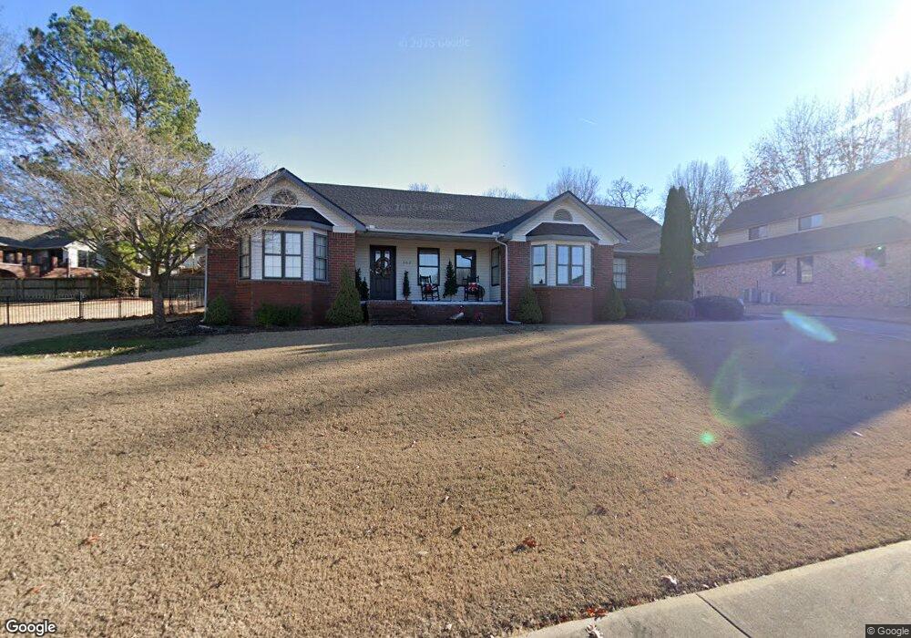
302 Emerald Point Dr Springdale, AR 72764
Shady Grove NeighborhoodEstimated Value: $452,409 - $508,000
3
Beds
3
Baths
2,298
Sq Ft
$212/Sq Ft
Est. Value
About This Home
This home is located at 302 Emerald Point Dr, Springdale, AR 72764 and is currently estimated at $486,102, approximately $211 per square foot. 302 Emerald Point Dr is a home located in Washington County with nearby schools including J. O. Kelly Middle School, Harp Elementary School, and George Junior High School.
Ownership History
Date
Name
Owned For
Owner Type
Purchase Details
Closed on
Aug 25, 1997
Bought by
Potts Mark W and Potts Patricia A
Current Estimated Value
Purchase Details
Closed on
Mar 21, 1991
Bought by
Shown James A
Purchase Details
Closed on
Apr 12, 1988
Bought by
Morehouse Thomas K
Purchase Details
Closed on
Aug 1, 1985
Bought by
Simpson Marilyn R
Purchase Details
Closed on
Jan 1, 1985
Bought by
Trimble Carroll O
Create a Home Valuation Report for This Property
The Home Valuation Report is an in-depth analysis detailing your home's value as well as a comparison with similar homes in the area
Home Values in the Area
Average Home Value in this Area
Purchase History
| Date | Buyer | Sale Price | Title Company |
|---|---|---|---|
| Potts Mark W | $146,000 | -- | |
| Shown James A | $137,000 | -- | |
| Morehouse Thomas K | $135,000 | -- | |
| Simpson Marilyn R | $28,000 | -- | |
| Trimble Carroll O | -- | -- |
Source: Public Records
Tax History
| Year | Tax Paid | Tax Assessment Tax Assessment Total Assessment is a certain percentage of the fair market value that is determined by local assessors to be the total taxable value of land and additions on the property. | Land | Improvement |
|---|---|---|---|---|
| 2025 | $1,722 | $89,190 | $14,000 | $75,190 |
| 2024 | $1,822 | $89,190 | $14,000 | $75,190 |
| 2023 | $1,942 | $89,190 | $14,000 | $75,190 |
| 2022 | $1,992 | $55,150 | $13,000 | $42,150 |
| 2021 | $1,992 | $55,150 | $13,000 | $42,150 |
| 2020 | $1,992 | $55,150 | $13,000 | $42,150 |
| 2019 | $1,992 | $44,920 | $9,600 | $35,320 |
| 2018 | $2,017 | $44,920 | $9,600 | $35,320 |
| 2017 | $1,995 | $44,920 | $9,600 | $35,320 |
| 2016 | $1,995 | $44,920 | $9,600 | $35,320 |
| 2015 | $1,995 | $44,920 | $9,600 | $35,320 |
| 2014 | $2,104 | $47,020 | $11,200 | $35,820 |
Source: Public Records
Map
Nearby Homes
- 310 Emerald Point Dr
- 409 W Lakeview Dr
- 412 Oak Manor Cir
- 504 Fairway Cir
- 4079 Jessica Ln
- 405 Lake Rd
- 2624 S Derby Ln
- 0 N Waterside Ct
- 123 San Jose Dr
- 3461 Remington St
- 301 W Edmondson Ave
- 3359 Ryan St
- 3801 Southland Dr
- 545 Gascony Ave
- 1909 Sycamore Place
- 1911 Cypress Place
- 4176 N Meadow View Dr Unit 14
- 3464 Corsica Terrace
- 2211 Blueberry Ln
- 2252 & 2254 E Cinnamon Way
- 304 Emerald Point Dr
- 302 Evergreen Dr
- 305 Emerald Point Dr
- 4408 Bogey Dr
- Lot 17 Emerald Point Dr
- 4404 Bogey Dr
- - Evergreen Dr
- 307 Emerald Point Dr
- 303 Emerald Point Dr
- 300 Evergreen Dr
- 301 Emerald Point Dr
- 313 Evergreen Dr
- 309 Evergreen Dr
- 0 Bogey Dr
- 307 Evergreen Dr
- 311 Evergreen Dr
- 309 Emerald Point Dr
- Lot 5 Bogey Dr
- 4400 Bogey Dr
- 301 Evergreen Dr
Your Personal Tour Guide
Ask me questions while you tour the home.