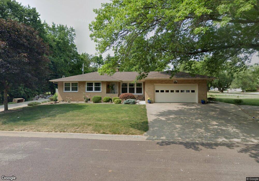
302 John Ln MacKinaw, IL 61755
Estimated Value: $162,000 - $199,184
About This Home
This home is located at 302 John Ln, MacKinaw, IL 61755 and is currently estimated at $187,046, approximately $185 per square foot. 302 John Ln is a home located in Tazewell County with nearby schools including Dee-Mack Primary/Junior High School, Dee-Mack Intermediate School, and Dee-Mack High School.
Ownership History
We collect this data history from publicly available records. To have your information removed, we recommend requesting removal directly through your county’s website.
Purchase Details
Home Financials for this Owner
Home Financials are based on the most recent Mortgage that was taken out on this home.Purchase History
We collect this data history from publicly available records. To have your information removed, we recommend requesting removal directly through your county’s website.
| Date | Buyer | Sale Price | Title Company |
|---|---|---|---|
| $138,000 | None Available |
Mortgage History
We collect this data history from publicly available records. To have your information removed, we recommend requesting removal directly through your county’s website.
| Date | Status | Borrower | Loan Amount |
|---|---|---|---|
| Open | $110,000 |
Tax History
We collect this data history from publicly available records. To have your information removed, we recommend requesting removal directly through your county’s website.
| Year | Tax Paid | Tax Assessment Tax Assessment Total Assessment is a certain percentage of the fair market value that is determined by local assessors to be the total taxable value of land and additions on the property. | Land | Improvement |
|---|---|---|---|---|
| 2025 | $2,888 | $66,650 | $6,340 | $60,310 |
| 2024 | $3,016 | $60,870 | $5,790 | $55,080 |
| 2023 | $3,016 | $56,000 | $5,330 | $50,670 |
| 2022 | $3,089 | $51,600 | $4,910 | $46,690 |
| 2021 | $3,118 | $49,610 | $4,720 | $44,890 |
| 2020 | $3,148 | $48,160 | $4,580 | $43,580 |
| 2019 | $3,159 | $48,160 | $4,580 | $43,580 |
| 2018 | $3,127 | $48,160 | $4,580 | $43,580 |
| 2017 | $3,081 | $47,680 | $4,530 | $43,150 |
| 2016 | $3,084 | $47,680 | $4,530 | $43,150 |
| 2015 | $2,720 | $0 | $0 | $0 |
| 2013 | $2,916 | $48,920 | $4,410 | $44,510 |
Map
- 304 S Monroe St
- 406 W Fast Ave
- 101 Tulip Dr
- 901 Brighton Ave
- 56,57 Summit Dr
- 309 Brandy Dr
- 26 Essex Ave
- 32 Roxbury Rd
- 7 Pickwick Ln
- 16 Londonderry Dr
- 14312 Appenzeller Rd
- 1428 NW Windermere Dr
- 18067 Dee Mac Rd
- 33987 Conley Rd
- 24845 Emanuel Ln
- 138 Kickapoo Dr
- 1214 Whippoorwill Dr
- 701 E Pearl St
- 2049 S 4th Ave
- 346 S Nebraska Ave
- 302 John Ln
- 303 John Ln
- 301 John Ln
- 208 S Tazewell Ave
- 305 S Tazewell Ave
- 307 S Tazewell Ave
- 307 S Tazewell St
- 306 W 4th St
- 309 S Tazewell Ave
- 209 S Tazewell Ave
- 300 W Fourth St
- 300 W Fourth St
- 400 W Fourth St
- 200 John Ln
- 206 S Tazewell Ave
- 207 S Tazewell Ave
- 311 S Tazewell St
- 311 S Tazewell Ave
- 201 John Ln
- 206 S Tazewell St
Ask me questions while you tour the home.