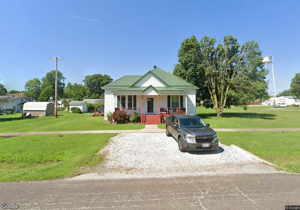
302 Roe St Pilot Grove, MO 65276
Estimated Value: $96,027 - $172,000
2
Beds
--
Bath
1,339
Sq Ft
$98/Sq Ft
Est. Value
About This Home
This home is located at 302 Roe St, Pilot Grove, MO 65276 and is currently estimated at $131,757, approximately $98 per square foot. 302 Roe St is a home with nearby schools including Pilot Grove Elementary School, Pilot Grove High School, and St. Joseph Elementary School.
Create a Home Valuation Report for This Property
The Home Valuation Report is an in-depth analysis detailing your home's value as well as a comparison with similar homes in the area
Tax History
| Year | Tax Paid | Tax Assessment Tax Assessment Total Assessment is a certain percentage of the fair market value that is determined by local assessors to be the total taxable value of land and additions on the property. | Land | Improvement |
|---|---|---|---|---|
| 2025 | $452 | $6,290 | $0 | $0 |
| 2024 | $452 | $5,810 | $0 | $0 |
| 2023 | $419 | $5,810 | $0 | $0 |
| 2022 | $366 | $5,420 | $0 | $0 |
| 2021 | $354 | $5,240 | $0 | $0 |
| 2020 | $362 | $5,020 | $0 | $0 |
| 2019 | $359 | $5,020 | $0 | $5,020 |
| 2018 | $302 | $5,020 | $0 | $5,020 |
| 2017 | $297 | $4,030 | $0 | $4,030 |
| 2016 | -- | $4,030 | $0 | $0 |
| 2015 | -- | $4,030 | $0 | $0 |
| 2011 | -- | $4,030 | $0 | $0 |
Source: Public Records
Map
Nearby Homes
- 110 3rd St
- 208 College St
- 500 4th St
- Ghost Holler Rd (Tract 2 Unit 17+/- Acres
- Ghost Holler Rd (Tract 1 Unit 2+/- Acres
- 11503 Hawk Hill Ln
- TBD Hwy Nn
- 0 M Hwy
- LOT 91 Madewood Rd
- 250ac Tbd Z Hwy
- 0 Ferry Rd
- 10469 Ferry Rd
- Tbd Hwy Z
- LOT 205 Mid-America Industrial Ct
- LOT 202 Mid-America Industrial Ct
- LOT 17A Mid-America Industrial Ct
- LOT 16 Mid-America Industrial Ct
- 20671 K Hwy
- 220 Acres M L Ferry Rd
- 401 Vassar St
Your Personal Tour Guide
Ask me questions while you tour the home.