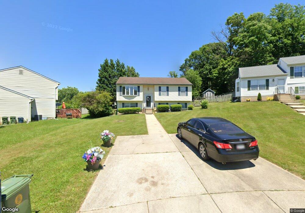
302 Snowbird Cir Brooklyn, MD 21225
Estimated Value: $336,239 - $379,000
Studio
2
Baths
1,108
Sq Ft
$322/Sq Ft
Est. Value
About This Home
This home is located at 302 Snowbird Cir, Brooklyn, MD 21225 and is currently estimated at $357,060, approximately $322 per square foot. 302 Snowbird Cir is a home located in Anne Arundel County with nearby schools including Brooklyn Park Elementary School, Brooklyn Park Middle School, and North County High School.
Ownership History
Date
Name
Owned For
Owner Type
Purchase Details
Closed on
Dec 31, 2014
Sold by
Rooks Glenn A and Rooks Gail I
Bought by
Rooks Monika L and Rooks Glenn A
Current Estimated Value
Purchase Details
Closed on
Jun 12, 2003
Sold by
Rooks Glenn
Bought by
Rooks Glenn and Rooks Gail I
Purchase Details
Closed on
Jun 12, 2001
Sold by
Ocwen Federal Bank
Bought by
Rooks Glenn
Create a Home Valuation Report for This Property
The Home Valuation Report is an in-depth analysis detailing your home's value as well as a comparison with similar homes in the area
Home Values in the Area
Average Home Value in this Area
Purchase History
| Date | Buyer | Sale Price | Title Company |
|---|---|---|---|
| Rooks Monika L | -- | None Available | |
| Rooks Glenn | -- | -- | |
| Rooks Glenn | $139,000 | -- | |
| Ocwen Federal Bank | $88,000 | -- |
Source: Public Records
Mortgage History
| Date | Status | Borrower | Loan Amount |
|---|---|---|---|
| Closed | Rooks Glenn | -- |
Source: Public Records
Tax History
| Year | Tax Paid | Tax Assessment Tax Assessment Total Assessment is a certain percentage of the fair market value that is determined by local assessors to be the total taxable value of land and additions on the property. | Land | Improvement |
|---|---|---|---|---|
| 2025 | $2,808 | $286,600 | $110,900 | $175,700 |
| 2024 | $2,808 | $278,900 | $0 | $0 |
| 2023 | $2,726 | $271,200 | $0 | $0 |
| 2022 | $2,544 | $263,500 | $110,900 | $152,600 |
| 2020 | $2,417 | $250,300 | $0 | $0 |
| 2019 | $2,377 | $243,700 | $96,200 | $147,500 |
| 2018 | $2,338 | $230,600 | $0 | $0 |
| 2017 | $2,228 | $217,500 | $0 | $0 |
| 2016 | -- | $204,400 | $0 | $0 |
| 2015 | -- | $204,400 | $0 | $0 |
| 2014 | -- | $204,400 | $0 | $0 |
Source: Public Records
Map
Nearby Homes
- 5614 Cliff Side Ct
- 5655 Harbor Valley Dr
- 6028 A Belle Grove Rd
- 201 9th Ave
- 944 1st St
- 932 1st St
- 215 Grove Park Rd
- 923 1st St
- 915 1st St
- 275 Rupert Cir
- 222 Townsend Ave
- 17 2nd Ave
- 5902 Helfrich Rd
- 5300 Brookwood Rd
- 219 Doris Ave
- 635 Sunset Strip
- 336 Arden Rd W
- 5103 Ballman Ave
- 405 Seward Ave
- 133 Cedar Hill Rd
- 300 Snowbird Cir
- 5639 Harbor Valley Dr
- 5641 Harbor Valley Dr
- 5600 Cliffside Ct
- 5602 Cliffside Ct
- 301 Snowbird Cir
- 5643 Harbor Valley Dr
- 5601 Cliffside Ct
- 303 Snowbird Cir
- 5604 Cliffside Ct
- 305 Snowbird Cir
- 5638 Harbor Valley Dr
- 5645 Harbor Valley Dr
- 5640 Harbor Valley Dr
- 5603 Cliffside Ct
- 5636 Harbor Valley Dr
- 5606 Cliffside Ct
- 5642 Harbor Valley Dr
- 5647 Harbor Valley Dr
- 5605 Cliffside Ct
Your Personal Tour Guide
Ask me questions while you tour the home.