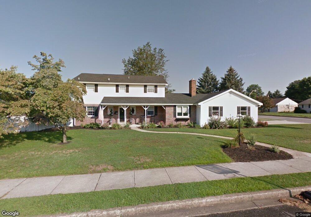
302 Thomas Rd Ephrata, PA 17522
Estimated Value: $455,435 - $505,000
4
Beds
4
Baths
2,280
Sq Ft
$211/Sq Ft
Est. Value
About This Home
This home is located at 302 Thomas Rd, Ephrata, PA 17522 and is currently estimated at $481,609, approximately $211 per square foot. 302 Thomas Rd is a home located in Lancaster County with nearby schools including Ephrata Intermediate School, Clay Elementary School, and Ephrata Senior High School.
Ownership History
Date
Name
Owned For
Owner Type
Purchase Details
Closed on
Jan 7, 2005
Sold by
Eamer Richard K
Bought by
Doutt Brian S and Doutt Kelly L
Current Estimated Value
Home Financials for this Owner
Home Financials are based on the most recent Mortgage that was taken out on this home.
Original Mortgage
$198,000
Outstanding Balance
$99,703
Interest Rate
5.71%
Mortgage Type
Purchase Money Mortgage
Estimated Equity
$381,906
Purchase Details
Closed on
Oct 30, 1998
Sold by
Brossman Bryan F
Bought by
Clingan Roy E and Clingan Tracey E
Home Financials for this Owner
Home Financials are based on the most recent Mortgage that was taken out on this home.
Original Mortgage
$133,200
Interest Rate
6.68%
Purchase Details
Closed on
Jul 17, 1998
Sold by
Brossman Bryan F and Brossman Suzanne K
Bought by
Brossman Bryan F
Create a Home Valuation Report for This Property
The Home Valuation Report is an in-depth analysis detailing your home's value as well as a comparison with similar homes in the area
Home Values in the Area
Average Home Value in this Area
Purchase History
| Date | Buyer | Sale Price | Title Company |
|---|---|---|---|
| Doutt Brian S | $220,000 | First American Title Ins Co | |
| Clingan Roy E | $177,618 | -- | |
| Brossman Bryan F | -- | -- |
Source: Public Records
Mortgage History
| Date | Status | Borrower | Loan Amount |
|---|---|---|---|
| Open | Doutt Brian S | $198,000 | |
| Previous Owner | Clingan Roy E | $133,200 |
Source: Public Records
Tax History
| Year | Tax Paid | Tax Assessment Tax Assessment Total Assessment is a certain percentage of the fair market value that is determined by local assessors to be the total taxable value of land and additions on the property. | Land | Improvement |
|---|---|---|---|---|
| 2025 | $5,345 | $222,900 | $59,800 | $163,100 |
| 2024 | $5,345 | $222,900 | $59,800 | $163,100 |
| 2023 | $5,214 | $222,900 | $59,800 | $163,100 |
| 2022 | $4,992 | $222,900 | $59,800 | $163,100 |
| 2021 | $4,887 | $222,900 | $59,800 | $163,100 |
| 2020 | $4,887 | $222,900 | $59,800 | $163,100 |
| 2019 | $4,820 | $222,900 | $59,800 | $163,100 |
| 2018 | $3,651 | $222,900 | $59,800 | $163,100 |
| 2017 | $5,073 | $191,700 | $44,100 | $147,600 |
| 2016 | $5,033 | $191,700 | $44,100 | $147,600 |
| 2015 | $1,113 | $191,700 | $44,100 | $147,600 |
| 2014 | $3,630 | $191,700 | $44,100 | $147,600 |
Source: Public Records
Map
Nearby Homes
- 1377 Apple St
- 56 Tyler Dr
- 129 Meadow Valley Rd Unit 11
- 66 Weaver Ave
- 637 W Main St
- 927 Emerald St
- 524 W Trout Run Rd
- 202 Roosevelt Cir
- 0 W Queen St
- 120 Morning Dr
- 00 Morning Dr
- 0 S State St
- 740 Lincoln Gardens Rd
- 517 Foggy Bottom Rd
- 144 Sunrise Ln
- 133 Wyndale Dr
- 154 Sunrise Ln
- 00 Wyndale Dr
- 5 Moccasin Dr
- 239 Railroad Ave
- 1256 Marilyn Ave
- 1220 Marilyn Ave
- 1241 Marilyn Ave
- 1231 Marilyn Ave
- 1249 Marilyn Ave
- 1214 Marilyn Ave
- 1221 Marilyn Ave
- 219 Hummer Rd
- 1215 Marilyn Ave
- 1208 Marilyn Ave
- 1242 Marie Ave
- 1250 Marie Ave
- 1224 Marie Ave
- 208 Hummer Rd
- 1209 Marilyn Ave
- 205 Hummer Rd
- 1196 Marilyn Ave
- 1216 Marie Ave
- 1314 Marilyn Ave
- 1208 Marie Ave
Your Personal Tour Guide
Ask me questions while you tour the home.