Estimated Value: $83,000 - $116,000
2
Beds
1
Bath
962
Sq Ft
$107/Sq Ft
Est. Value
About This Home
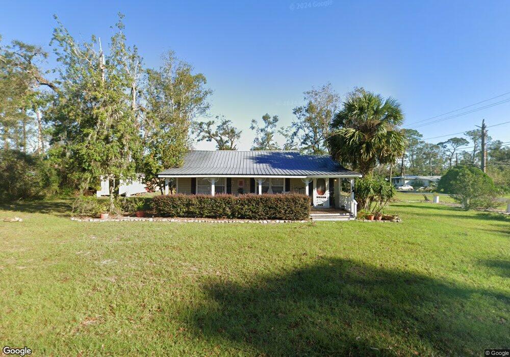
This home is located at 302 W High St Unit 1, Perry, FL 32347 and is currently estimated at $103,184, approximately $107 per square foot. 302 W High St Unit 1 is a home located in Taylor County with nearby schools including Perry Primary School, Taylor County Elementary School, and Taylor County Middle School.
Ownership History
Date
Name
Owned For
Owner Type
Purchase Details
Closed on
Apr 10, 2019
Sold by
Albritton William J and Albritton Michael S
Bought by
Albritton William J and Albritton Joanne G
Current Estimated Value
Purchase Details
Closed on
Jan 14, 2009
Sold by
Fremont Investment & Loan Company
Bought by
Albritton William J and Albritton Carolyn L
Purchase Details
Closed on
Aug 28, 2008
Sold by
Agerton Jack and Agerton Cinderella
Bought by
Fremont Investment & Loan Co
Purchase Details
Closed on
Jul 8, 2004
Sold by
Mangum Gary H
Bought by
Agerton Jack and Agerton Cinderella
Create a Home Valuation Report for This Property
The Home Valuation Report is an in-depth analysis detailing your home's value as well as a comparison with similar homes in the area
Home Values in the Area
Average Home Value in this Area
Purchase History
| Date | Buyer | Sale Price | Title Company |
|---|---|---|---|
| Albritton William J | -- | Attorney | |
| Albritton William J | $24,000 | Attorney | |
| Fremont Investment & Loan Co | -- | None Available | |
| Agerton Jack | $38,000 | Frith Abstract & Title Co |
Source: Public Records
Tax History
| Year | Tax Paid | Tax Assessment Tax Assessment Total Assessment is a certain percentage of the fair market value that is determined by local assessors to be the total taxable value of land and additions on the property. | Land | Improvement |
|---|---|---|---|---|
| 2025 | -- | $43,410 | -- | -- |
| 2024 | -- | $42,190 | -- | -- |
| 2023 | -- | $40,970 | $0 | $0 |
| 2022 | $0 | $39,780 | $0 | $0 |
| 2021 | $0 | $38,630 | $0 | $0 |
| 2020 | $0 | $38,100 | $0 | $0 |
| 2019 | $0 | $37,250 | $0 | $0 |
| 2018 | $0 | $36,720 | $0 | $0 |
| 2017 | $0 | $39,210 | $13,500 | $25,710 |
| 2016 | $0 | $32,480 | $6,300 | $26,180 |
| 2015 | -- | $32,940 | $6,300 | $26,640 |
| 2014 | -- | $35,432 | $0 | $0 |
Source: Public Records
Map
Nearby Homes
- 510 W Ash St
- 309 W Oak St
- 401 W Ash St
- Vacant Marshall Dr
- 100 Forest Cir
- TBD N Veterans Dr
- 708 W Julia St
- 802 N Quincy St
- 603 N Faulkner St
- 413 E Elm St
- 602 W Bay St
- 1946 N US 221
- 808 W Main St Unit n/a
- 808 W Main St
- 415 W Main St
- 804 W Green St Unit n/a
- 804 W Green St
- xxx N Peacock Ave
- 611 W Green St
- 315 W Green St
- 302 W High St
- 306 W High St
- 301 W Cedar St
- 303 W Cedar St
- 1400 N Cherry St
- 213 W Cedar St
- 301 W High St
- 211 W High St
- 210 W High St
- 309 W Cedar St Unit 1
- 309 W Cedar St
- 307 W High St
- 211 W Cedar St
- 1501 N Cherry St
- 304 W Cedar St Unit 1
- 304 W Cedar St
- 209 W High St
- 502 W Ash St
- 506 W Ash St
- 306 W Cedar St
Your Personal Tour Guide
Ask me questions while you tour the home.