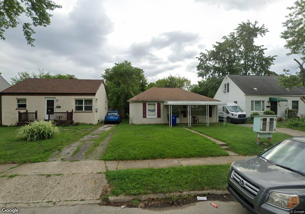
3022 Howey Rd Columbus, OH 43224
North Linden NeighborhoodEstimated Value: $141,000 - $160,000
About This Home
This home is located at 3022 Howey Rd, Columbus, OH 43224 and is currently estimated at $150,457, approximately $154 per square foot. 3022 Howey Rd is a home located in Franklin County with nearby schools including Como Elementary School, Dominion Middle School, and Whetstone High School.
Ownership History
We collect this data history from publicly available records. To have your information removed, we recommend requesting removal directly through your county’s website.
Purchase Details
Home Financials for this Owner
Home Financials are based on the most recent Mortgage that was taken out on this home.Purchase Details
Purchase Details
Home Values in the Area
Average Home Value in this Area
Purchase History
We collect this data history from publicly available records. To have your information removed, we recommend requesting removal directly through your county’s website.
| Date | Buyer | Sale Price | Title Company |
|---|---|---|---|
| $68,000 | Chicago Title | ||
| -- | -- | ||
| -- | -- |
Mortgage History
We collect this data history from publicly available records. To have your information removed, we recommend requesting removal directly through your county’s website.
| Date | Status | Borrower | Loan Amount |
|---|---|---|---|
| Open | $67,467 |
Tax History
We collect this data history from publicly available records. To have your information removed, we recommend requesting removal directly through your county’s website.
| Year | Tax Paid | Tax Assessment Tax Assessment Total Assessment is a certain percentage of the fair market value that is determined by local assessors to be the total taxable value of land and additions on the property. | Land | Improvement |
|---|---|---|---|---|
| 2025 | $1,951 | $43,480 | $11,660 | $31,820 |
| 2024 | $1,951 | $43,480 | $11,660 | $31,820 |
| 2023 | $1,926 | $43,470 | $11,655 | $31,815 |
| 2022 | $1,465 | $24,920 | $5,250 | $19,670 |
| 2021 | $1,411 | $24,920 | $5,250 | $19,670 |
| 2020 | $1,504 | $24,920 | $5,250 | $19,670 |
| 2019 | $1,404 | $21,150 | $4,380 | $16,770 |
| 2018 | $1,312 | $21,150 | $4,380 | $16,770 |
| 2017 | $1,353 | $21,150 | $4,380 | $16,770 |
| 2016 | $1,303 | $19,670 | $3,850 | $15,820 |
| 2015 | $1,183 | $19,670 | $3,850 | $15,820 |
| 2014 | $1,186 | $19,670 | $3,850 | $15,820 |
| 2013 | $649 | $21,840 | $4,270 | $17,570 |
Map
- 2954 Grasmere Ave
- 2950 Grasmere Ave
- 3028 Hiawatha St
- 2897 Grasmere Ave
- 3081 Grasmere Ave
- 2899 McGuffey Rd
- 3049 Hiawatha St
- 2872 Howey Rd
- 2905 Hiawatha St
- 3103 Azelda St
- 2804 Grasmere Ave
- 2913 Gerbert Rd
- 3085 Gerbert Rd
- 3054 Gerbert Rd
- 1197 Manchester Ave
- 983 Mohican Ave
- 845 Weldon Ave
- 2849 Osceola Ave
- 811 E Como Ave
- 3196 Hamilton Ave
- 2998 Howey Rd
- 3002 Howey Rd
- 3008 Howey Rd
- 2988 Howey Rd
- 2991 Grasmere Ave
- 3012 Howey Rd
- 2982 Howey Rd
- 2985 Grasmere Ave
- 3001 Grasmere Ave
- 3016 Howey Rd
- 2978 Howey Rd
- 2979 Grasmere Ave
- 2999 Howey Rd
- 3003 Howey Rd
- 2993 Howey Rd
- 2975 Grasmere Ave
- 3005 Grasmere Ave
- 3007 Howey Rd
- 2989 Howey Rd
- 2972 Howey Rd
Ask me questions while you tour the home.