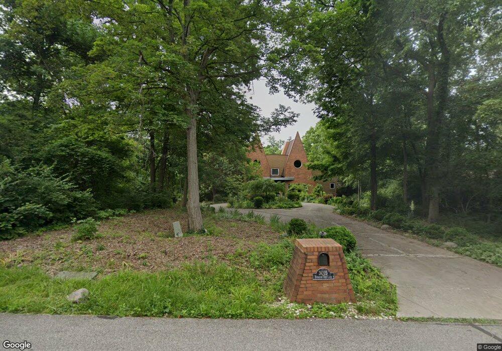
3025 Burning Tree Ln Cincinnati, OH 45237
Estimated Value: $708,233 - $1,100,000
5
Beds
4
Baths
4,212
Sq Ft
$212/Sq Ft
Est. Value
About This Home
This home is located at 3025 Burning Tree Ln, Cincinnati, OH 45237 and is currently estimated at $894,808, approximately $212 per square foot. 3025 Burning Tree Ln is a home located in Hamilton County with nearby schools including Pleasant Ridge Montessori School, Shroder High School, and Clark Montessori High School.
Ownership History
Date
Name
Owned For
Owner Type
Purchase Details
Closed on
Oct 23, 2002
Sold by
Patterson William Alonzo and Patterson Sharon Battle
Bought by
Patterson William Alonzo and Patterson Sharon Battle
Current Estimated Value
Home Financials for this Owner
Home Financials are based on the most recent Mortgage that was taken out on this home.
Original Mortgage
$650,000
Interest Rate
6.01%
Purchase Details
Closed on
Aug 24, 2000
Sold by
Patterson William and Patterson Sharon
Bought by
Patterson William Alonzo and Patterson Sharon Battle
Purchase Details
Closed on
Apr 11, 1997
Sold by
Jewish Federation Of Greater Dayton Inc
Bought by
Wiers Brandon H
Purchase Details
Closed on
Apr 10, 1997
Sold by
Wiers Brandon H
Bought by
Patterson William and Patterson Sharon
Purchase Details
Closed on
Aug 19, 1996
Sold by
Guttman Harold B and Guttman Cynthia L
Bought by
Jewish Federation Of Greater Dayton Inc
Create a Home Valuation Report for This Property
The Home Valuation Report is an in-depth analysis detailing your home's value as well as a comparison with similar homes in the area
Home Values in the Area
Average Home Value in this Area
Purchase History
| Date | Buyer | Sale Price | Title Company |
|---|---|---|---|
| Patterson William Alonzo | -- | -- | |
| Patterson William Alonzo | -- | Prodigy Title Agency Llc | |
| Patterson William Alonzo | -- | -- | |
| Wiers Brandon H | $150,000 | -- | |
| Patterson William | -- | -- | |
| Jewish Federation Of Greater Dayton Inc | -- | -- |
Source: Public Records
Mortgage History
| Date | Status | Borrower | Loan Amount |
|---|---|---|---|
| Previous Owner | Patterson William Alonzo | $650,000 |
Source: Public Records
Tax History
| Year | Tax Paid | Tax Assessment Tax Assessment Total Assessment is a certain percentage of the fair market value that is determined by local assessors to be the total taxable value of land and additions on the property. | Land | Improvement |
|---|---|---|---|---|
| 2025 | $13,554 | $218,166 | $40,250 | $177,916 |
| 2024 | $13,534 | $218,166 | $40,250 | $177,916 |
| 2023 | $13,556 | $218,166 | $40,250 | $177,916 |
| 2022 | $13,246 | $185,245 | $39,550 | $145,695 |
| 2021 | $13,177 | $185,245 | $39,550 | $145,695 |
| 2020 | $13,037 | $185,245 | $39,550 | $145,695 |
| 2019 | $12,786 | $163,933 | $35,000 | $128,933 |
| 2018 | $12,799 | $163,933 | $35,000 | $128,933 |
| 2017 | $12,392 | $163,933 | $35,000 | $128,933 |
| 2016 | $13,358 | $167,395 | $36,750 | $130,645 |
| 2015 | $12,007 | $167,395 | $36,750 | $130,645 |
| 2014 | $12,067 | $167,395 | $36,750 | $130,645 |
| 2013 | $10,958 | $149,748 | $36,750 | $112,998 |
Source: Public Records
Map
Nearby Homes
- 7510 Fernwood Dr
- 3275 Legacy Trace
- 2281 E Galbraith Rd
- 2127 Longmeadow Ln
- 6610 Hudson Pkwy
- 867 E Columbia Ave
- 0 Hill St Unit 1616370
- 2543 Vera Ave
- 2541 Vera Ave
- 2539 Vera Ave
- 2537 Vera Ave
- 6458 Crestview Ave
- 2652 Cedarbrook Dr
- 20 Clark Rd
- 6462 Crestview Ave
- 6466 Crestview Ave
- 6470 Crestview Ave
- 7651 Sagamore Dr
- 6454 Crestview Ave
- 1128 Oldwick Dr
- 3029 Burning Tree Ln
- 3021 Burning Tree Ln
- 3033 Burning Tree Ln
- 3024 Burning Tree Ln
- 3028 Burning Tree Ln
- 7707 Creekwood Ln
- 7717 Creekwood Ln
- 3020 Burning Tree Ln
- 7708 Creekwood Ln
- 3036 Burning Tree Ln
- 7712 Creekwood Ln
- 3016 Burning Tree Ln
- 3032 Burning Tree Ln
- 7716 Creekwood Ln
- 2890 Belkay Ln
- 7520 Fernwood Dr
- 7438 E Aracoma Dr
- 7720 Creekwood Ln
- 3012 Burning Tree Ln
- 7500 Fernwood Dr
Your Personal Tour Guide
Ask me questions while you tour the home.