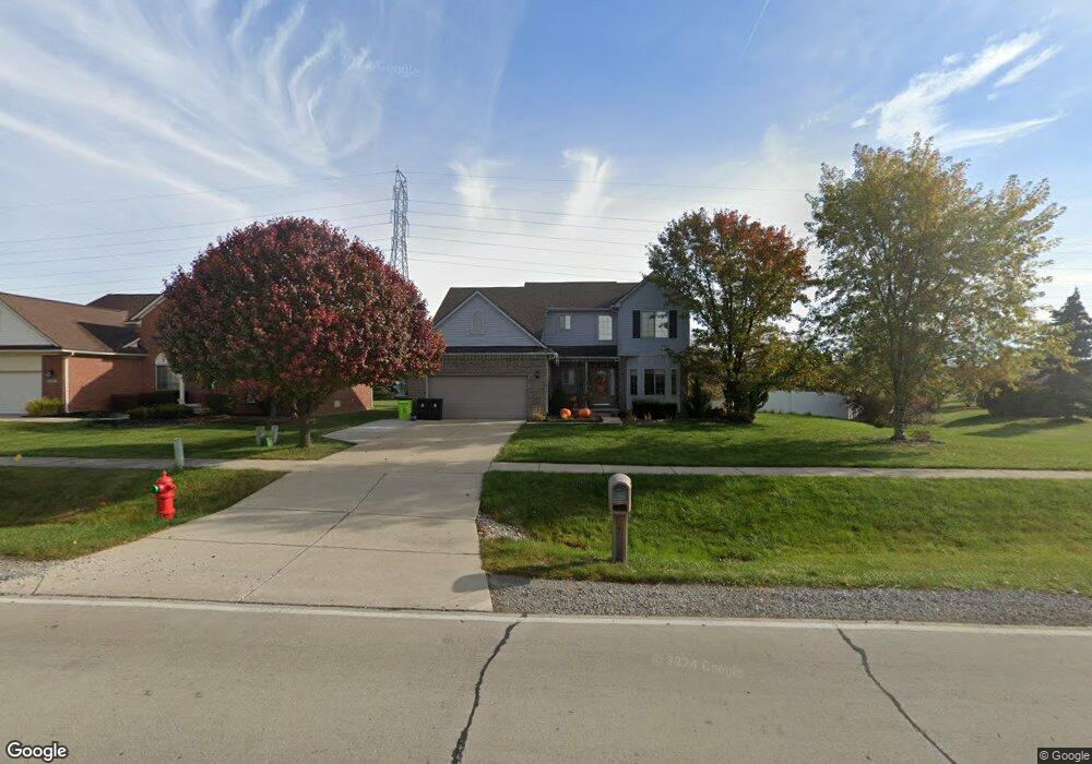
30289 Olmstead Rd Flat Rock, MI 48134
Estimated Value: $354,337 - $479,000
Studio
1
Bath
2,234
Sq Ft
$179/Sq Ft
Est. Value
About This Home
This home is located at 30289 Olmstead Rd, Flat Rock, MI 48134 and is currently estimated at $399,084, approximately $178 per square foot. 30289 Olmstead Rd is a home located in Wayne County with nearby schools including Oscar A. Carlson High School, Summit Academy - Flat Rock, and Calvary Christian Academy.
Ownership History
Date
Name
Owned For
Owner Type
Purchase Details
Closed on
Oct 14, 2011
Sold by
Sreniawski Louis R and Sreniawski Tina Michelle
Bought by
Sreniawski Louis and Sreniawski Tina Michelle
Current Estimated Value
Home Financials for this Owner
Home Financials are based on the most recent Mortgage that was taken out on this home.
Original Mortgage
$149,600
Outstanding Balance
$14,160
Interest Rate
4.12%
Mortgage Type
New Conventional
Estimated Equity
$384,924
Purchase Details
Closed on
Mar 6, 2007
Sold by
Sreniawski Amanda
Bought by
Sreniawski Louis
Purchase Details
Closed on
Apr 15, 2005
Sold by
River Homes Development Llc
Bought by
Sreniawski Louis R
Home Financials for this Owner
Home Financials are based on the most recent Mortgage that was taken out on this home.
Original Mortgage
$164,800
Interest Rate
6.05%
Mortgage Type
Fannie Mae Freddie Mac
Create a Home Valuation Report for This Property
The Home Valuation Report is an in-depth analysis detailing your home's value as well as a comparison with similar homes in the area
Home Values in the Area
Average Home Value in this Area
Purchase History
We collect this data history from publicly available records. To have your information removed, we recommend requesting removal directly through your county’s website.
| Date | Buyer | Sale Price | Title Company |
|---|---|---|---|
| Sreniawski Louis | -- | Chirco Title Company | |
| Sreniawski Louis | -- | None Available | |
| Sreniawski Louis R | $206,000 | Lawyers Title Ins |
Source: Public Records
Mortgage History
We collect this data history from publicly available records. To have your information removed, we recommend requesting removal directly through your county’s website.
| Date | Status | Borrower | Loan Amount |
|---|---|---|---|
| Open | Sreniawski Louis | $149,600 | |
| Previous Owner | Sreniawski Louis R | $164,800 | |
| Closed | Sreniawski Louis R | $20,600 |
Source: Public Records
Tax History
| Year | Tax Paid | Tax Assessment Tax Assessment Total Assessment is a certain percentage of the fair market value that is determined by local assessors to be the total taxable value of land and additions on the property. | Land | Improvement |
|---|---|---|---|---|
| 2025 | $4,141 | $202,000 | $0 | $0 |
| 2024 | $4,019 | $194,200 | $0 | $0 |
| 2023 | $3,832 | $175,000 | $0 | $0 |
| 2022 | $4,138 | $158,500 | $0 | $0 |
| 2021 | $3,903 | $147,200 | $0 | $0 |
| 2020 | $3,851 | $140,400 | $0 | $0 |
| 2019 | $3,779 | $127,600 | $0 | $0 |
| 2018 | $3,291 | $120,600 | $0 | $0 |
| 2017 | $860 | $90,500 | $0 | $0 |
| 2016 | $3,555 | $85,400 | $0 | $0 |
| 2015 | $7,050 | $83,200 | $0 | $0 |
| 2013 | $6,830 | $68,700 | $0 | $0 |
| 2012 | $2,808 | $66,700 | $12,300 | $54,400 |
Source: Public Records
Map
Nearby Homes
- 30537 Linden Ct
- 30232 Torry Ave
- 30529 Bradbury Dr
- 22646 Candace Dr
- 22244 Candace Dr
- 20087 Herzog Dr
- 22119 Candace Dr
- 31577 Lafler Dr
- 31583 Lafler Dr
- 31700 Lafler Dr
- VL Gibraltar Rd
- 00 Gibraltar Rd
- 21301 Woodruff Rd
- 23965 Gibraltar Rd
- 0 Huron River Dr Unit 20261024545
- 24664 E Huron River Dr
- 29516 Hunter St
- 29855 Tamarack Ct
- 32338 Church St
- 29490 Hunter St Unit 59
- 30257 Olmstead Rd
- 30284 Cherry Blossom Ln
- 30268 Cherry Blossom Ln
- 30228 Cherry Blossom Ln
- 30225 Olmstead Rd
- 30197 Olmstead Rd
- 23007 Country View Ln
- 30202 Cherry Blossom Ln
- 30448 Bayberry Ct
- 30312 Cherry Blossom Ln
- 30171 Olmstead Rd
- 23019 Country View Ln
- 30494 Olmstead Rd
- 30453 Bayberry Ct
- 30180 Cherry Blossom Ln
- 23031 Country View Ln
- 30235 Cherry Blossom Ln
- 30334 Cherry Blossom Ln
- 30143 Olmstead Rd
- 30257 Cherry Blossom Ln
Your Personal Tour Guide
Ask me questions while you tour the home.